Colorado Weather: Cold Statewide Behind Huge Mountain Snow
DENVER (CBS4) - The final snowflakes associated with the storm responsible for more than 3 feet of snow in the mountains will end Monday. Left behind will be very chilly temperatures that will continue into Tuesday.
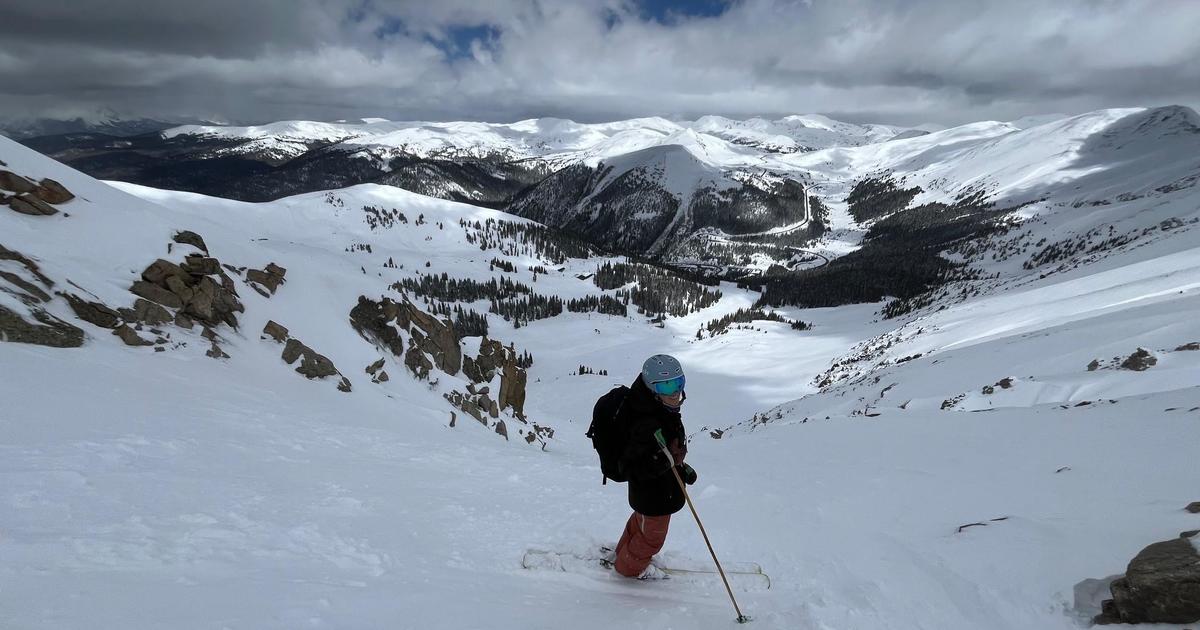
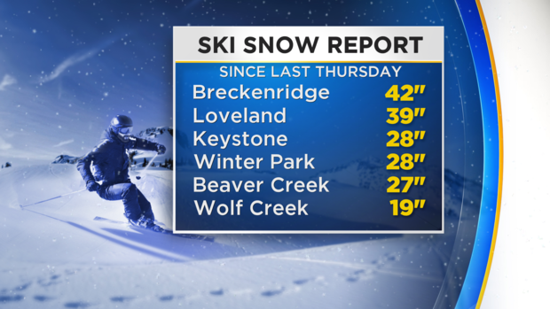
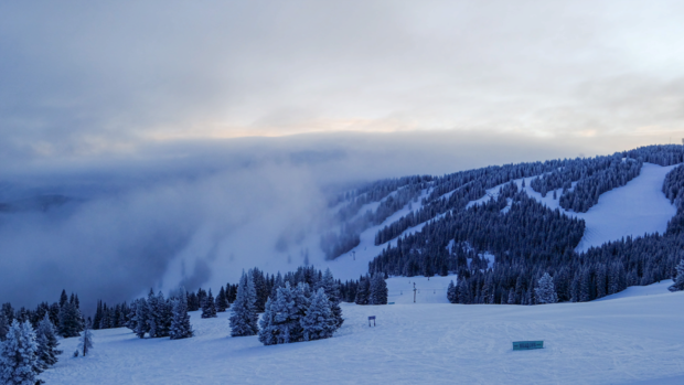
While most winter storms in Colorado bring no more than 18 inches of snow at a time, the storm that impacted the mountains from Thursday through Sunday brought over 40 inches in some areas including around Rabbit Ears Pass. And the Breckenridge ski area reported 42 inches of snow over the 4 day period.
Any additional snow in the mountains on Monday will be light. The bigger issue will likely be the existing snow blowing around thanks to northwest winds gusting up to 30 mph. Meanwhile, air temperatures (not wind chills) will be stuck in the teens in the high country on Monday.
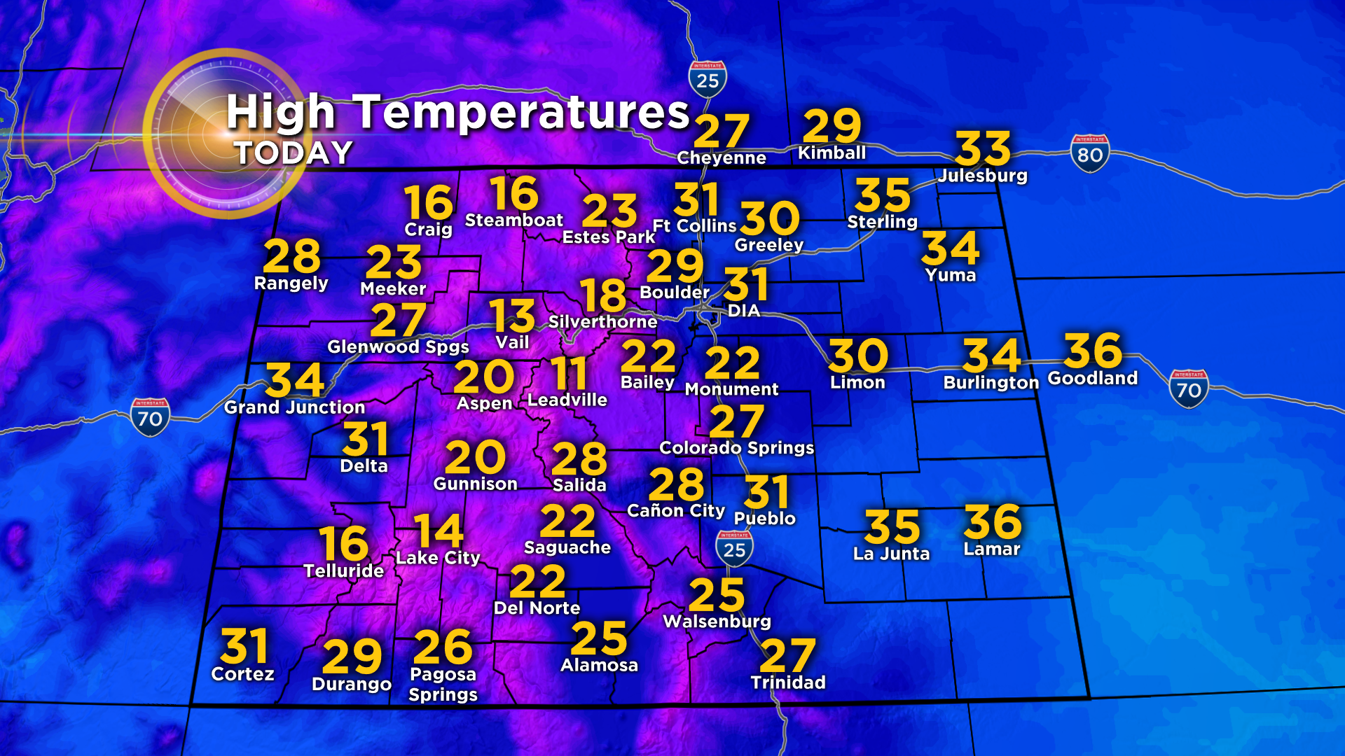
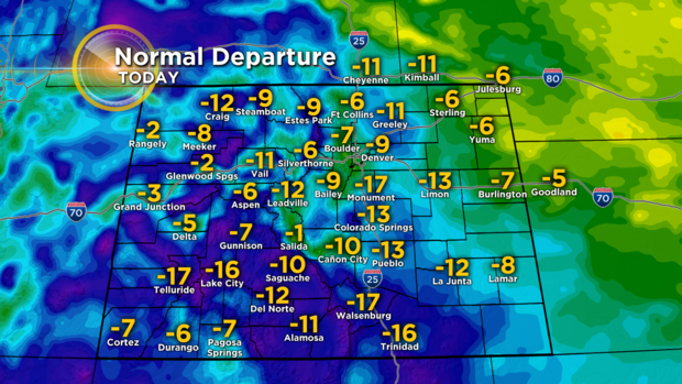
In the metro area, high temperatures will struggle to reach near freezing with a few flurries or light snow showers possible in the morning. Tempera trues will average 10 to 15 degrees colder than normal for the second half of December.
Skies will gradually clear in the afternoon and that clearing will lead to frigid weather Monday night into Tuesday morning.
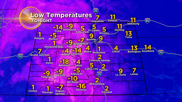
Low temperatures Tuesday morning will be in the single digits and teens both above and below zero. In the Denver, Boulder, and Fort Collins areas, there will not be much wind but enough to cause wind chills to drop near zero during the Tuesday morning commute.
Somewhat warmer weather will develop by Tuesday afternoon before a much bigger warm up starts on Wednesday.