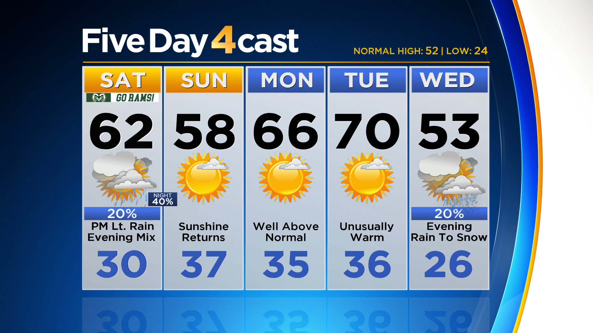
Denver Weather: Turning Windy With Quick Shot For Rain, Snow By Sunset
DENVER (CBS4) - Get ready for a short-lived but abrupt weather change by this evening for many areas, including Denver and the Front Range. It's associated with a fast-moving storm system that will clip northeast Colorado as it rides along the jet stream.
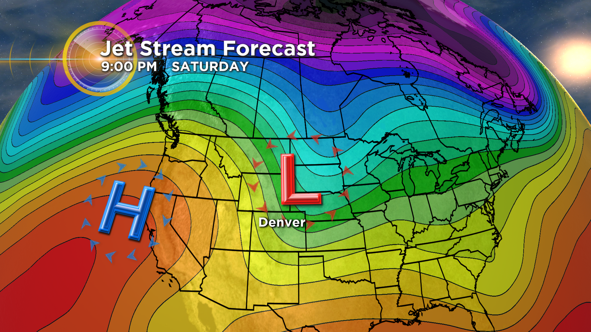
A cold front will move into northwest Colorado sometime this afternoon and move through the Denver area between 3-6 pm. We anticipate a period of strong, gusty winds as the front passes by and that will usher in some colder air.
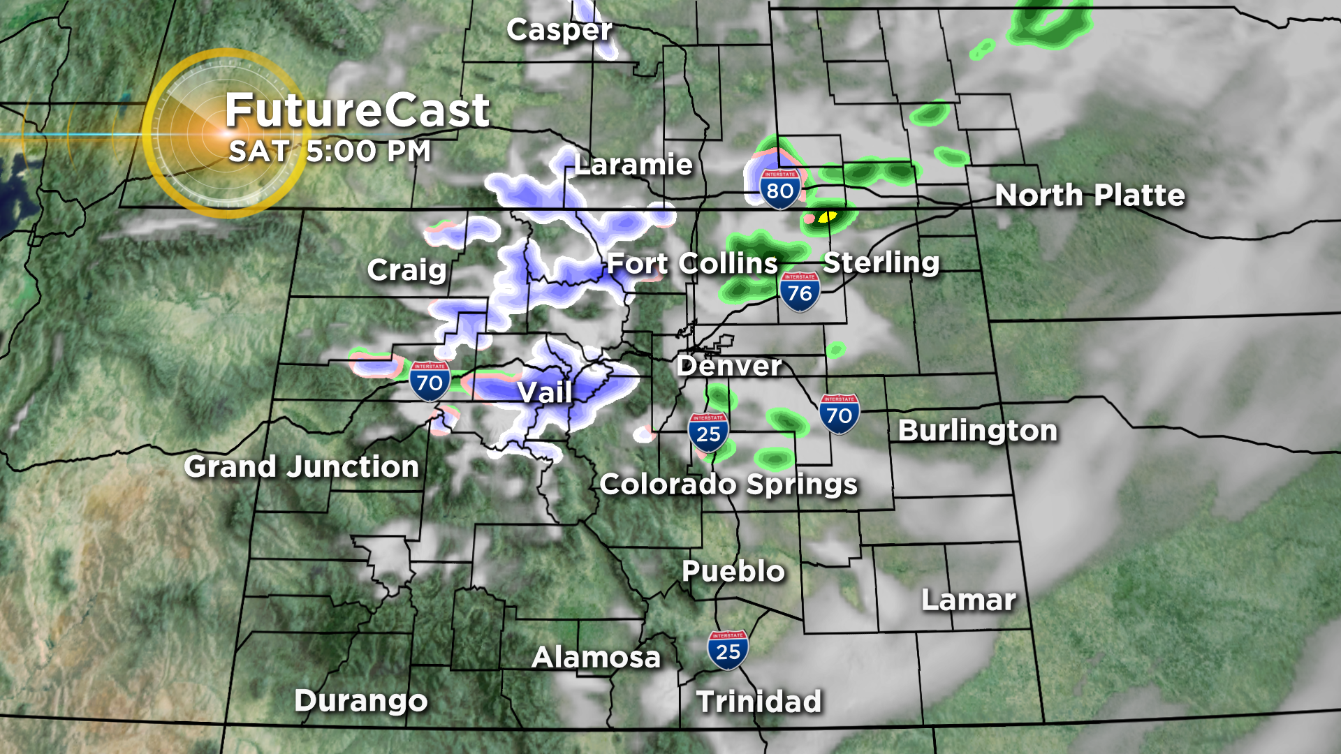
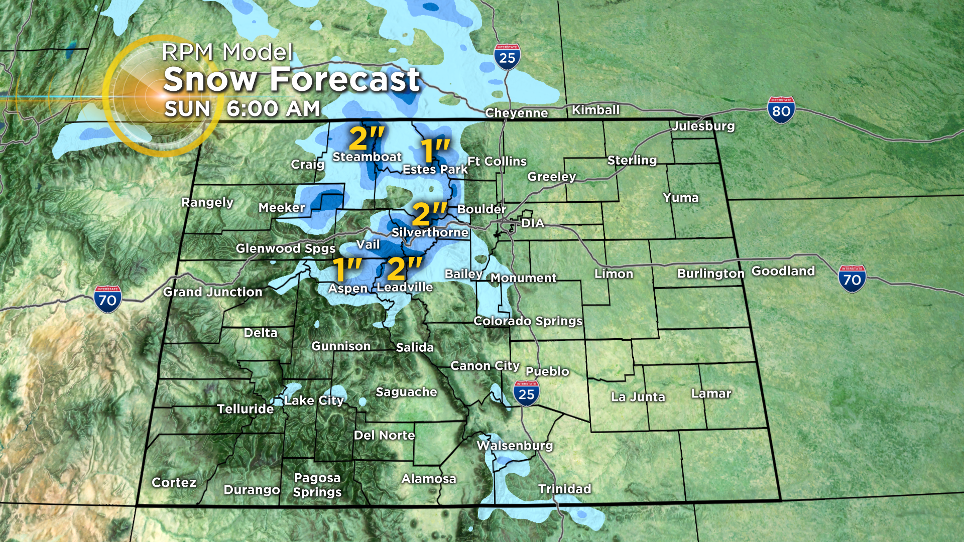
The cold front will kick up a brief window of rain and snow showers along the Front Range with all snow expected in the mountains. Some of the high country locations along and north of Highway 50 could pick up a few quick inches but lower elevations shouldn't see much, if any, unless you happen to get under a snow squall.
Everything should come to an end around or shortly after midnight with partly cloudy to mostly clear skies expected by sunrise on Sunday. It could be a little breezy to end your weekend but it should be dry.
Unusually warm weather is expected for Monday and Tuesday before the next storm moves in sometime on Wednesday. That one could bring snow to Denver for the Thursday morning drive.