Twin Storms To Bring Snow, Record Cold To Colorado Through Wednesday
DENVER (CBS4) - An unusual dip in the Polar Jet Stream will send Colorado into the deep freeze for the last week of October with highs in Denver staying below freezing between Sunday and Wednesday. In addition to the cold there will be accumulating snow.
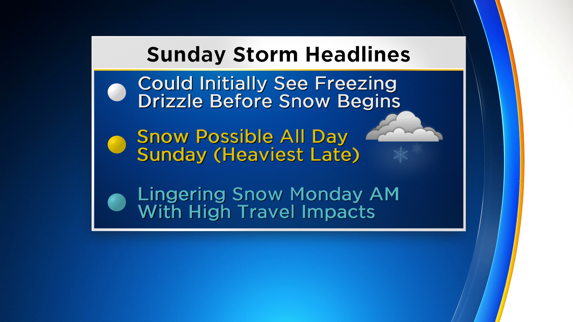
A cold front associated with the first storm moved into northern Colorado late Saturday afternoon. A second front with even colder air will arrive by sunrise on Sunday. There will likely be a period of freezing drizzle before the precipitation changes to all snow. The snow could be moderate to heavy at times, especially by Sunday night.
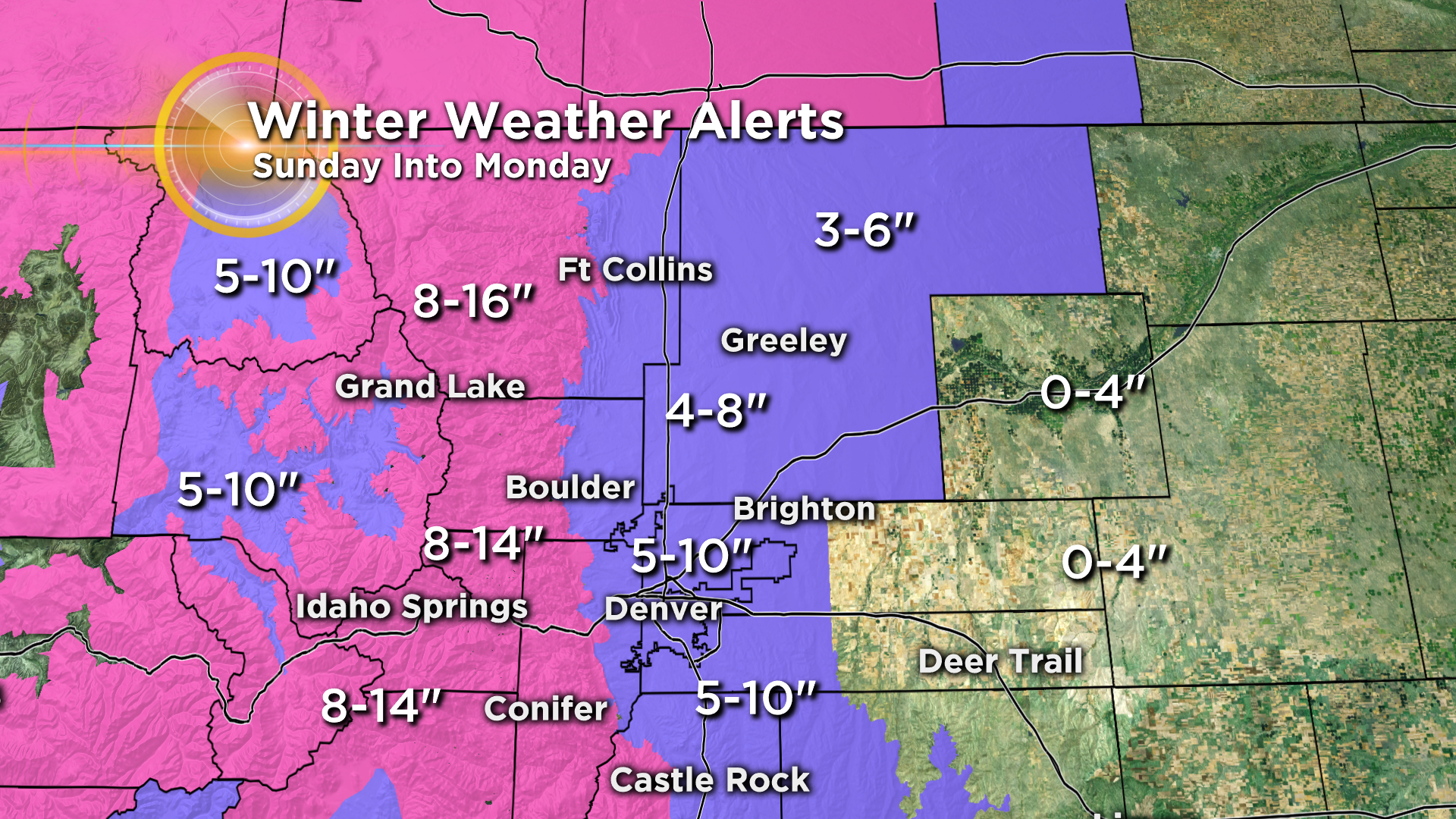
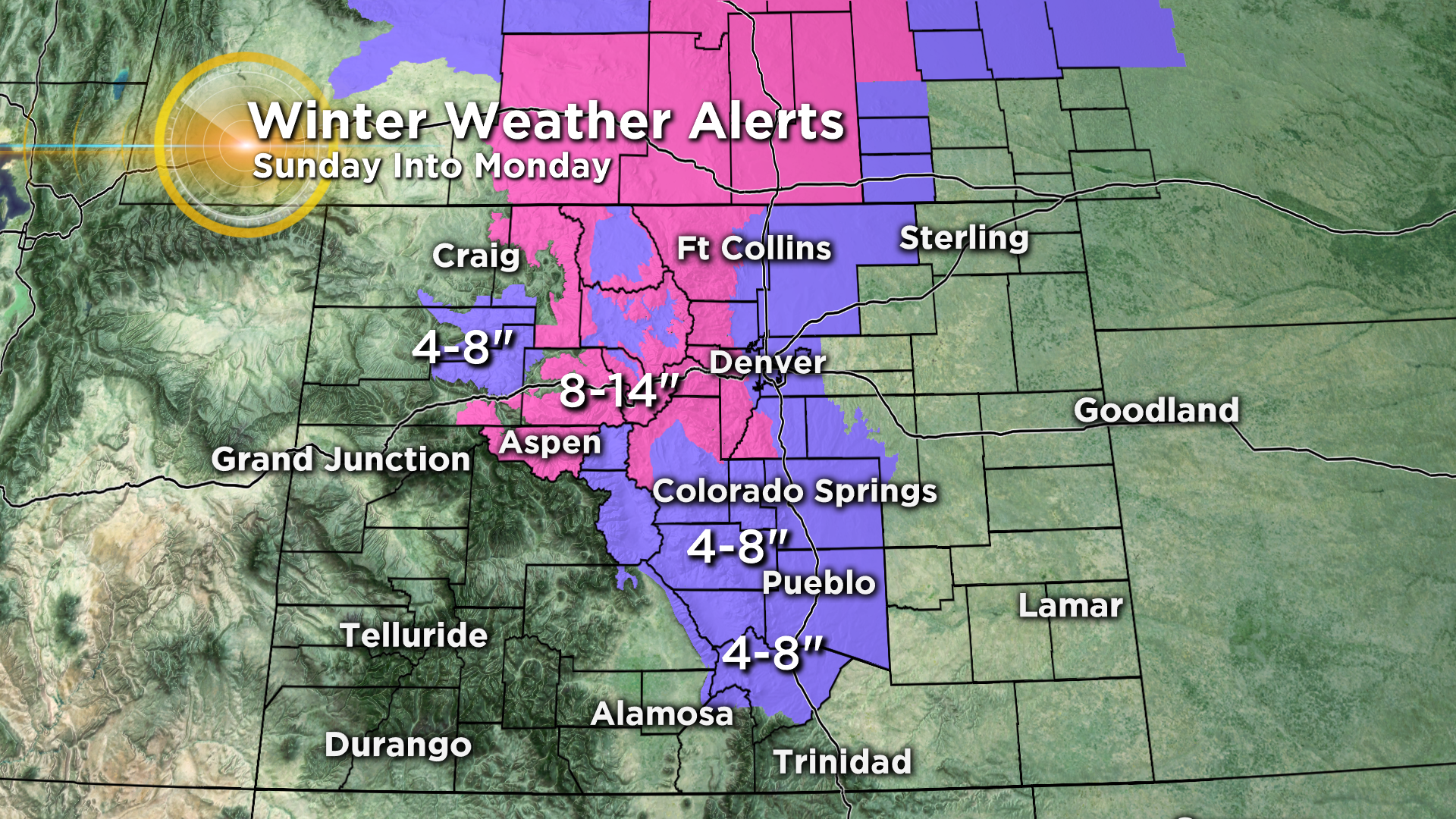
Several inches of snow could fall in the Denver metro area by Monday night with some places in the foothills exceeding a foot of new snow. The National Weather Service has issued Winter Storm Warnings (pink) and Winter Weather Advisories (purple) for a large part of the Interstate 25 urban corridor and the adjacent mountains and foothills.
NOTE: The following snow total forecasts are for the period covering Sunday and Monday. Additional snow is expected Tuesday and Wednesday. Stay tuned for new watches, warnings and snow totals from that storm as we get closer.
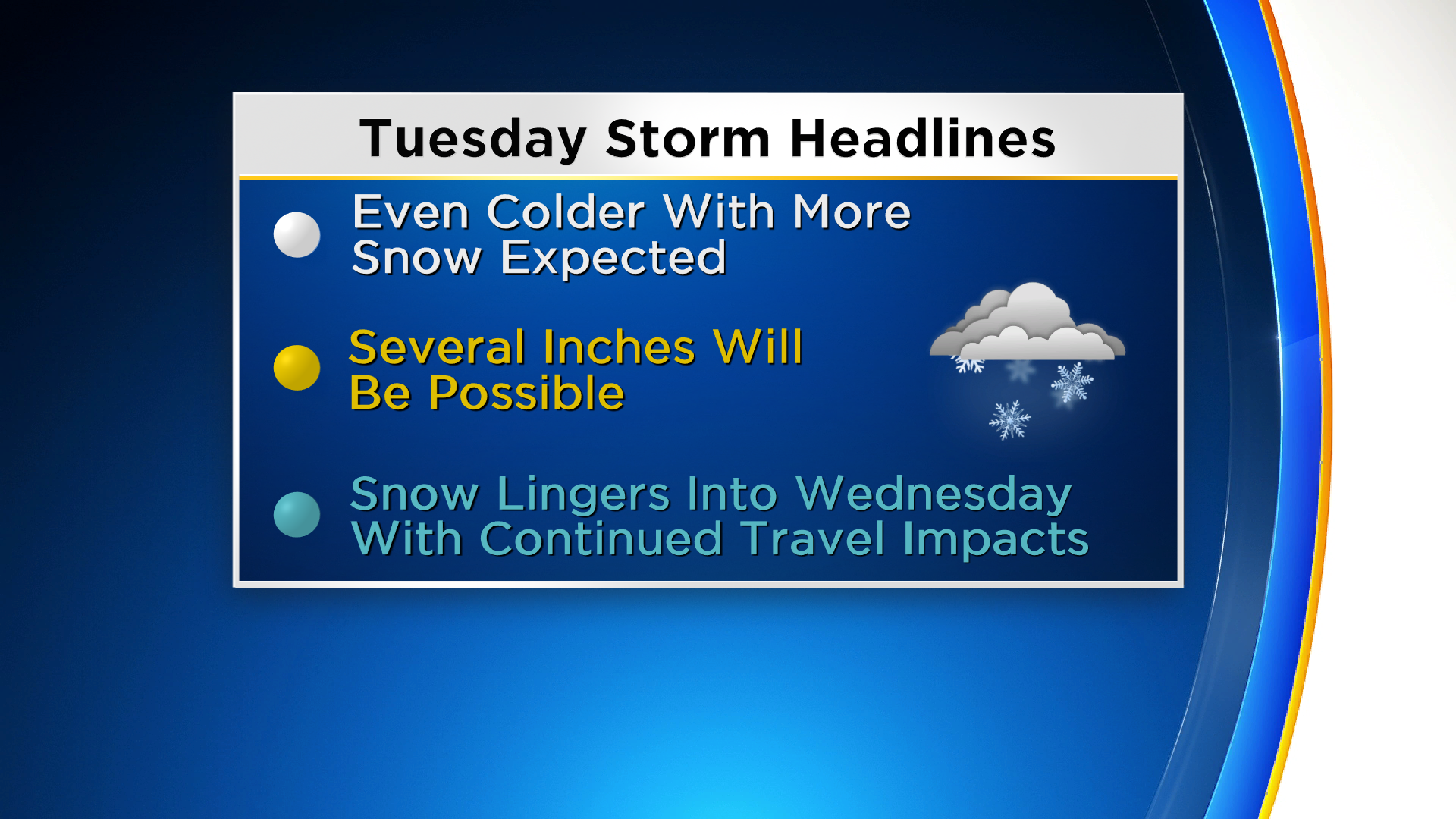
Once the first storm departs on Monday a second storm will arrive by Tuesday. It will bring even colder air and another round of accumulating snowfall. Travel issues are anticipated during all commutes to work and school on Monday, Tuesday and Wednesday. Temperatures will approach records levels for both the high and low each day.