Snow Is Coming: Winter Storm Watch Issued For Foothills, Palmer Divide
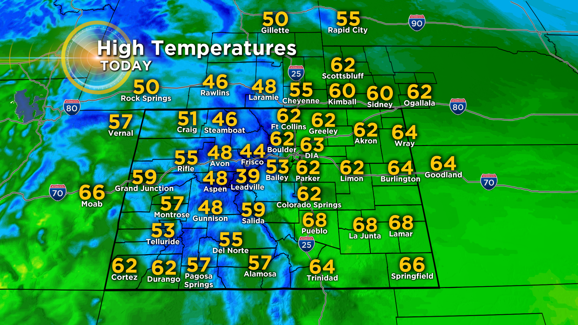
DENVER (CBS4) - We have a big change coming up in the forecast starting tomorrow. But for now your Tuesday will be seasonal across Colorado with just a handful of snow showers over the northern mountains, mainly along and north of Interstate 70. It will be breezy at times with highs ranging from the 30s and 40s in the mountains to the 50s and 60s on the eastern plains and western slope.
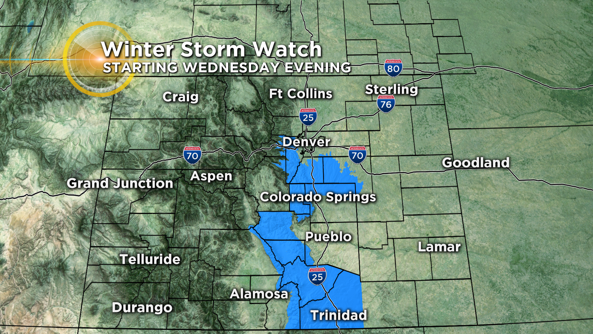
By Wednesday afternoon a strong cold front will move into the state with scattered rain showers. They'll change over to all snow by sunset and it could snow most of the night in some areas. Right now we expect little to no snow in the northern Interstate 25 urban corridor ... places like Greeley, Loveland and Fort Collins ... with the potential for 1-4 inches across metro Denver.
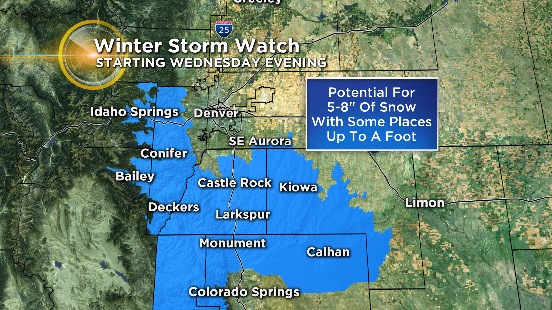
Heavier snow is possible in the foothills along and south of Interstate 70 and across the Palmer Divide between Denver and Colorado Springs. Because of this the National Weather Service has issued a Winter Storm Watch for the potential of 5-8 inches of snow with isolated higher totals.
The winter storm will be a fast mover with clearing skies settling into the region by Thursday night and Friday morning. Then we warm up nicely to start your weekend before another storm arrives on Sunday. Colorado could be in for an extended period of colder weather starting next week.