Some Weather Models Show Nocturnal Severe Storms On I-25 Corridor
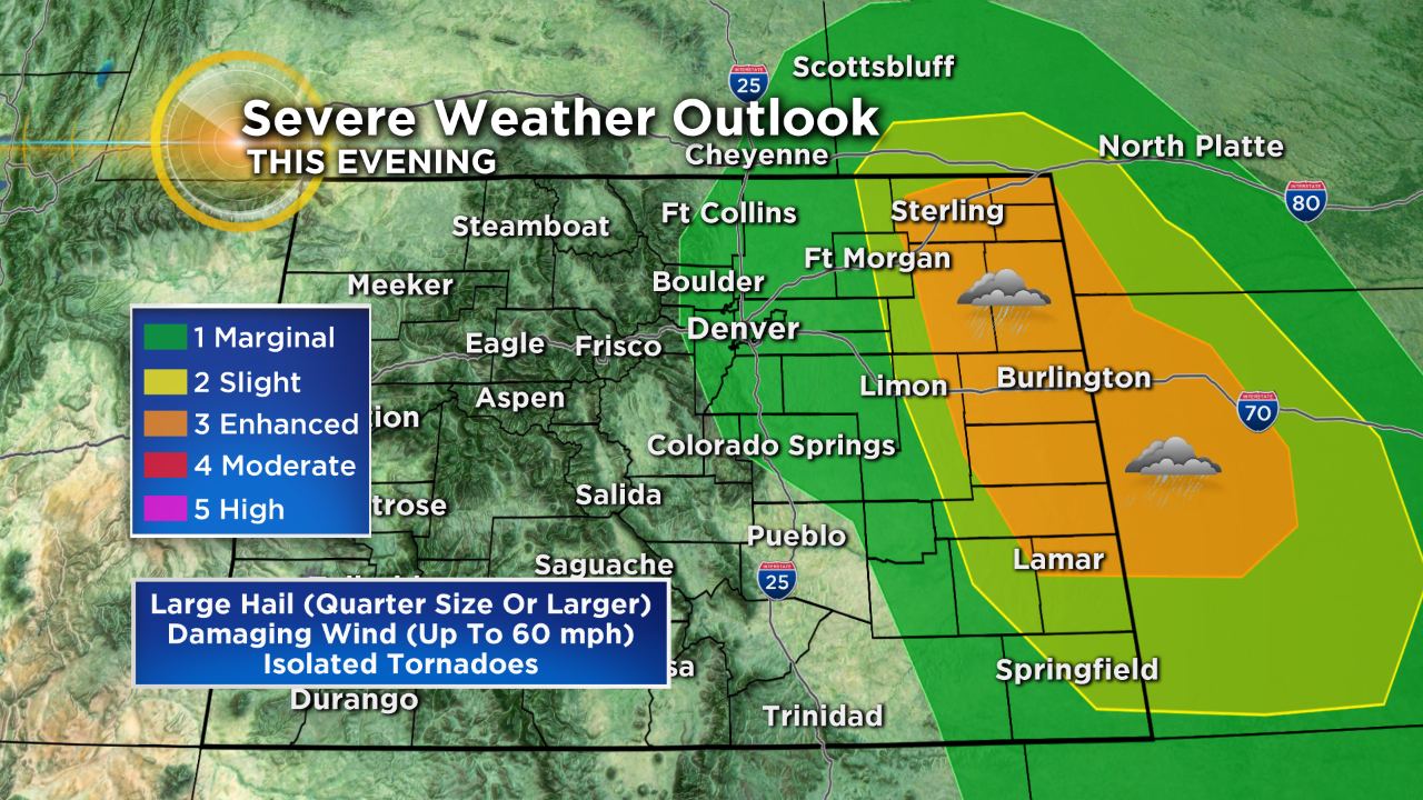
DENVER (CBS4) - Strong to severe thunderstorms are in the forecast for the far eastern plains of Colorado this afternoon and evening with the potential to see large hail, damaging wind, flash flooding and even a few tornadoes.
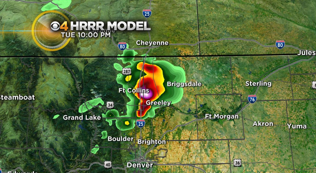
In addition to that threat some short-term weather models are now pointing to the potential for a few severe storms to pop up in the Interstate 25 urban corridor sometime around or after sunset. The following image was taken from the HRRR model at 1 pm, showing strong to severe storms possibly forming between Denver and Fort Collins around 10 pm.
It's hard to say if this will happen or not because the atmosphere is undergoing rapid changes with the severe weather in progress on the plains combined with ongoing daytime heating. But just in case we wanted to give a heads up.
A very astute forecaster at the National Weather Service in Boulder referenced a similar scenario in his forecast discussion this morning. On July 20, 2009 a round of severe thunderstorms exploded during the late evening hours over Denver. The following is a recap of that event...
July 20, 2009 - A severe thunderstorm produced damaging winds, large hail and very heavy rain across the western and southern suburbs of Denver. Widespread damage was observed in the cities of Arvada, Lakewood and Wheat Ridge. The intense straightline winds were the result of a wet microburst which downed hundreds of trees and snapped power poles. Wind gusts to 80 mph were reported along with hail up to 1 3/4 inches in diameter. The combination of wind and hail caused widespread damage to homes and vehicles. The damage claim estimates totaled 350 million dollars; about 32,900 claims were filed for homes, while another 19,500 claims were filed for vehicles. As many as 90,000 homes and businesses were left without power. In some areas it took up to 3 days to completely restore electrical service. Minor injuries were reported from broken glass during the storm, but no one was hospitalized. The storm crippled the computers at the Colorado Crime Information Center in Lakewood for nearly 3 hours. One weak tornado touched down near Parker but did no damage. In southern Weld County, severe thunderstorms produced widepread damage over 150 square miles of farmland. In all, 400 farms were directly impacted by severe weather. Damage to crops alone was estimated to 3 million dollars. At Denver International Airport, a peak wind gust to 48 mph was observed from the northeast. In addition, 1.01 inches was measured at the airport.