Denver Weather: Severe Storms Possible On Eastern Plains
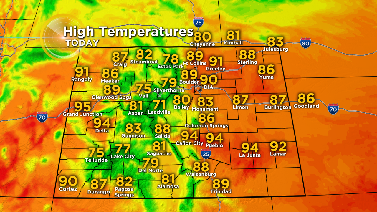
DENVER (CBS4) - Temperatures will reach near 90 degrees again along the Front Range. We have a growing threat for storms to develop on the far eastern plains of Colorado this afternoon.
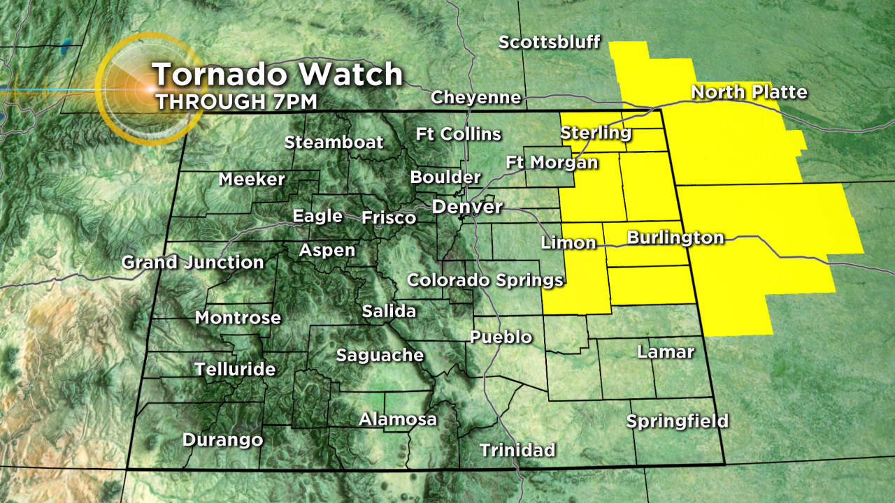
Most locations east of Fort Morgan, Limon and La Junta have been placed under an "enhanced" risk for severe weather. Threats include large hail, damaging wind, and isolated tornadoes. A tornado watch has been issued until 7 pm for many of these areas. There is also a Flash Flood Watch for a few counties in extreme east-central Colorado.
Farther west closer to the Front Range the threat for severe weather is very small. That said, some models do show a few storms developing around sunset in the I-25 urban corridor ... so we'll just have to wait and see how that evolves.
Prior to the chance for a thunderstorm, temperatures will be hot with highs near 90 degrees around Denver, Boulder, and Fort Collins which is slightly above normal for the middle of August.
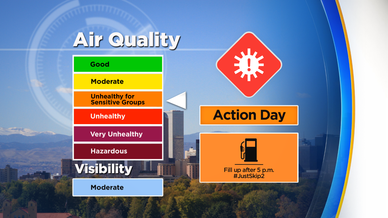
Another Ozone Action day has been declared on Tuesday. You're asked to fill up your gas tank after 5 p.m. and carpool whenever possible to help care for our summer air.
Very few changes will occur with our weather through the weekend with highs near 90 degrees each day and slight chance for late day thunderstorms. We have no good rain chances anytime soon.


