May Storm Could Dump Foot Or More Of Snow Across Mountains Of Colorado
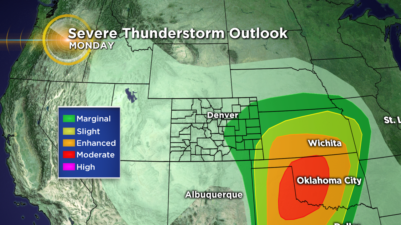
DENVER (CBS4) - A strong spring storm with unusually cold air will move into Colorado during the day on Monday. Ahead of the storm there is the potential to see strong to severe thunderstorms on Colorado's eastern plains Monday afternoon.
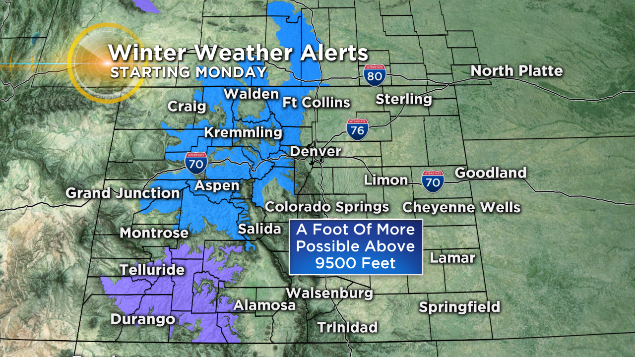
It will be a different story in the mountains where the air will be cold enough to produce snow, and it could pile up to a foot or more for locations above 9,500 feet. The National Weather Service has issued a Winter Storm Watch for places including Rocky Mountain National Park, the northern Front Range Foothills and adjacent mountain ranges. A Winter Weather Advisory has been issued for the San Juan Mountains where 5-10 inches of snow is possible.
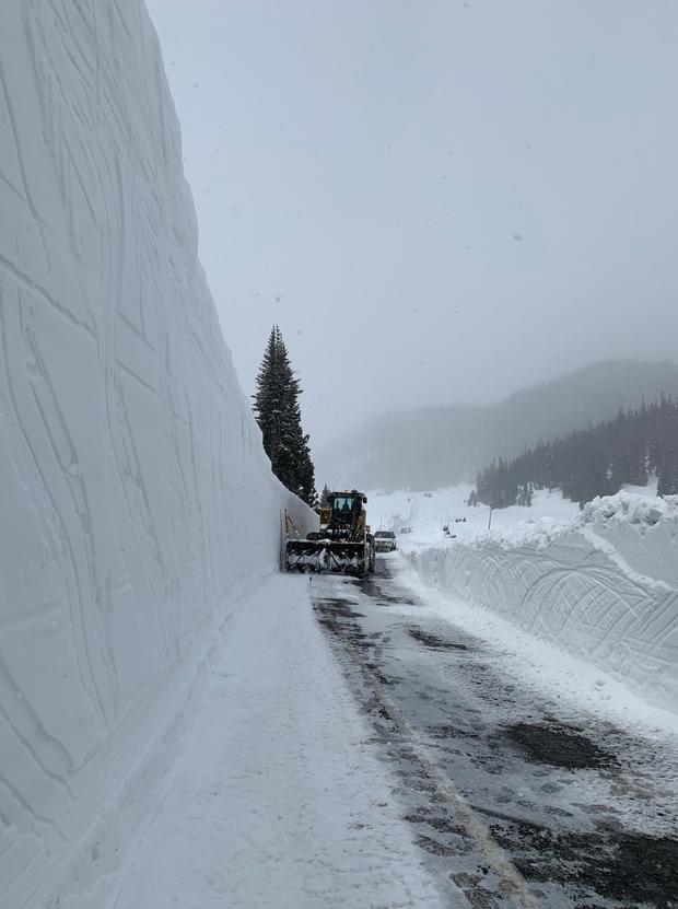
Travel by Monday night and Tuesday morning could be very difficult on mountain passes through heavily traveled routes, including Interstate 70.
The new snow will likely create additional delays in opening roadways such as Trail Ridge Road through Rocky Mountain National Park. Road crews try to open as many passes as possible in Colorado's high country ahead of the busy Memorial Day Weekend, but are facing extra challenges this year due to a deep snowpack and the current forecast.