Denver Weather: Storm Drops Slushy Snow On The Front Range
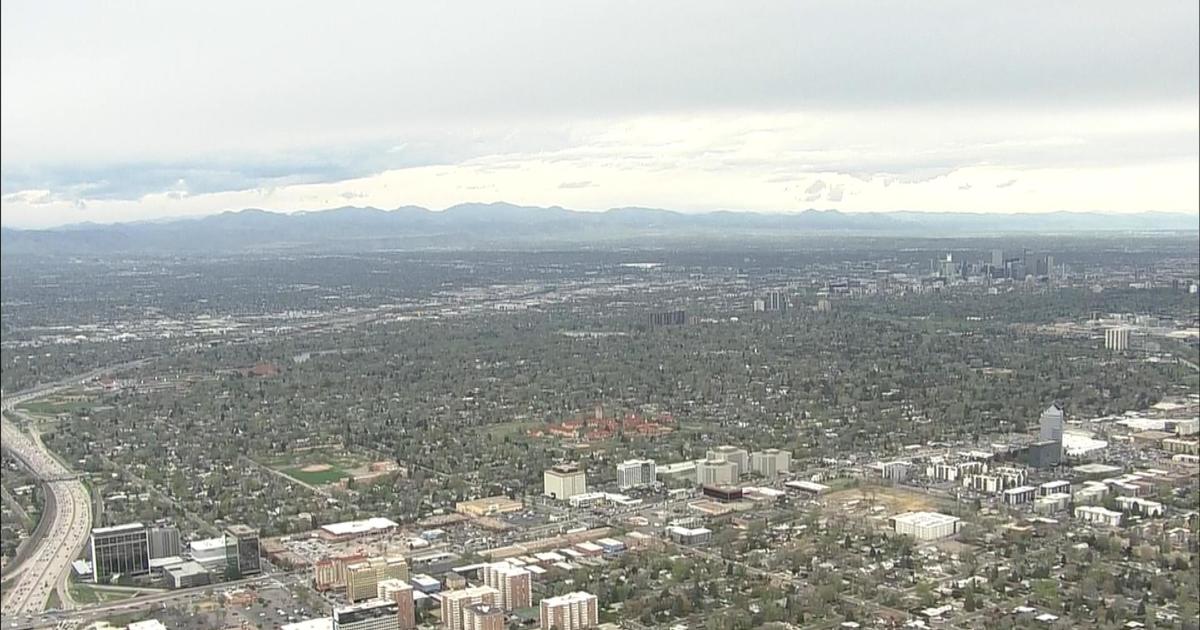
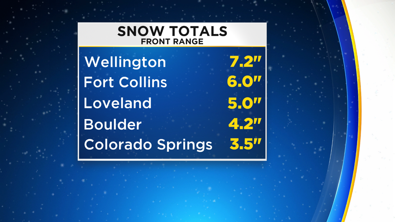
DENVER (CBS4) - A late season storm that promised spring snow in Colorado certainly delivered starting late Monday. By early Tuesday the snow had ended along the the Front Range with totals ranging from just a trace in some areas to more than 5 inches in northern Colorado. Most of the accumulation was limited to the grass.
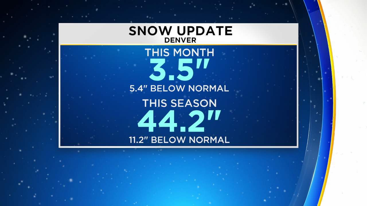
The official snow total for Denver as measured at DIA was 1.0" This brings to the total for April to 3.5 inches or 5.4 inches below normal for April. For the season Denver is just under a foot below normal. May averages only 1.7 inches of snow in Denver so it seems likely this season will end below our normal annual average of 57.1 inches.
Heavier snow fell in the Colorado Springs area early Tuesday where some roads were snowpacked and icy during the morning commute in El Paso County.
No additional snow is expected in the Denver, Boulder, and Fort Collins areas on Tuesday but scattered rain showers and a few isolated thunderstorms are possible starting Tuesday evening. Meanwhile temperatures will not be as chilly on Tuesday compared to Monday but highs in the lower 50s are still far below normal for the final day of April. Very similar weather is expected in the metro area on Wednesday.
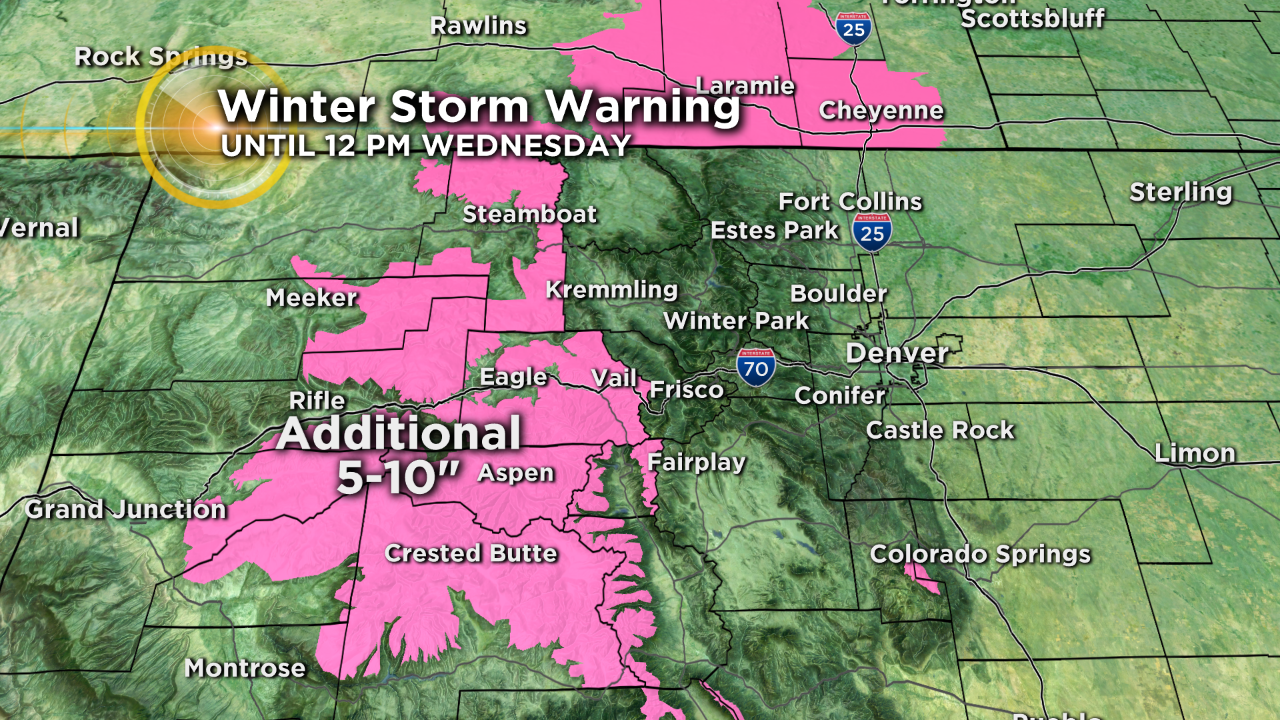
In the mountains there will continue to be additional snow through Wednesday. A Winter Storm Warning continues west of Vail Pass until 12 p.m. Wednesday for an additional 5-10 inches of snow and wind gusts over 30 mph.
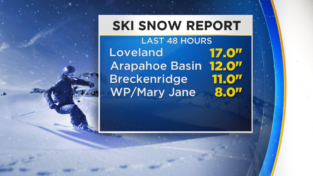
And speaking of the mountains, the handful of ski areas that remain open have seen impressive snow since Sunday. The total for the season at Loveland ski area is now a whopping 421 inches. On average they see about 400 inches each year.
Drier and warmer weather is still on track to return later this week.