Colorado Weather: Blizzard's Full Potential Didn't Develop, Impact Still High
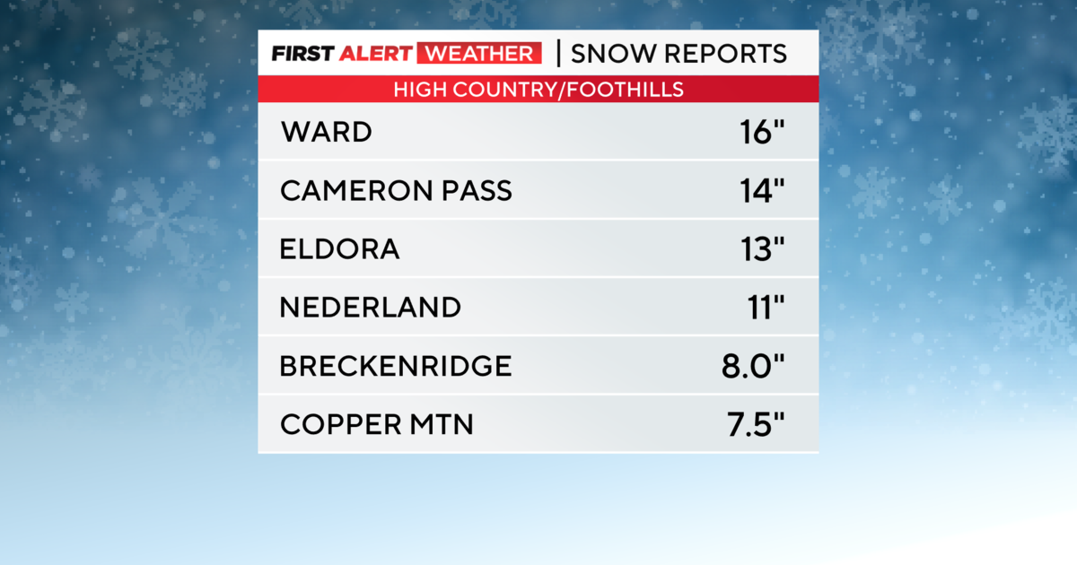
DENVER (CBS4) - There's a lot of water-cooler chit chat today about our April blizzard, which some referred to as Bomb Cyclone #2. In a few places the storm lived up to the forecast, such as in Loveland, Fort Collins and Elizabeth, with up to 10 inches of snow and significant blowing and drifting.
Weather forecasts are created around the potential for what a storm could deliver to a region. In a place like Colorado there's an extra challenge in that storms take on a new life once they have cleared their biggest hurdle on the North American continent -- the beautiful Rocky Mountains.
After days of analyzing countless amounts of data, when confidence grows high enough for potential impact, the National Weather Service will issue warnings, watches or advisories. But a warning doesn't mean we are dealing with a slam-dunk forecast. Storms sometimes take on a new look that even computer models can't predict once they move onto the open plains. That new look could be a different position, path, size or a combination of all three.
At the point where we see a storm is not looking like it should, the damage has been done because the forecast has been issued and the expectation has been set for the general public. Despite, meteorologists do their best to get the NEW message out saying things just aren't coming together and the forecast is changing.
One factor that played into the lower snow totals for the Denver metro area was the delayed changeover from rain to snow during the afternoon on Wednesday. Regardless of the lower snow amounts and warm days prior, area roads still turned icy and snowpacked Wednesday night thanks to a flash freeze, or a rapid drop in temperature, which fell from near 30 degrees to the lower 20s in just a matter of hours.
While the full potential for our April blizzard never developed Wednesday over eastern Colorado, the region still saw high impact after experiencing June-like temperatures just 36 hours prior. Denver's official weather station recorded a 61 degree temperature swing in just under 37 hours. The high on Tuesday was 78 degrees and the low Thursday morning was 17 degrees.
Thanks to the longer days and April's higher sun angle we'll see a rapid recovery for those who did see accumulating snow, and any lingering travel impacts should wrap up by Thursday afternoon.
PHOTO GALLERY: Bomb Cyclone: April Blizzard