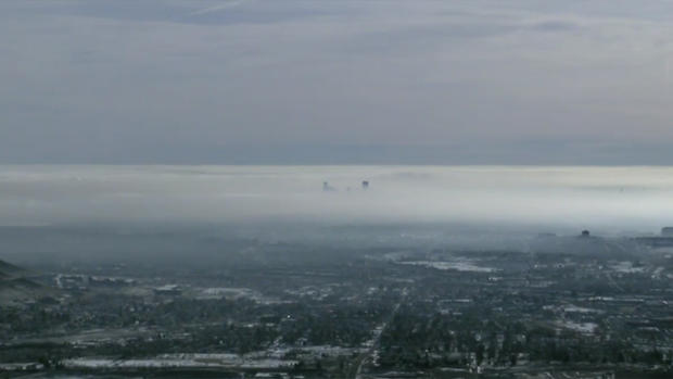
Denver Weather: Morning Fog To Cause Wide Variety of Temperatures Tuesday
DENVER (CBS4) - Dense fog responsible for cancellations and delays at Denver International Airport and slowdowns on many roads Tuesday morning will be slow to clear in some areas. The fog has been caused by a very shallow cloud deck that extended only about 1,000 feet about the ground. Locations above about 6,000 have enjoyed sunshine all morning.
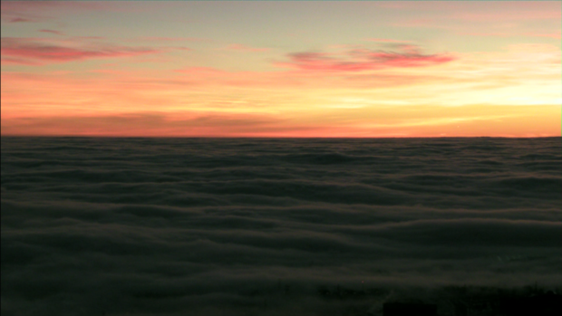
The low clouds will have a significant influence on high temperatures on Tuesday.
There were nine cancellations, all departures, and 36 delays of an hour or more with United Airlines on Tuesday morning.
In areas along the Front Range where the fog clears early enough, highs will be in 50s. Neighborhoods near the base of the foothills will also likely be in the 50s Tuesday afternoon regardless of clearing. Most other areas will be stuck in the 40s again except for locations on the far Eastern Plains where highs will be in the 20s and 30s.
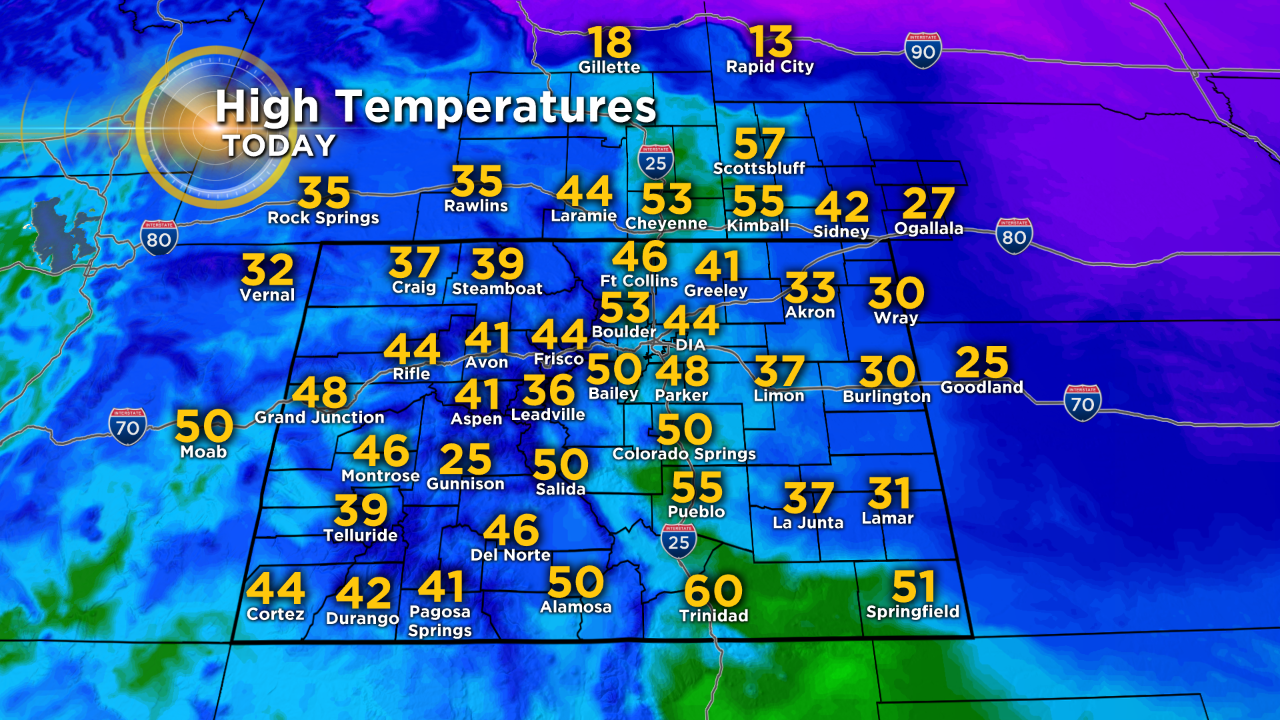
Many mountain towns will be warmer than most towns on the Eastern Plains thanks to ample sunshine in the high country. Remember sunscreen if you're lucky enough to be skiing on Tuesday!
Looking further ahead, we may have fog again at lower elevations Wednesday morning. Wednesday temperatures will be similar to Tuesday before substantially warmer weather arrives on Thursday with highs in the mid and upper 50s in the Denver, Boulder, and Fort Collins areas. In many neighborhoods it will be the warmest day in weeks.
Then cooler weather arrives for Friday followed by cold weather for weekend. Chances are good that we'll see snow showers return to the mountains at the end of this week and it's also possible we could see a rain/snow mix in the Denver area on Friday and then flurries or light snow along the Front Range on Saturday and Sunday.