First Of Two Storms Arrives
DENVER (CBS4) - The first of two storms will have lots of snow and wind for the western mountains into Friday.
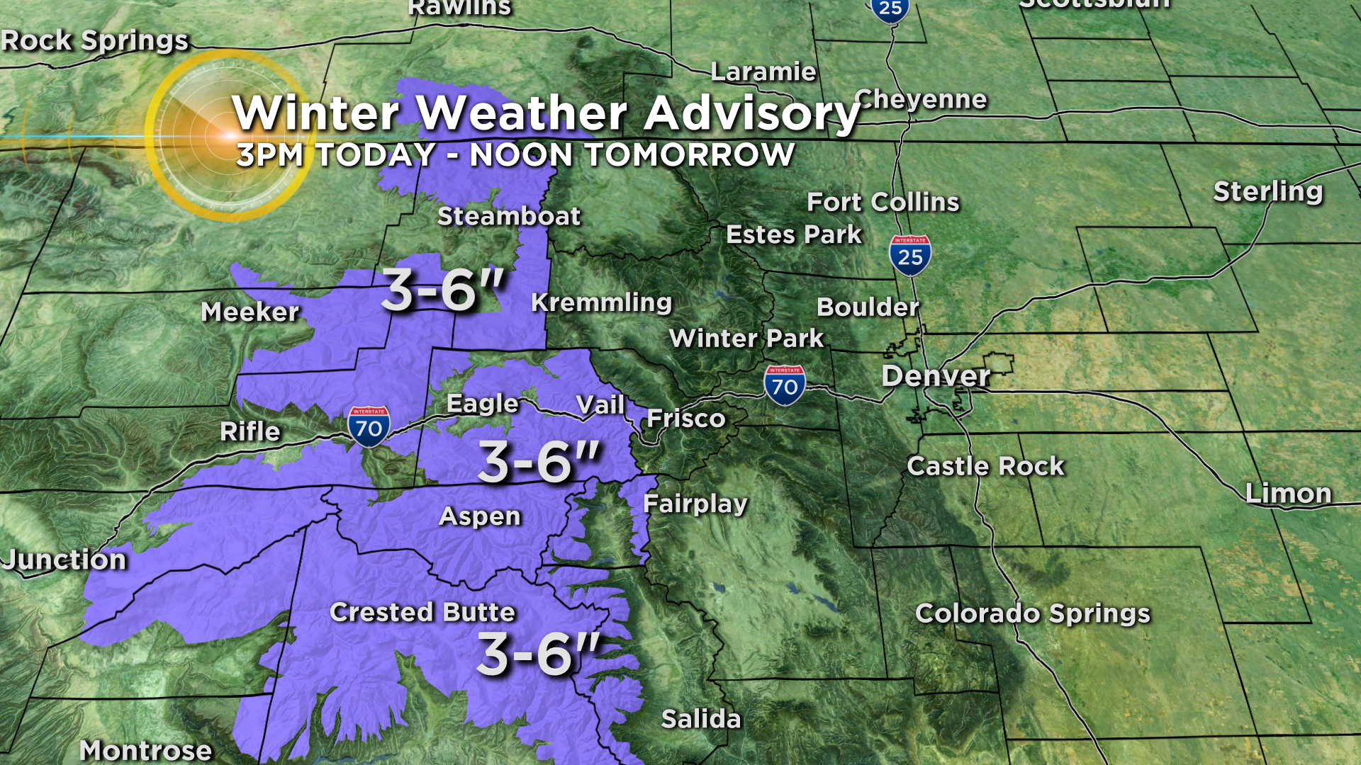
Accumulation will be limited with this first storm but a Winter Weather Advisory has been issued starting at 3pm Thursday west of Vail Pass for 3-6". Slightly higher amounts are expected in the San Juans Mountain including the Telluride, Lake City and Ouray areas. Meanwhile Summit County and the Winter Park/Estes Park areas should get less than 4" of snow with this first storm.
The metro area will stay completely dry through Friday but it will get WINDY. Gusts could top 40 mph inside the metro area from late Thursday night through Friday.
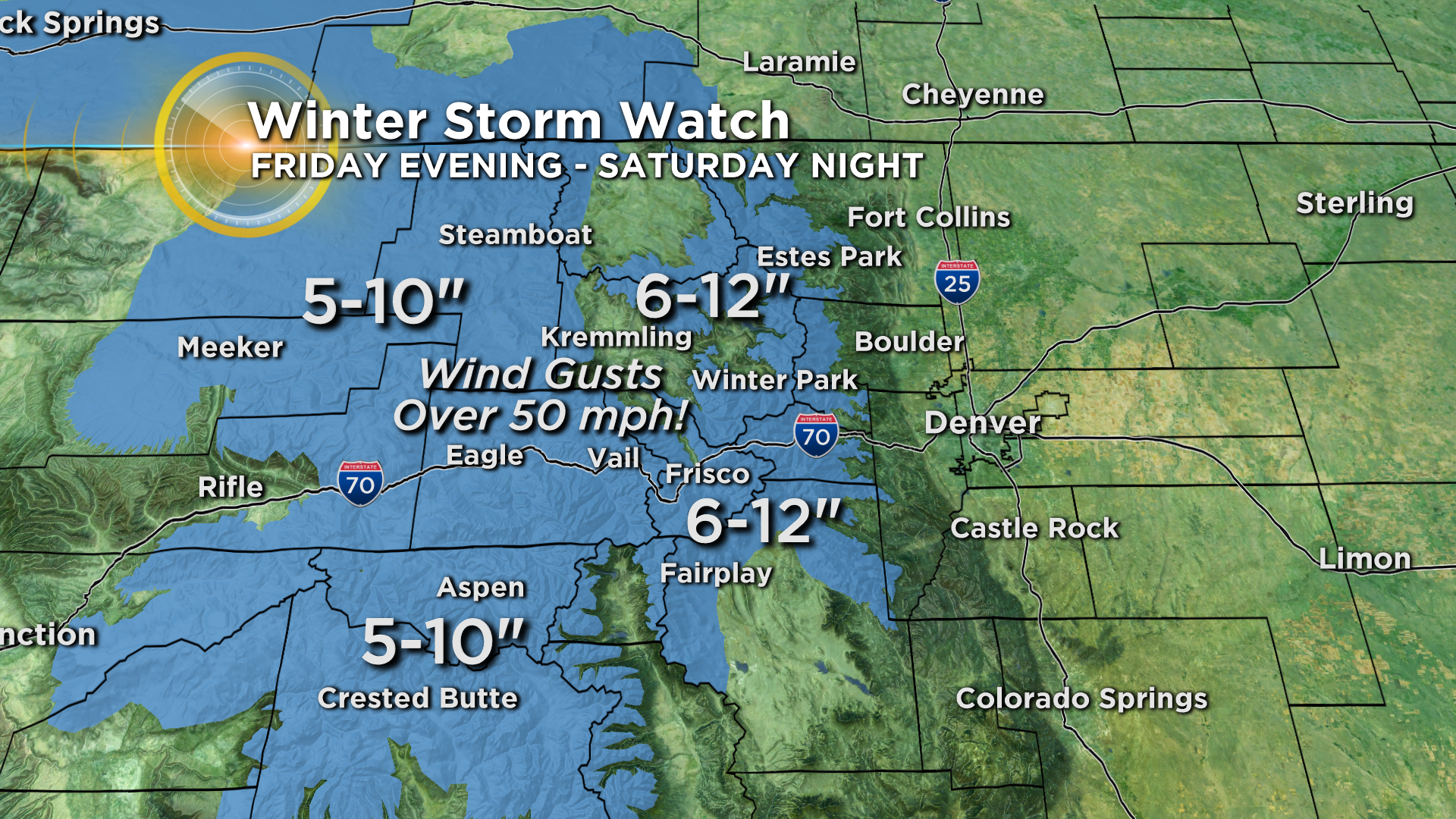
Our second storm is much stronger and has the potential to cause major travel issues in the high country including road closures. The storm will hit in earnest late Friday evening and will cause snow and wind in the mountains through much of Saturday. A Winter Storm Watch has been issued for 6-12 inches of snow but amounts could easily exceed a foot over the higher peaks and passes. Wind gusts will top 50 mph.
It will be noticeably cooler and still quite windy on Saturday. Moisture should be limited but we could get a few light cold rain showers. That's right – rain! At this time it doesn't look cold enough for accumulating snow in Denver. There could be an inch or two along the Palmer Divide and in the foothills.
Regardless, we'll dry out statewide for the big travel day on Sunday. Plan on chilly temperatures during the Broncos game at Mile High. At kickoff we'll be near 40°.


Ashton Altieri is a Certified Broadcast Meteorologist. Watch him on the CBS4 Morning News weekdays from 4:30 a.m. to 7 a.m. Connect with Ashton on Facebook and on Twitter @AshtonCBS4.