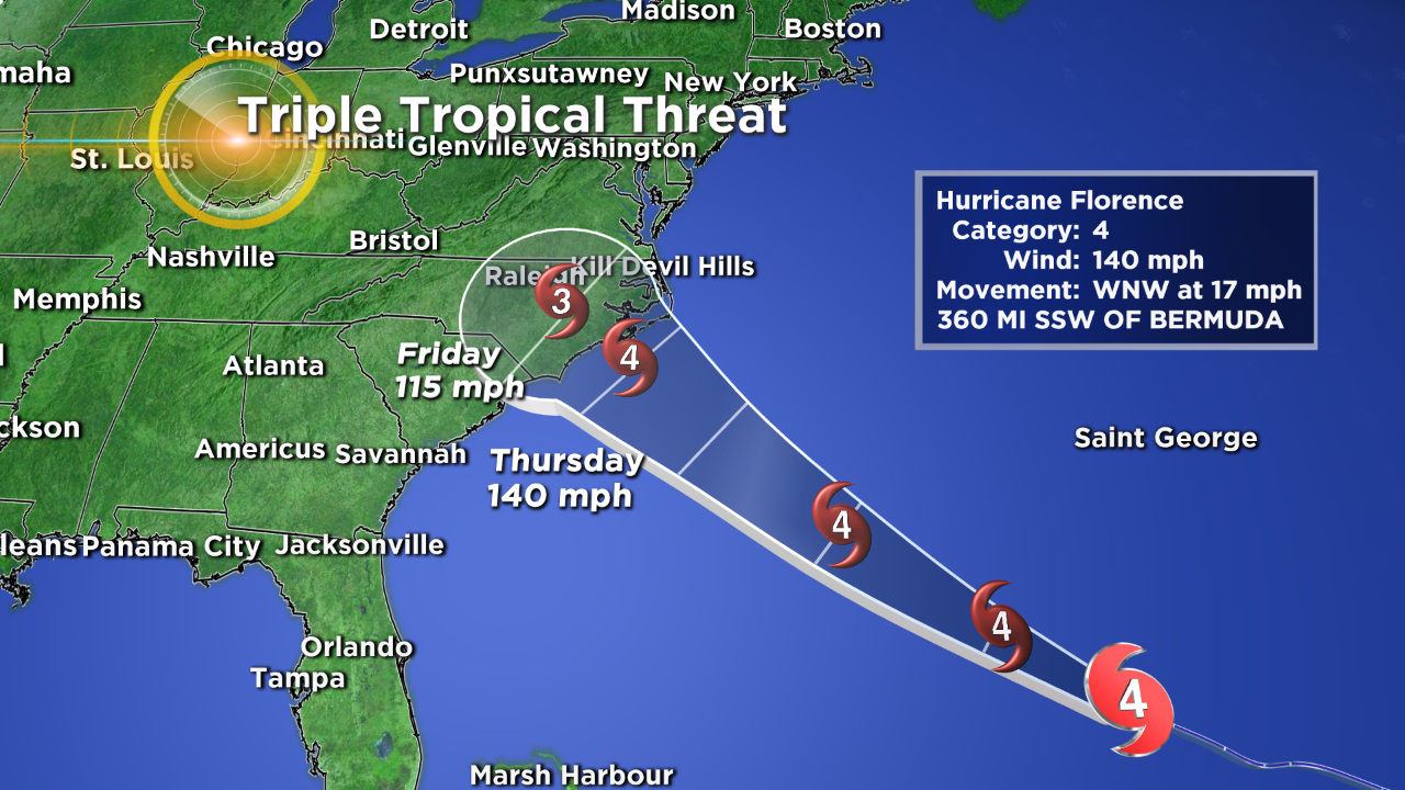
Little Change In Hurricane Florence Predicted Path
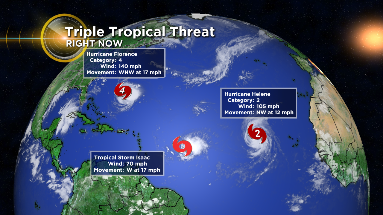
Hurricane Florence waxed and waned in the last 24 hours weakening a little overnight Monday into Tuesday morning and then regaining strength during the day on Tuesday locking in as a Category 4 storm.
The latest track still brings Florence crashing into the Carolinas and Virginia late Thursday into Friday as a major Hurricane. There are a few of the forecast models indicating it may weaken to a Category 3 before landfall. This remains to be seen as there is no major system or weakening wind shear pattern in its path through the end of the week.
The weather pattern Thursday into the weekend still has a cold front with high pressure behind it moving into the northeast and the blocking high over the mid-Atlantic holding firm. This means the storm impact may be two fold. One being the initial storm surge on the coastlines. With some of the surges expected to be well over a foot. The second impact will be flooding inland rains as the storm system continues to be locked over western parts of the Carolinas and Virginia through the weekend.
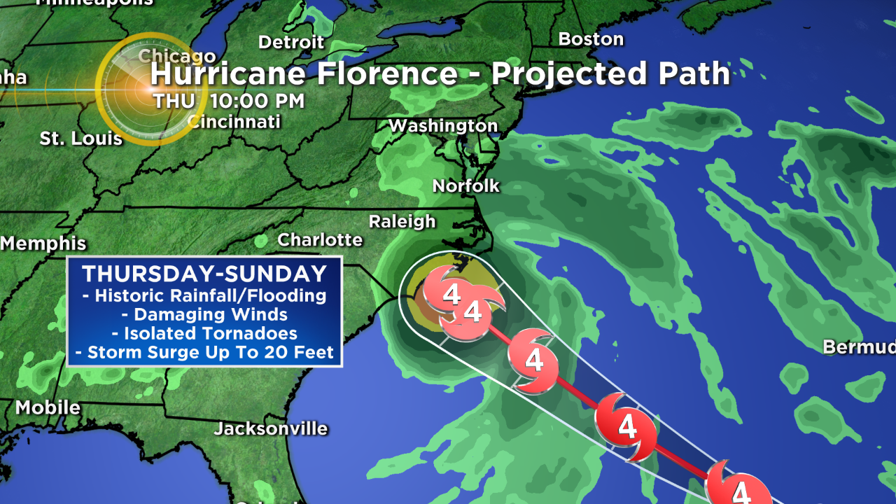
This scenario may have the potential of producing one of the strongest hurricane strikes on record to hit the East Coast. With a variety of destructive elements ranging from life-threatening storm surge, destructive winds and potentially catastrophic inland rainfall flooding.
Meteorologist Dave Aguilera is a Colorado native and has been forecasting weather in the Rocky Mountain region for over 25 years! Connect with Dave on Facebook and on Twitter @DaveAgCBS.