Cold Front Arrives Late Sunday
DENVER (CBS4) - Saturday was even warmer than Friday and is now the warmest day so far this year in the metro area with an official high of 71° at DIA. Sunday will be somewhat cooler but still far above normal with highs in the lower 60s ahead of a cold front that will arrive in the late afternoon.
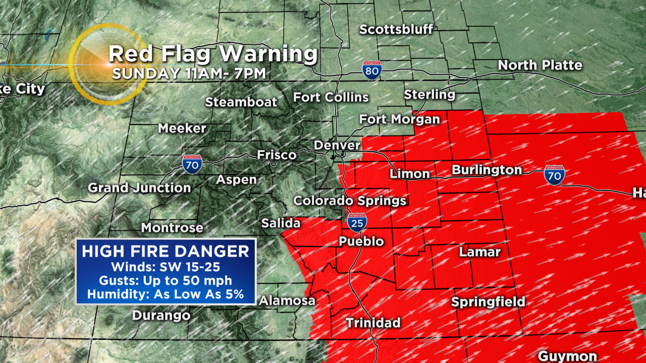
The front is coming from the west instead of the north and therefore the wind behind the front will descend the east side of the Rockies and keep Denver and the Front Range dry thanks to the "downsloping" effect. But although we'll stay mainly dry, it will turn quite windy in the metro area by Sunday evening and gusts on Monday could reach 50 mph - even strong east of Denver. The wind will combine with very dry soil and extremely low relatively humidity to create an elevated fire danger southwest of the metro area. A Red Flag Warning has been issued from 11am until 7pm Sunday.
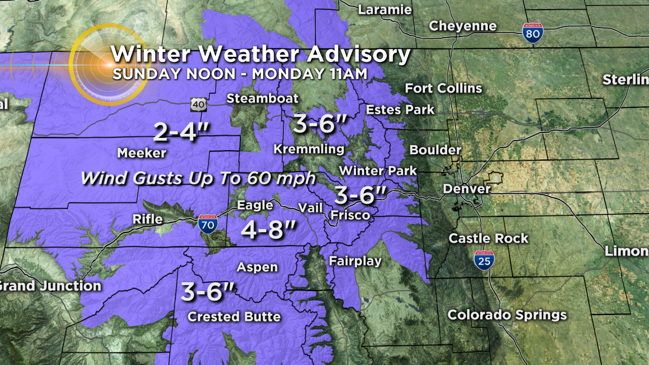
For the mountains, it will be a combination of wind and snow on Sunday. The snow will develop mainly in the afternoon for mountain areas east of Vail Pass with 3-6 inches on average by Monday morning. Slightly higher amounts are possible west of Vail Pass. Meanwhile, the wind will gust up to 60 mph at the same time causing considerable blowing an drifting snow. Needless to stay, travel will become difficult in many mountain areas by Sunday night.
Monday and Tuesday will be much cooler with highs in the 40s. Wind chill will also be an issue on Monday. A warming trend returns Wednesday through next weekend.


Ashton Altieri is a Certified Broadcast Meteorologist. Watch him on the CBS4 Morning News weekdays from 4:30 a.m. to 7 a.m. Connect with Ashton on Facebook and on Twitter @AshtonCBS4.