Plenty of Clouds over the Eastern Plains
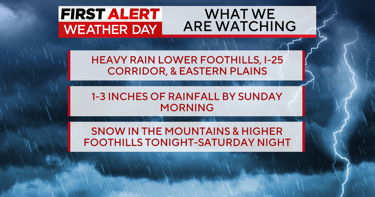
DENVER (CBS4) - A weak storm system wobbling over the eastern plains really got a few good rain producing thunderstorms going on Saturday. Some areas near Parker and Deer Trail received anywhere from a quarter of an inch to over one inch of rainfall late Saturday afternoon.
This moisture is the combination of a small low pressure disturbance over the Palmer Divide, monsoon moisture and cooler air pushing into the region.
At the same time slightly drier air is pushing in from the west. This drier air will work its way over the eastern side of Colorado on Sunday. Making for a mostly sunny day in the Mile High City by then. The best chances for rain on Sunday will be in the San Juan mountains of the west slope and the extreme eastern fringes of the state close to the Kansas line.
Hot temperatures will return to Denver in the week ahead with the return of the 90s starting on Monday. There will still be a slight chance for late day storms each afternoon.


Meteorologist Dave Aguilera is a Colorado native and has been forecasting weather in the Rocky Mountain region for over 25 years! Connect with Dave on Facebook and on Twitter @DaveAgCBS.