Not As Hot Sunday With More Storms Soon
DENVER (CBS4) - We are smack dab in the middle of another hot and dry weekend. There were a few thunderstorms that fired up over the extreme northeast and southeastern areas of the state that did have hail and high winds. But, over all most of the state stayed high and dry for another day. Denver's official high made it to 97 degrees on Saturday.
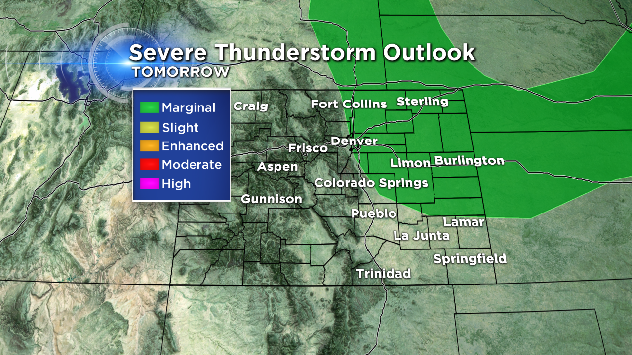
Sunday should be just a little cooler over northern Colorado. On the weather map there is a dry cold front that will surge in and bring highs down by about 5 to 8 degrees from Saturday's highs. There is a slight chance for a few afternoon thunderstorms over the state on Sunday. And a marginal chance that some could be severe from Denver out over the northeastern plains.
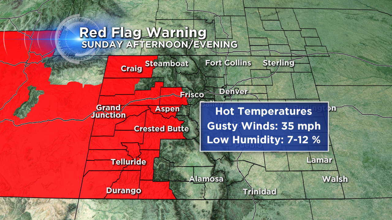
The Fire Danger for Western Colorado will loom large over the Sunday forecast. With a Red Flag Warning again in place over most of the western slope.
In the week ahead the forecast charts are showing a return of a weak monsoon flow that will increase chances for late day thunderstorms across the Front Range and adjacent plains. Monday will cool down a bit with warmer temps returning by mid-week.

Meteorologist Dave Aguilera is a Colorado native and has been forecasting weather in the Rocky Mountain region for over 25 years! Connect with Dave on Facebook and on Twitter @DaveAgCBS.