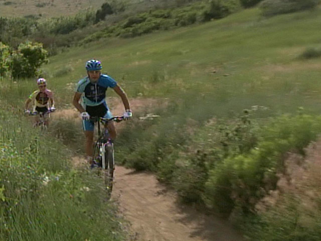
Top Mountain Biking Trails In The Denver Area
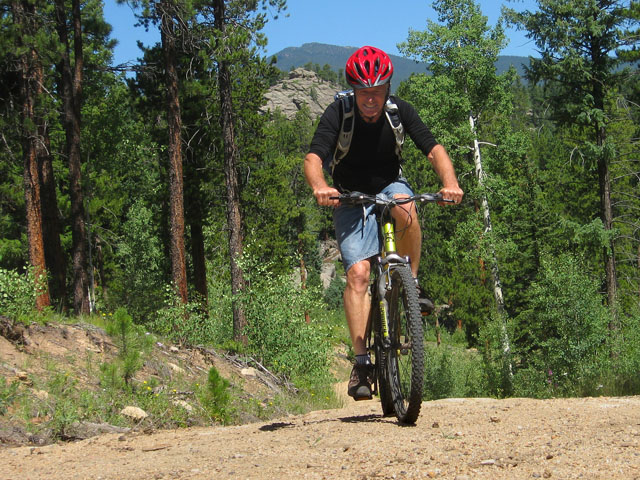
Mountain biking continues to grow as a hobby in the Denver metro area. Families and tentative types ride their knobby-tired bikes on wide, unpaved and often fairly smooth roads. More skilled riders seek out narrow trails where they can crank uphill and cruise downhill. They consider logs and rocks in the trail to be challenges, not obstacles. Close-in trails can get so crowded on warm-weather weekends that land managers have sometime instituted one-way loop routes or alternate days when bikes are permitted or prohibited. These regulations do change, so check signs. Also, mountain bikers are required to yield to hikers and especially equestrians.
Apex Park
Nearest town: Golden
Trailhead: Heritage Square, lower parking lot
co.jefferson.co.us/openspace
This 5½-mile loop trail provides a lot of bank for the biker's buck. It is easy to reach, has a huge parking lot and offers both challenge and interest. Various sections feature steep climbs or descents, rocky singletrack, forest-shaded stretches and challenging soft sandy areas. The trail makes a loop. To add roughly 3 more miles of singletrack to the ride, bikers continue heading west through the park on the Apex Trail out to Lookout Mountain Road. The route is one-way on odd-numbered days. The Apex Park trail system consists of the Apex Trail, Enchanted Forest, Sluicebox and Grubstake, and there is also a link to Lookout Mountain Road and Chimney Gulch for those who want more miles.
Barr Lake State Park
Fee Area
Nearest town: Brighton
outdoorbasecamp.com
Park entrance: From Denver, I-76 northeast, exit at Bromley Lane, then east to Picadilly Road and south to the park entrance. From E-470, exit 34 (120th Ave.), then east to Tower Rd., left (north) onto Tower Rd. and follow pavement to Picadilly Rd. Left on Picadilly. Park entrance is a mile ahead on the left.
This 8.8-mile mountain biking route is actually not in the mountains but on the plains but with spectacular view of the mountains. The high peaks of the Indian Peaks Wilderness and Rocky Mountain National Park to the west compensate for this trail's lack of adrenalin excitement, for this is a wide and flat trail around Barr Lake. The Crest Trail segment is the top of the dam that creates the lake. On a clear day, the panorama stretches for 100 north-south miles. Barr Lake is known for its outstanding birding opportunities, and it's the rare bicyclist who doesn't stop at special viewing areas along the trail to look for birds and wildlife. Park officials encourage thorn-proof tires.
Betasso Preserve Mountain Bike Trail
Nearest town: Boulder
Trailhead: Drive up Boulder Canyon on Hwy. 119 (west). Right on Sugarloaf Road and then right to Betasso Preserve (follow signs).
bouldercounty.org/play
In 1975, Betasso Preserve became Boulder County's first major open space purchase. It has been a gift that keeps on giving to mountain bikers, hikers and equestrians who share this multi-use parcel. Expert mountain bikers might not think too much of Betasso, but for novices, this tree-lined loop plenty turns, and alternating climbs and quick downhills. From the parking area the trail drops into the valley, and that means there is a climb at the very end. Parts of the 3-mile singletrack trail boast fine views and others scary ones of sharp drop-offs right next to the trail. The trail is ridden clockwise and counterclockwise on alternate months, but bikes are prohibited altogether on Wednesdays and Saturdays. In May 2011, the steep and gnarly 3.1-mile Benjamin Loop was added to the original Betasso Trail, and a 2-mile connector built by 329 mountain biker volunteers with a connection directly from Boulder's Eben Fine Park via the Boulder Creek Trail.
Red Rocks Trail
Nearest town: Morrison
Trailhead: Lower north lot of Red Rocks Park, I-70 to Morrison exit, then south on Hwy. 93 to park entrance.
redrocksonline.com
Red Rocks Park is famous for its spectacular amphitheater, but it also has a fine trail system. The eponymous Red Rocks Trail can be and end unto itself or provide access to two additional trails. It is a fairly smooth singletrack trail through spectacular rock formations and fine views. It splits after 1.2 miles. The left route goes north into Jefferson County's Matthews-Winters Park, where it forms a 2-mile loop, Going right at the split, the trail heads east and eventually connecting with the Dakota Ridge Trail, which offers the rare technical slick rock riding on the Front Range.
- Mile High Cheapskates Claire Walter & Laura Daily keep Denver/Boulder residents informed about the latest deals, discounts and freebies at MileHighOnTheCheap.com
RELATED STORY: Mountain Biking In Grand Valley Gains In Popularity
RELATED STORY: Valmont Bike Park Opens To The Public