Monday afternoon storms expected, mostly in the mountains south of Interstate 70
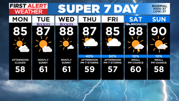
It's back to work and school for a lot of people around Colorado this week and overall the weather will be pretty typical for this time of the year. For Denver and the Front Range it'll be a little warmer and drier over the next few days, as compared to what we saw over the weekend.
Highs on Monday should climb into the 70s and 80s just about statewide with a few low 90s on the western slope and eastern plains. You'll find 50s and 60s in the mountains above 9,500 feet.
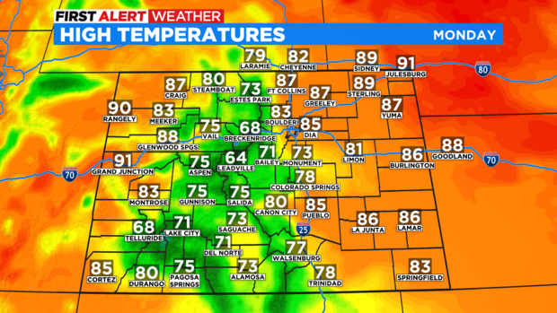
We are going to see more showers and thunderstorms during the afternoon hours on Monday but those will mostly be confined to the mountains along and south of Interstate 70. The Denver area and extreme northern Colorado will most likely stay dry, but there is always a slight chance to see a pop up storm.
The forecast will be similar on both Tuesday and Wednesday before we see a pretty good chance for widespread showers and storms back in the forecast to wrap up the work week. Thursday and especially Friday could be on the wet side for many areas, including Denver.