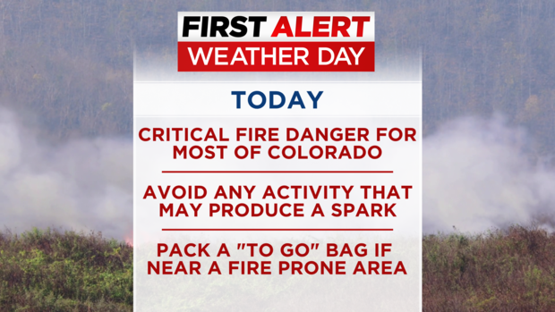
First Alert Weather Day: Colorado Returns To A Familiar Pattern With High Fire Danger This Week
DENVER (CBS4) - It's become a very familiar situation along the Front Range this season. The combination of dry air, warm temperatures, and gusty winds will create critical fire danger on Monday and probably on Tuesday and Wednesday as well.
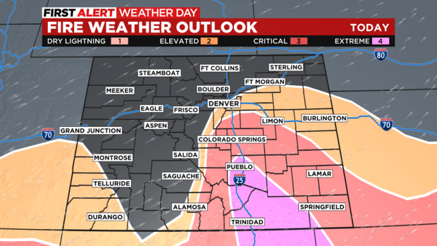
The National Weather Service has issued a Red Flag Warning for Denver and most of the metro area for high fire danger from 11 a.m. until 7 p.m. on Monday. Wind gusts up to 50 mph together with relatively humidity under 15% and above normal temperatures in the 70s means if a fire were to start, it could spread very quickly in the warned area.
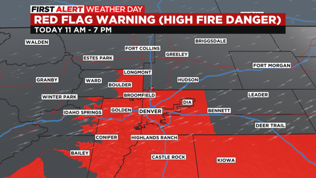
The warning also extends into southern Colorado where it starts earlier and ends later compared to Denver on Monday.
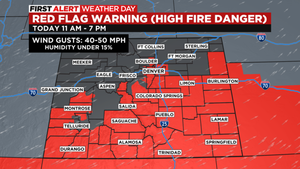
While fire danger is high virtually everywhere in Colorado where snow doesn't cover the ground, the primary concern is in southern Colorado with "extreme" danger from around Pueblo south to Walsenburg and into the Trinidad area. On a of 1-4 with 4 being the highest fire danger, these cities are at a 4 on Monday. The danger around Denver is officially described as "elevated" whereas the Castle Rock and Colorado Springs areas are described as "critical".
The CBS4 Weather Team has declared Monday a First Alert Weather Day and additional declarations seem likely for Tuesday and Wednesday.
The warmest day of the week will be Wednesday when Denver could experience record heat again. The city reached 89 degrees on Saturday which is the warmest temperature observed in Denver so far this year. That was enough for a record on Saturday but the record on Wednesday is 90 degrees from May 11, 1961. It's entirely possible will at least tie the record.