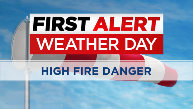
Colorado Weather: First Alert Weather Day For High Fire Danger On Easter
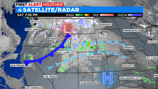
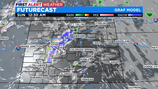
DENVER (CBS)- Happy Easter! We have an Easter cold front heading into the state for Sunday. The system pushed clouds, wind and a few light showers of rain and snow into western Colorado on Saturday.
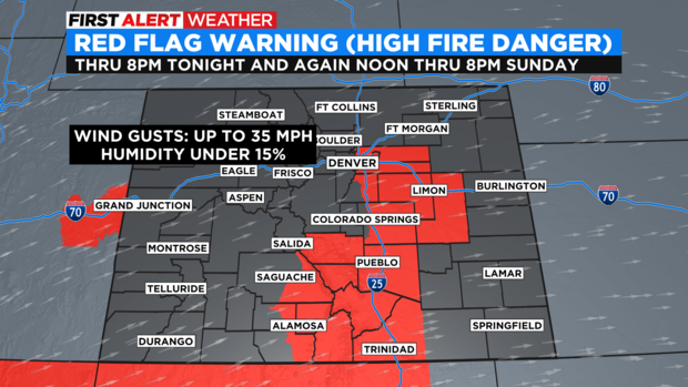
There will be a little moisture for the high country Sunday but, the big story for areas east of the Front Range mountains will be wind. We have a First Alert Weather Day posted for High Fire Danger on Easter.
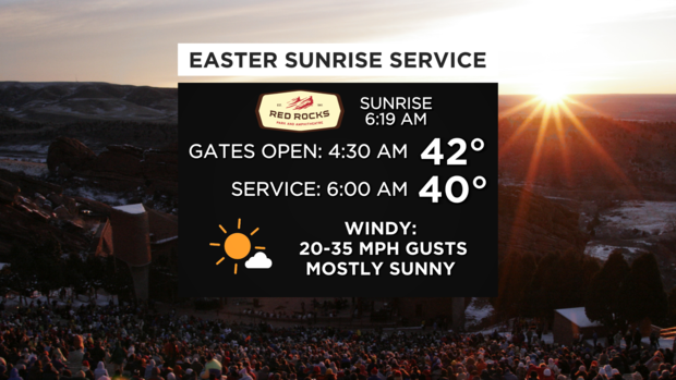
Sunrise services at Red Rocks will be chilly and windy. With a sunrise temp around 40 degrees and wind gusts 20 to 35 mph.
Gusts over eastern Colorado will be in the 30 to 35 mph range by afternoon. There is another Red Flag Warning for high fire danger for the Denver metro area south along the I-25 corridor including the San Luis Valley into northern New Mexico from noon to 8pm Sunday.
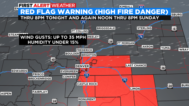
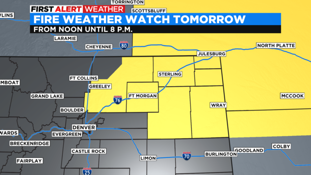
There is also, a Fire Weather Watch in place for northeastern parts of Colorado from Weld county to the Nebraska/Kansas state lines.
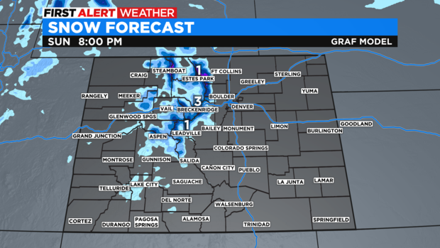
The system will bring in a few inches of snow into the northern and central mountains overnight Saturday into Sunday. Amounts will be in the 1 to 4 inch range but will be pushed along with 30 to 40 mph wind gusts.
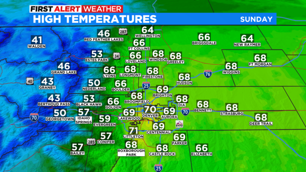
The strong westerly winds will be a downslope warming, chinook wind for Denver and Eastern Colorado. As a result, Easter Afternoon highs will rise into the 60s and 70s!
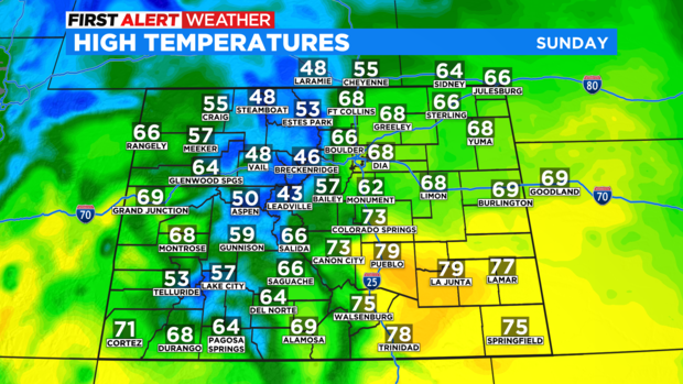
With a string of 60s and 70s into next week with westerly winds kicking up and keeping the fire danger elevated thru Friday.