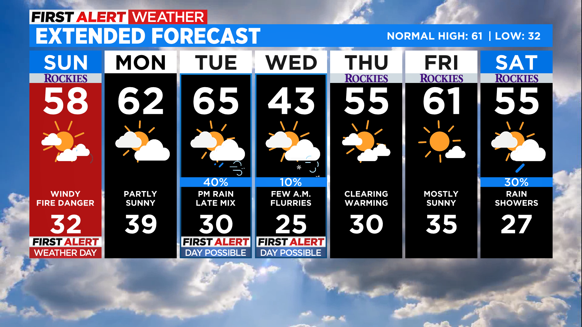
Denver Weather: Cooler On Sunday But Still Windy With High Fire Danger
DENVER (CBS4) - A cold front will pass through Denver late Saturday into early Sunday and behind it we'll see another period with strong and gusty wind. There could even be a handful of scattered rain showers behind the front during the overnight hours in the Denver area. Some snow is expected in the northern and central mountains.
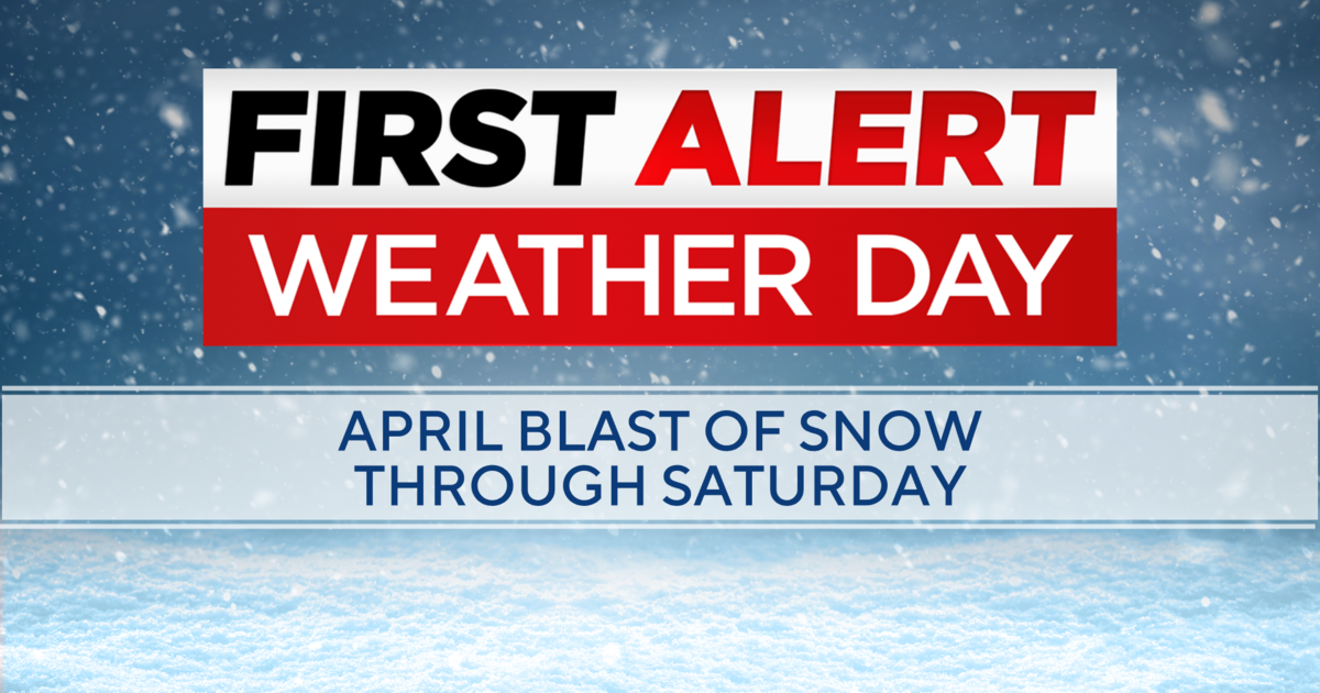
Sunday is a First Alert Weather Day.
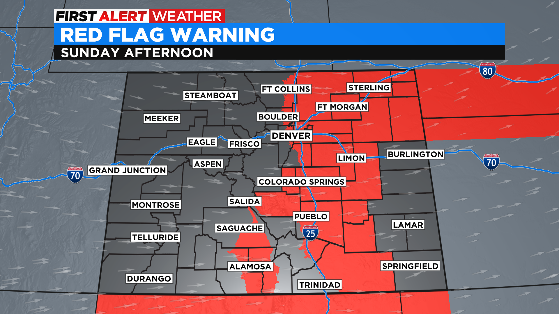
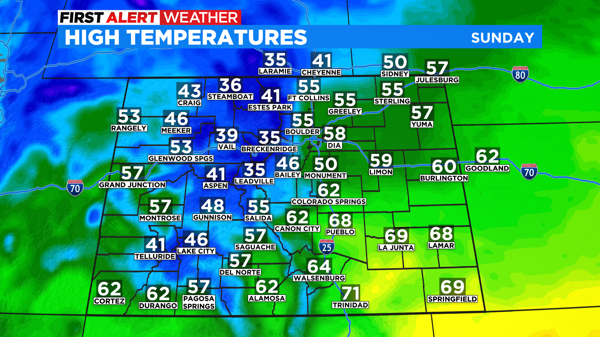
The main headline from this front will be the drop in temperatures for much of Colorado with places like Denver expecting highs on Sunday to be as much as 15 to 25 degrees cooler than Saturday. It will also be windy again with low relative humidity and that will create elevated to extreme fire danger across the region. The National Weather Service has already issued a Red Flag Warning on Sunday and it covers a large part of eastern and south-central Colorado, including metro Denver.
This cold front will be the first of a few to impact the region during the week ahead. An active jet stream will park itself over the Rocky Mountains and that means we will see a lot of wind over the next several days. Temperatures will also be on a bit of a roller coaster ride. After Sunday's cooler temps we will warm again heading into Monday and Tuesday.
The next strong cold front will move into the state sometime on Tuesday with cooler temps, more wind and some mountain snow. In Denver it looks like we could see some rain develop during the afternoon on Tuesday. If it can last long enough it may mix with or change to snow overnight and into the morning on Wednesday.
Stay tuned to the forecast this week as there is still a lot of uncertainty as to exactly how all of this will play out. One thing we know is that it will be a busy week with a lot of wind around the state.