Colorado Weather: Wind-Driven Snow Could Make Travel Rough South And East Of Denver Monday
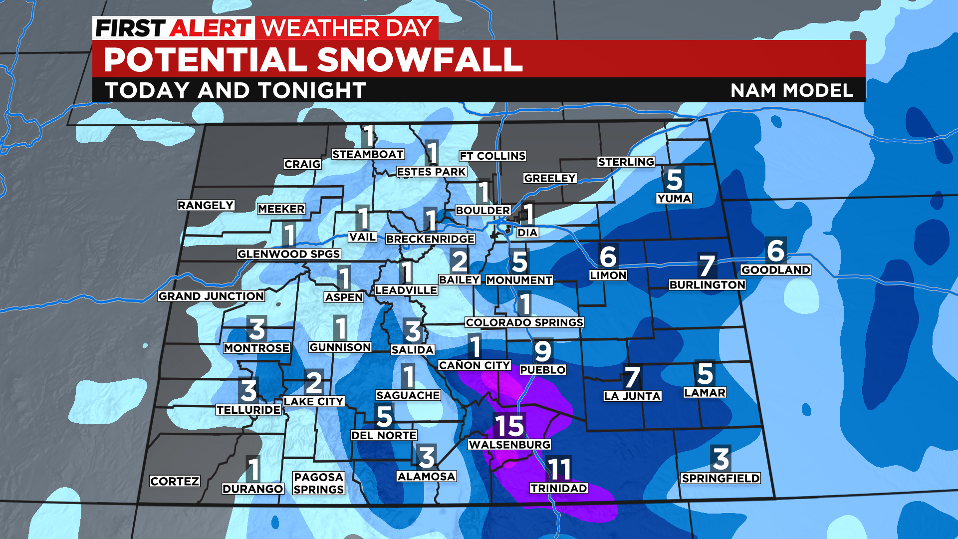
DENVER (CBS4) - A storm will move from eastern New Mexico into central Kansas over the next 24 hours and it will produce some high wind and locally heavy snow on Colorado's southeastern plains. The heaviest snow is expected to fall during the afternoon and early evening hours on Monday.

The National Weather Service has issued Winter Weather Advisories that cover Interstate 70 between Limon and the Kansas state line as well as areas south along Highway 287. A Winter Storm Warning is in effect for Interstate 25 between Pueblo and the New Mexico state line.
Storm totals could approach a foot in the Sangre de Cristo Mountains of south-central Colorado. Anywhere from 3 to 7 inches of snow could fall on portions of the eastern plains. Denver will be right on the edge of the accumulating snow with some grassy areas seeing up to an inch. Parts of the foothills and the Palmer Divide could see between 2 and 4 inches of slushy, wet snow.
Light snow showers are also expected to fall in the northern and central mountains on Monday with most places seeing just an inch or two. A few favored spots could see up to four inches.
It will remain cold and windy on Tuesday with another chance for snow showers around the state. Warmer weather will arrive on Wednesday and that trend will last into the upcoming weekend.


