Colorado's Snowpack Is Near Normal After More Mountain Snow Overnight
DENVER (CBS4) - With just 25 days to go until snowpack reaches the average maximum in Colorado, most of the eight river basins in the state are very close to normal. More snow Sunday night didn't hurt.
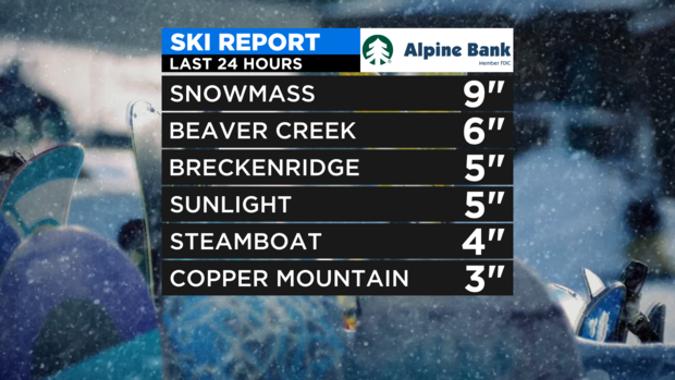
Almost all ski areas in Colorado reported at least a couple inches of snow Sunday night into early Monday morning. Snowmass reported the most with 9 inches of snow.
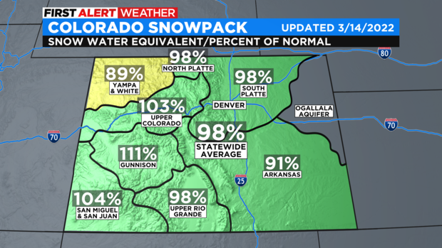
As of Monday morning, statewide snowpack was 98% of normal for March 14. Three river basins in the state are over 100% including the Gunnison, Upper Colorado, and San Miguel/Dolores/Animas/San Juan basin in the southwest corner. Only the Yampa/White River basin in northwest Colorado is significantly below normal (89% compared to normal in mid-March.
The healthier snowpack numbers are going into the final weeks before peak snowpack, the better chance Colorado will avoid significant drought and water restrictions later in the year.
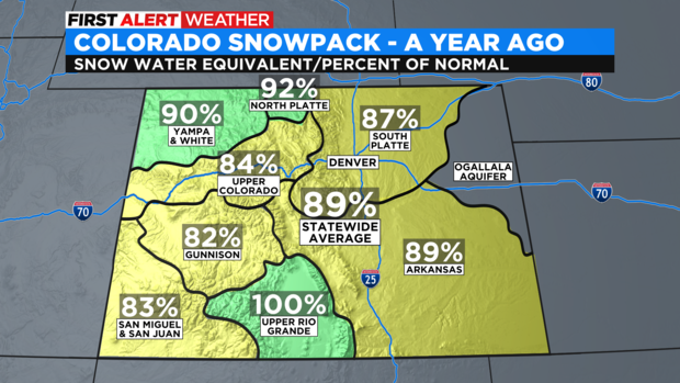
The overall snowpack situation is better this season compared to a year ago when statewide snowpack on March 14, 2021 was 89% of normal. At that time, only one basin was at normal and the Gunnison, Upper Colorado, and San Miguel/Dolores/Animas/San Juan basins were all below 85% of normal.
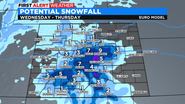
Dry weather will dominate Colorado on Monday and Tuesday this week before snow returns to the mountains and portions of the I-25 urban corridor on Wednesday. At this time, it appears the heaviest snow will be in the southern foothills and across the central and southern mountains (mostly south of I-70).
It will also turn cooler again on Wednesday but nothing dramatic.