Denver Weather: Snow This Season Is Finally Catching Up To Normal, And More Is Coming For Thursday
DENVER (CBS4) - Far above normal snowfall this month has helped put a large dent in the historic snow drought Denver had through December. And another round of snow on the way for Thursday has prompted another First Alert Weather Day.
The CBS4 weather team issues a First Alert Weather Day to signal a big change in the weather. Thursday is expected to be very similar to Tuesday with widespread snow mostly in the morning causing icy and slick travel.
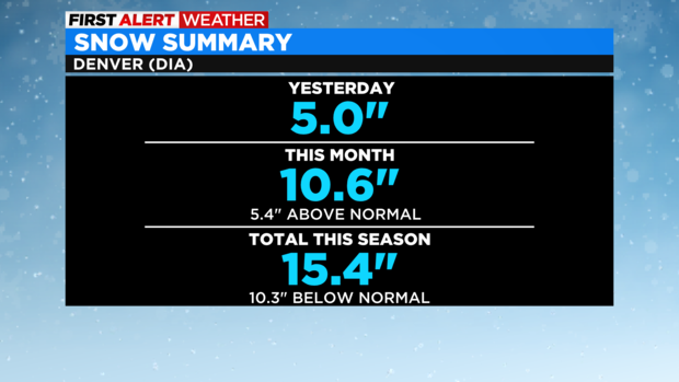
Denver officially received 5 inches of snow on Tuesday which brings the total for the month of January to 10.6 inches. That's more than 5 inches above normal for the month. Total snow for the season is now 15.4 inches which is still more than 10 inches below normal but that's a significant improvement from a month ago. Denver shattered a record with the latest first snow of the season not arriving until December 10.
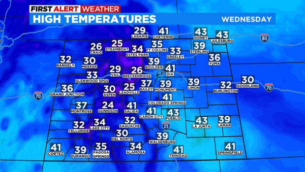
Before the next storm arrives, Wednesday will be quite cold in the morning before somewhat milder weather arrives in the afternoon under mostly sunny skies. Despite the sunshine, temperatures will remain below normal for late January with a high around 40 degrees in Denver and Boulder and just lower and middle 30s around Fort Collins, Loveland, and Greeley.
Snow will initially develop in the mountains Wednesday night but amounts will be minor. Then snow should spread into Northern Colorado by 5 a.m. Thursday and reach the Denver metro area no later than 7 a.m.
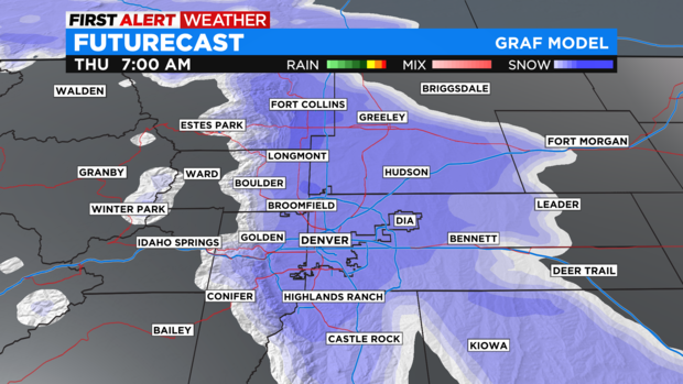
The overall timing of the snow is about 2 hours later than on Tuesday so the heaviest snow could wait until just after the morning commute. Total snowfall on Thursday should be slightly less for most areas. Most neighborhoods in the Denver metro area that are along and east of I-25 should get 1-3 inches of snow while locations to the west of I-25 should get slightly more. Some areas in the foothills above 6,500 feet could get up to 5 inches of snow.
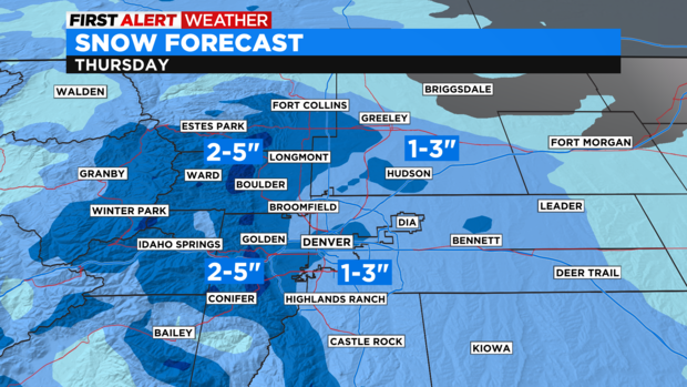
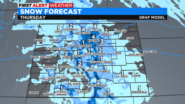
Snow in the mountains will once again be unimpressive with only 1-4 inches for most ski areas. And unlike the Tuesday storm, the Eastern Plains should not get much if any snow. Bethune, Colorado (population 207) which is 20 miles from the Kansas state line measured 26 inches of snow on Tuesday. They probably won't get anything measurable on Thursday.
Sunny and dry weather will return to Colorado on Friday and will continue through the weekend. The next chance for snow will arrive Monday night into Tuesday next week with the snow initially in the mountains. A First Alert Weather Day is possible in Denver on Tuesday due to the snow. We'll keep you posted!