First Alert Weather Day: Slick Roads Possible Through Wednesday Evening
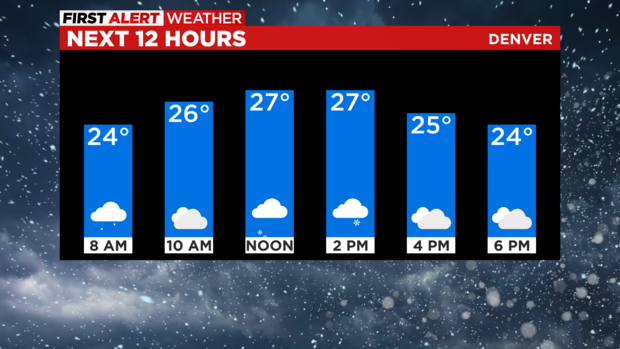
DENVER (CBS4) - Wintry weather has quickly returned to Denver and the Front Range on Wednesday with unusual freezing drizzle in the morning and a chance for light snow later in the day. Temperatures will also remain below freezing all day.
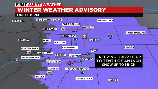
It's a First Alert Weather Day because of the possibility of slick and icy conditions on roads, sidewalks, and driveways. Bridges and overpasses will be especially susceptible to ice especially early in the day on Wednesday.
A Winter Weather Advisory is posted for Denver and most of northeastern Colorado though 8pm Wednesday largely because it's somewhat rare to get accumulating ice in the Rocky Mountain region. Unusually precipitation is only rain or snow in Colorado. It's even more rare to get freezing rain in the month of January.
By around midday on Wednesday, the chance for light snow will become better than the chance for freezing rain but snowfall amounts will be very light in and around the Front Range. The vast majority of the Denver metro area will get under 1 inch of snow on Wednesday and even less is expected in the mountains.
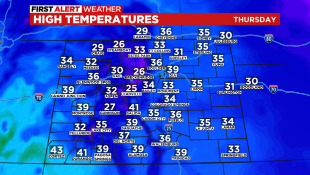
Sunshine will return to most of Colorado on Thursday but it will stay chilly with highs only in the 30s along the urban corridor. It will also be blustery in the mountains with wind chill values in the single-digits.
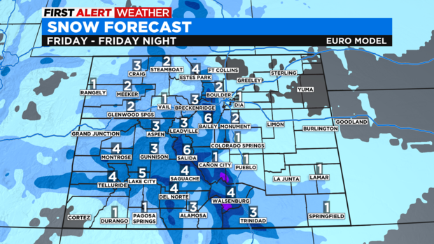
Then another storm will reach Colorado on Friday. It will be a far more traditional winter storm with about 2-6 inches of snow in the mountains and possibly 1-2 inches of snow in the Denver metro area especially on the south and west sides of town.
Drier and eventually warmer weather will return for the upcoming weekend.