Colorado Weather: Days Of Snow Starts Soon In The Mountains, Denver Gets Next To Nothing
DENVER (CBS4) - A sizable change in the weather pattern across the country will put in the Colorado mountains is a very favorable location for big snow through Christmas weekend. Unfortunately almost none of the moisture will reach Denver and the Front Range.
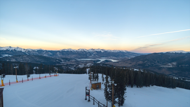
After such a dry start to the snow season in the high country, it's exciting news for skiers and snowboarders and for the mountain economy that relives heavily on the ski industry.
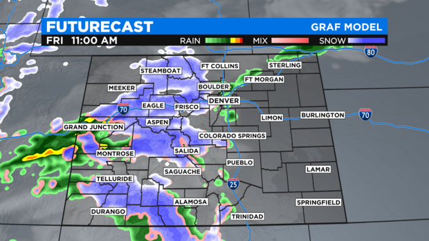
The snow will initially start in the San Juan Mountains in southwest Colorado Thursday morning and will gradually move north through the rest of the mountains during the day on Thursday. The heaviest snow will wait until Thursday night into Friday in most areas.
Mountain areas west of Vail Pass are already under a Winter Storm Warning from 11am Thursday until 11 Saturday for 1 to 2 feet of snow. Somewhat lower amounts are possible in Eagle County but ski areas like Vail and Beaver Creek should still get 10 to 16 inches of snow.
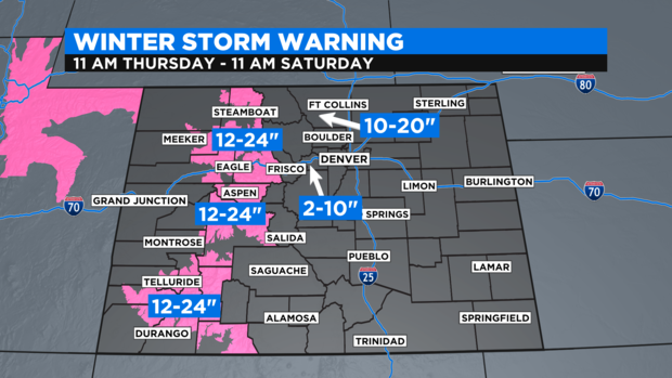
Farther east, there are not currently any warnings or advisories for Summit County, Winter Park, or the Rocky Mountain National Park (RMNP) region but they should be coming soon. Total snowfall will be less along I-70 between Georgetown and Copper Mountains but up to 10 inches is still possible. Areas farther north from Winter to RMNP should get 10 to 20 inches of snow mainly Thursday night and Friday.
For Denver and the front Range, there is a small chance a few showers could reach out of the mountains and cross the I-25 corridor mainly in the morning on Friday. But since the incoming storm is coming from the west, a strong downsloping flow will work hard to keep the Denver, Boulder, and Fort Collins areas dry.
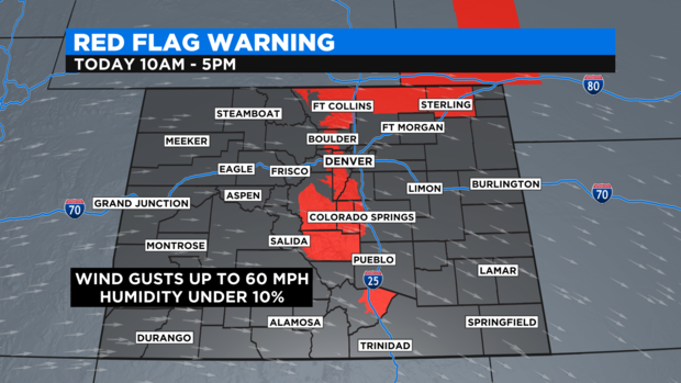
Prior to the storm arriving, fire danger will be quite high again especially in the foothills of Jefferson and Boulder Counties and almost all of Larimer County. There is a Red Flag Warning through 5 p.m. on Wednesday for communities such as Evergreen, Genesee, Conifer, Bailey, Ward, Nederland, Estes Park, and Red Feather Lakes.
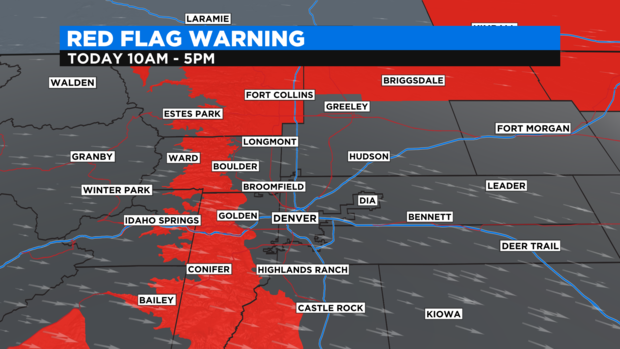
The Red Flag Warning also extends south into Park, Teller, and Freemont counties including Hartsel, Cripple Creek/Victor, and Cañon City.
In terms of temperatures, Denver and the Front Range will remain above normal through at least Sunday before temperatures drop close to normal for most of next week. Christmas Eve and Christmas Day should be about 15 degrees warmer than normal (which is about 43 degrees during the day and about 18 degrees at night in late December).