Colorado Weather: Intense Storm Bringing Hurricane Force Winds
DENVER (CBS4) - An intense winter storm is churning toward Colorado bringing with it damaging winds and lots of moisture. This is a system that knocked out power, created mudslides in California and as much as 3 to 5 feet of snow in the Sierra Nevada mountains.
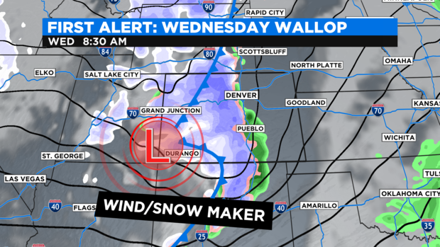
When the storm hits Colorado on Wednesday morning it will bring many threats with it. Warnings and watches are posted for hurricane force winds, high fire danger, heavy mountain snow and avalanches all in the same day!
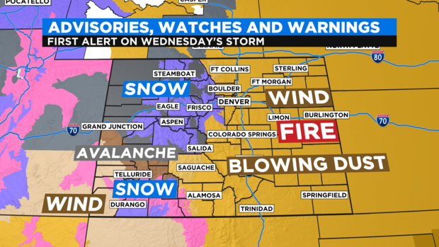
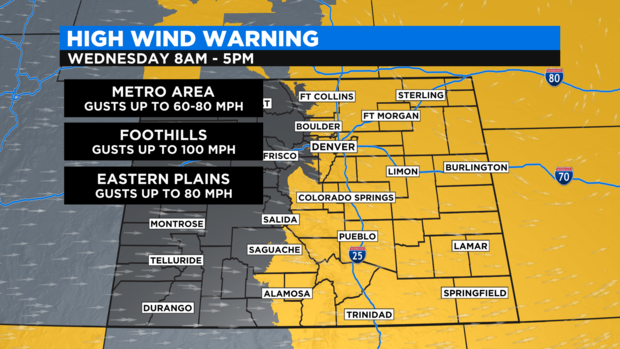
The main concern for the Front Range revolves around the high wind event that starts Wednesday morning. The Denver metro area and all of the Eastern Plains could see wind gusts of 60 to 80 mph. The hardest hit areas will be the foothills where winds may blow from 75 to 100 mph from 8am to 5pm Wednesday.
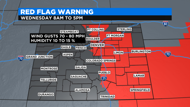
This will cause a surge in the fire danger threat for almost all of eastern Colorado. With humidity levels as low as 10 to 15% any little flame or spark could blow up into a raging wildfire.
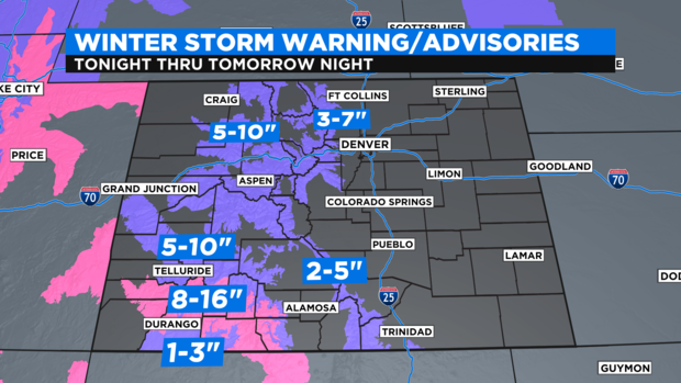
The other element of the storm is the mountain snow that will be blown in with 70 to 80 mph for most mountain areas. Winter Weather Advisories are posted for areas from Rocky Mountain National Park down to the east side of the Eisenhower Tunnel for 3 to 7 inches of snow. West of the divide many areas may see 5 to 10 inches. The bullseye for heavier amounts will be the southern San Juan mountains where 8 to 16 inches are expected.
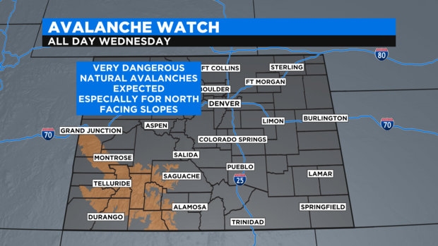
With the heavy, wind driven snow expected in those southwest mountains there is an Avalanche Watch posted for Wednesday. The most susceptible zones will be the north facing slopes.