Colorado Weather: The Mountains Will Measure Snow In Feet, Denver Will Be Lucky To Get An Inch
UPDATE: Denver Metro Area Finally Gets A Snowstorm
DENVER (CBS4) - All of Colorado's 27 larger ski areas will get snow in the coming days while Denver struggles to get the first accumulating snow of the season about 7 weeks later than normal.
The storm will initially arrive Wednesday night with snow spreading across the mountains mainly west of the Continental Divide. The snow will then spread east across all mountain areas on Thursday followed by the heaviest snow arriving late Thursday into Friday. The snow will end in the high country by late Friday night so it will be a 48 hour storm.
The highest snow totals in the state will likely be in the San Juan Mountains where up to 36 inches of snow is possible over Wolf Creek Pass and at the Wolf Creek Ski Area. That area along with all areas above about 9,000 feet west of Vail and Monarch Passes are under a Winter Storm Watch from Wednesday afternoon through Friday afternoon.
RELATED: 'Hello Winter': Telluride Celebrates The Arrival Of Some Fresh Snow
While Wolf Creek could get 3 feet of snow, most mountain areas will 1 to 2 feet. Regardless, when the snow is combined with wind gusts up to 50 mph, travel will become difficult to impossible along many high mountain roads.
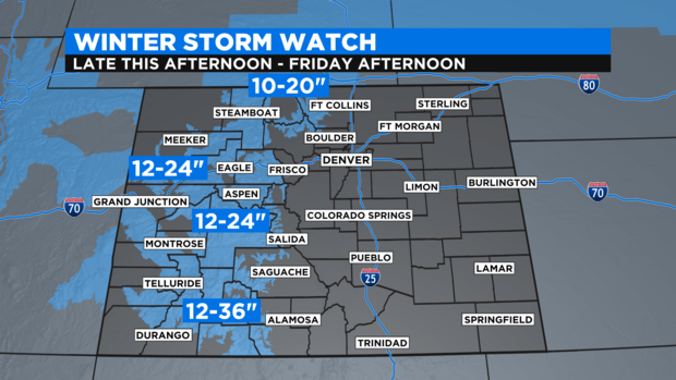
Rabbit Ears Pass, Rocky Mountain National Park, and the Medicine Bow Range area also under a Winter Story watching starting late Wednesday afternoon but it should be noted that Summit County and the Winter Park area is not. But even without the watch, ski areas like Copper Mountain, Keystone, Breckenridge, Loveland, Arapahoe Basin, and Winter Park should still get at least 6 inches of snow during the two day storm.
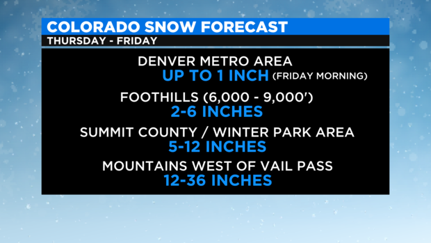
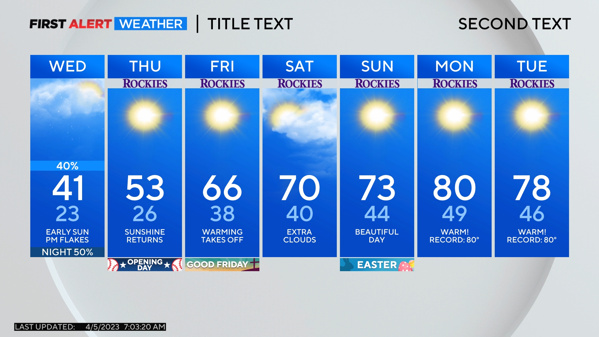
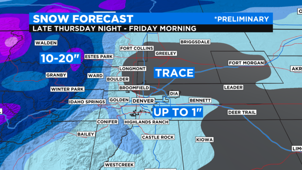
It's a different story for Denver and the Front Range because upslope flow is not expected to be as healthy was it was once forecast to be. Therefore snow should be much more limited at lower elevations east of the mountains. The best chance for snow in the metro area should occur as a cold front passes Friday morning. Cold fronts by themselves in Denver are notorious for producing precious little snow and Friday will probably be no exception. That said, a quick inch of snow is possible in Denver with many areas probably getting less and some areas possibly seeing slightly more.
Regardless of the snow, Friday will is guaranteed to be much colder day with high temperatures in the lower 30s.