Colorado Weather: Light Mountain Snow, Few Evening Rain Showers For Denver And The Plains
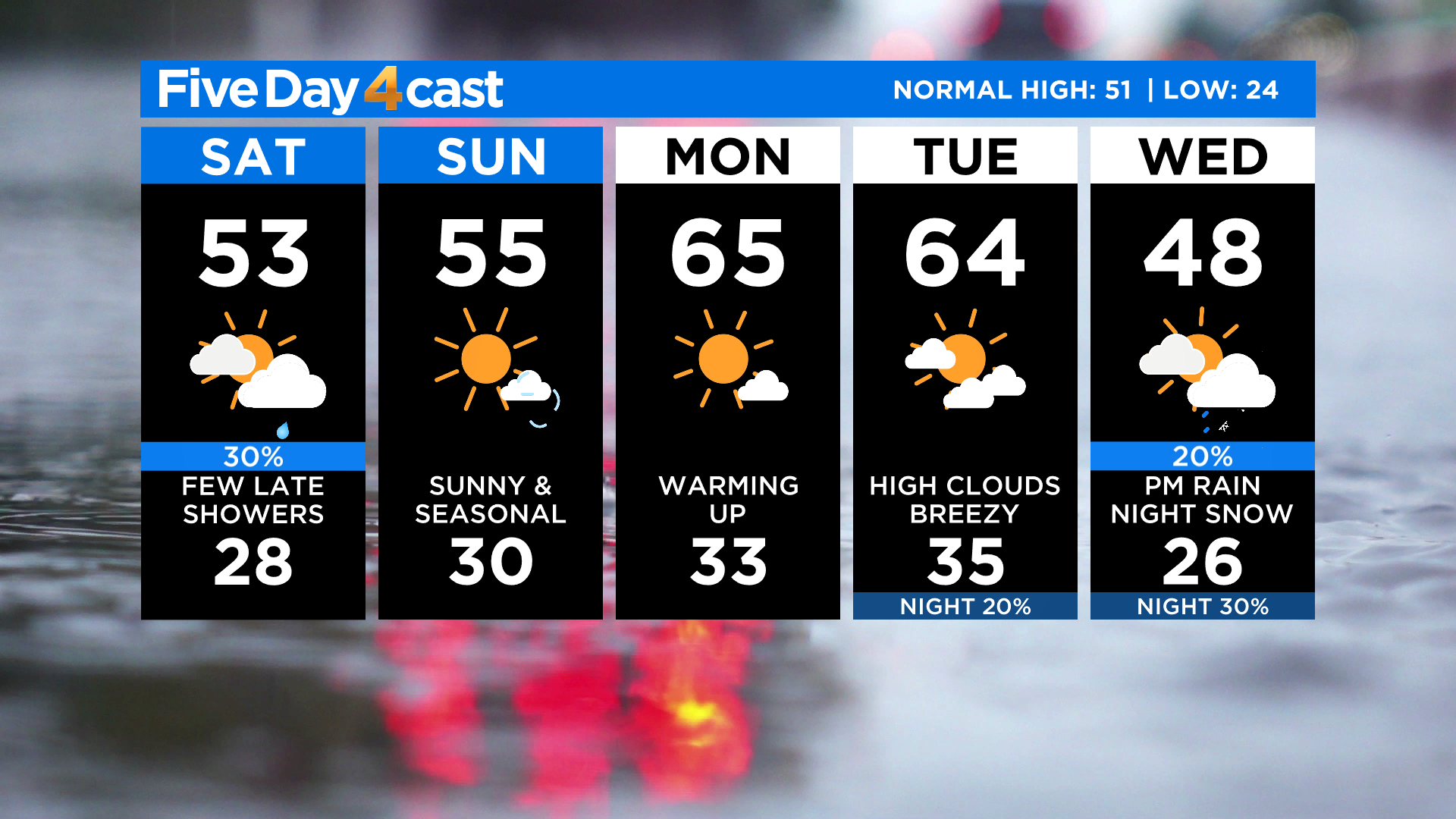
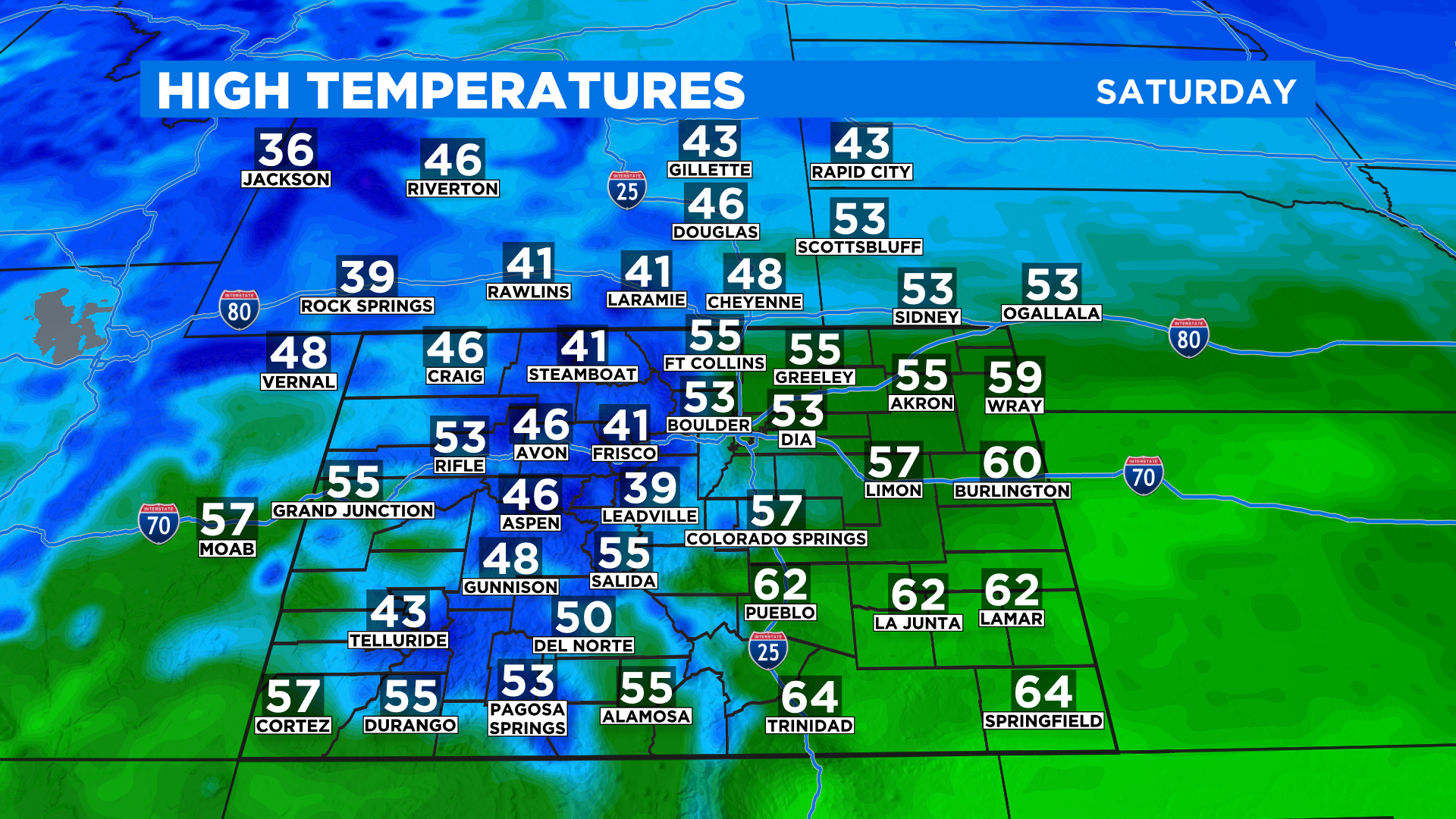
DENVER (CBS4) - A weak weather system will pass to the north of Colorado today and we'll be on the southern fringe of that storm as it goes by. It will usher in some cooler temperatures for the weekend, kick up some light snow in the mountains and maybe even a few sprinkles or rain showers in Denver and on the eastern plains by this evening.
There are a lot of outdoor holiday activities taking place this evening around the region, including the Starlighting in Castle Rock. The best window to see any showers in Denver and along the Front Range is between 3 pm and 8 pm. I wouldn't change your plans. If we do get some moisture it will be on the lighter side and shouldn't last all that long.
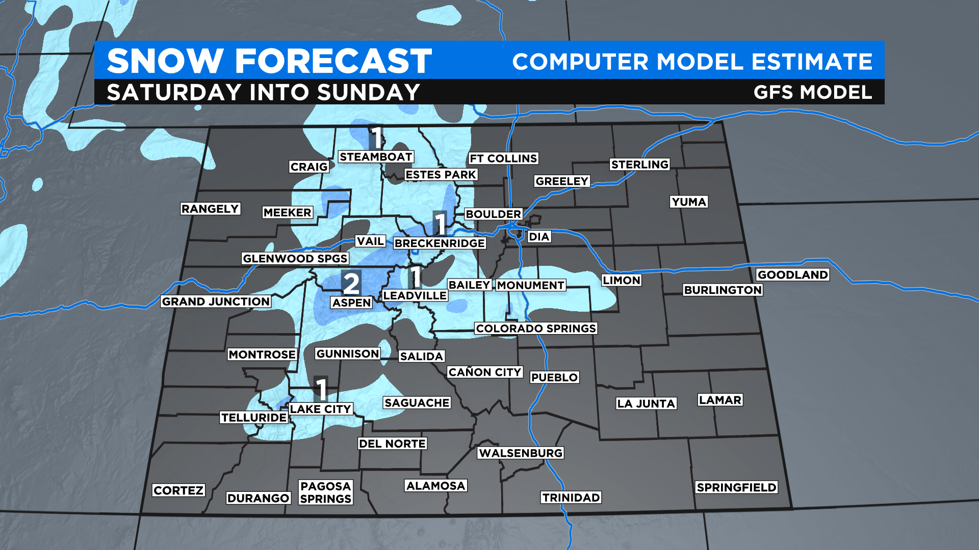
If the rain showers develop and can hang on long enough we may even see a little bit of snow after sunset along the Palmer Divide, between Denver and Colorado Springs. Areas such as the Black Forest and Monument Hill could get a quick burst of snow.
Accumulations will be light with only a few inches at best in the mountain communities and at the resorts. Some places will only get a dusting. There are no watches, warnings or advisories in effect so if you have travel plans you should be just fine.
Looking ahead we warm up and remain dry for the start of the new week. Temperatures on Monday and Tuesday will get back to being above normal. A new storm will move our way for Wednesday with some colder temperatures, mountain snow and the threat for a few rain or snow showers in Denver by late Wednesday or early Thursday.