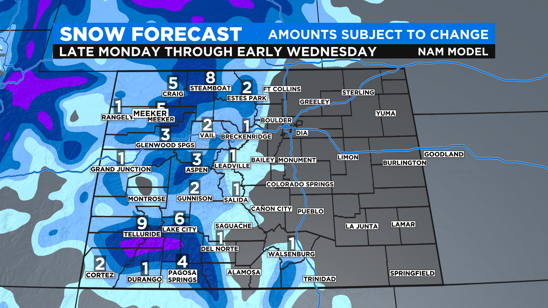
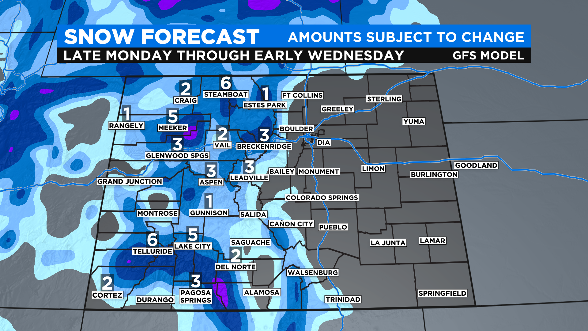
Early Look At Potential Mountain Snow Totals For Tuesday's Storm
UPDATE: Denver Weather: Two Storms Hit Colorado This Week, The Second A Bigger Deal For The Metro Area
DENVER (CBS4) - The first widespread mountain snow of the season is on the way to Colorado and for some areas it could be several inches. The snow should begin sometime late Monday and last into the morning hours on Wednesday.
As of this post on Sunday morning there were no watches, warnings or advisories in place for the mountains, but that could change by Sunday night or Monday morning. Current forecast models show the potential for several mountain towns to get somewhere between 2 and 4 inches of snow.
The totals could be even higher in the San Juan Mountains and the Park Mountains where as much as 6 to 10 inches of snow could fall. A few other favored spots with elevations in excess of 10,000 feet, such as around Vail Pass and in parts of Summit County, could pick up between 4 and 8 inches of snow.
NOTE: Any changes to the speed and path of this storm could result in pretty drastic changes to potential snow totals so please check back with us here at CBS4 for updates. We want to give you a starting point as you start to think about your mountain travel plans this week. Below are two forecast models ran early Sunday morning.