Colorado Weather: High Mountain Snow Saturday With Wildfire Danger On The Plains
UPDATE: Denver Weather: First Freeze In 5 Months, Up Next Is A Chance For Snow
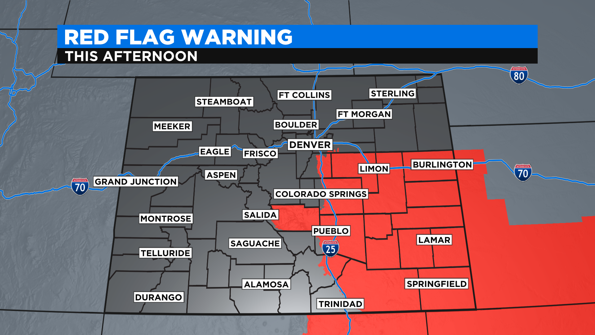
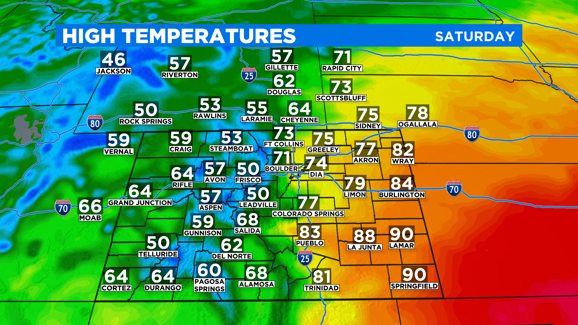
DENVER (CBS4) - It's a tale of two seasons across Colorado on this Saturday with wet and chilly weather in the mountains and summer-like temps on the plains. It will also be windy at times which will drive the fire danger to extreme levels for a large part of east-central and southeast Colorado.
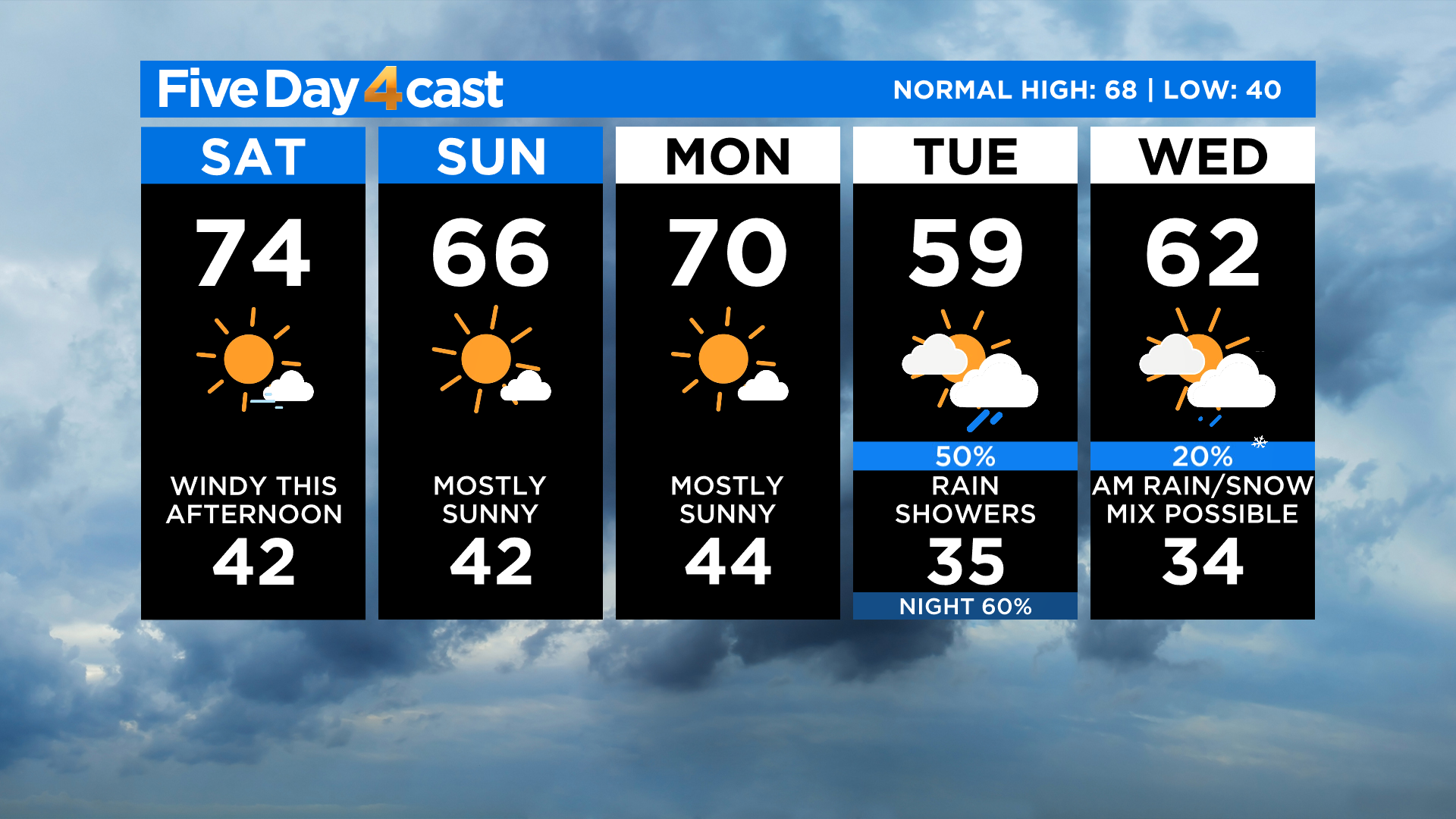
Up to a few inches of snow fell overnight in the highest mountains along and west of the Continental Divide. Most of the accumulation was at or above 11,000 feet. We will see some more snow showers during the day on Saturday with light rain in the mountains and valleys below 9,000 feet. Locations between 9,000 and 11,000 feet could get a mix at times.
Areas along and east of the foothills should remain dry. The main weather story there will be the wind and very warm temperatures. A few places on the far southeast plains could get near 90 degrees!
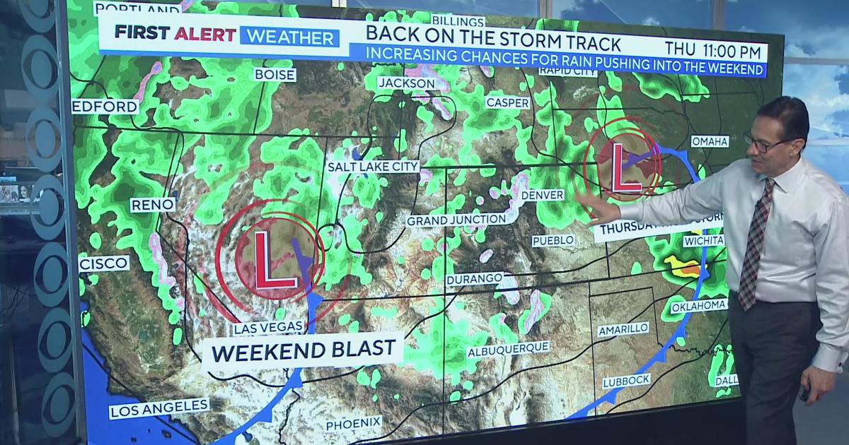
The next storm to impact Colorado will enter the picture by Tuesday. It will drop into the Great Basin and then eject to the northeast. The entire state will see wind and much colder temperatures, but the chances for rain and snow will vary based on the exact track.
Right now the computer models show a more northwest track, going from near Las Vegas to around Cheyenne, which would lower the chances for heavy rain or snow in our state. But if it goes a little further south, the entire forecast could change drastically. So stay tuned!