Denver Weather: Cooler Temperatures Arrive Quickly
After two days with near record high temperatures, the mercury is about to dip well below normal. Monday may have been our last hot day for quite some time. We officially hit 89 degrees out at DIA.
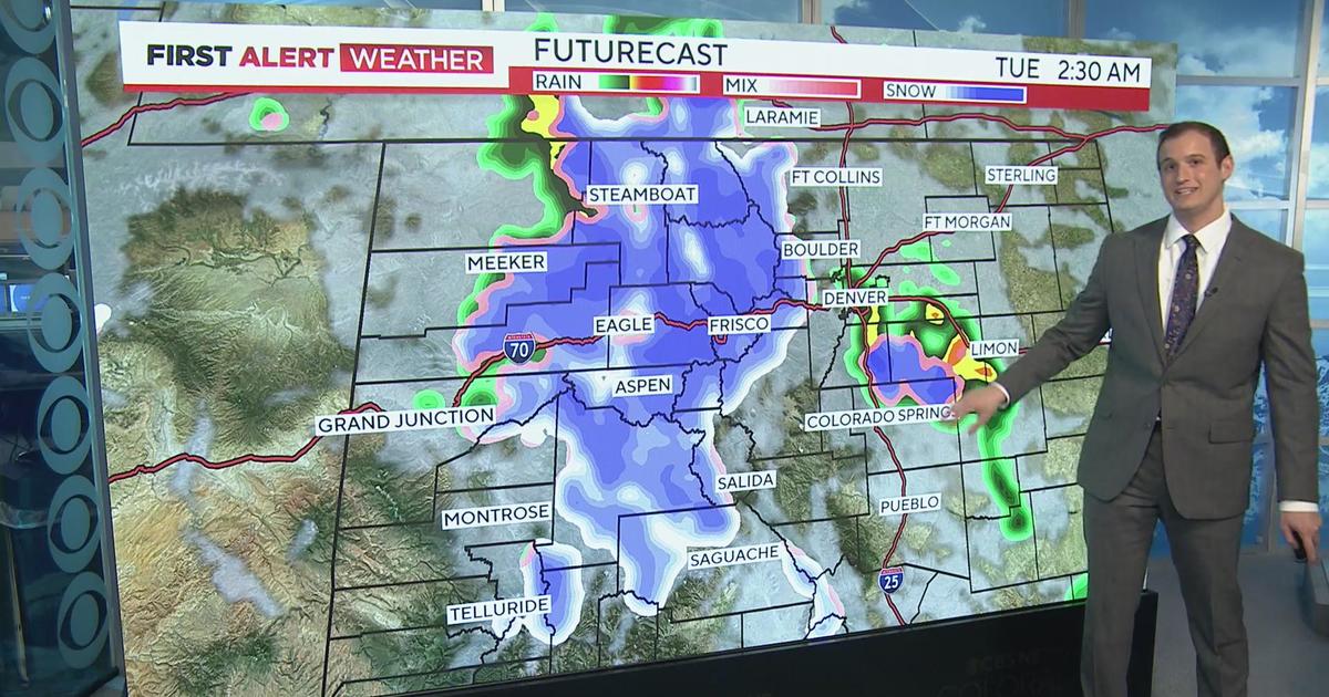
Tuesday we cool off just a bit to the low 80s with a bit more cloud cover for the Front Range. An area of low pressure is going to pass through the state from the southwest, and this will bring rain and even some snow to the mountains. The high country gets the most of this moisture surge, but the Denver area can't rule out a shower or two. Any snow would come at night and to high elevations, mainly in the central mountains.
Then, very quickly, we have a cold front move through on Wednesday. This knocks down our temperatures to the 60s! We see a much better chance for rain in Denver on Wednesday, with widespread rain likely in the high country. We may even pick up a few inches of snow in the mountains above 10,000 feet! Hopefully this doesn't put an end to our pretty fall colors.
Temperatures will stay in the 60s for the rest of the week and into the weekend. We could see rain on and off this whole week, a much different forecast than the heat and sun we saw last week. It will finally feel a bit more like fall as we head into October.