Colorado Weather: Unusual Threat For Large Hail, Damaging Wind On Tuesday
DENVER (CBS4) - Severe weather season in Colorado is typically over before September. But with much warmer than normal temperatures holding on much later than normal again this year, the necessary ingredients are in place for severe storms Tuesday afternoon.
The National Weather Service has upgraded the threat for thunderstorms producing large hail and damaging wind on the Eastern Plains south of Interstate 76. Cities southeast of the Denver metro area including Limon, Burlington, La Junta, and Lamar have the highest risk for severe thunderstorms mainly between 3 p.m. and 8 p.m.
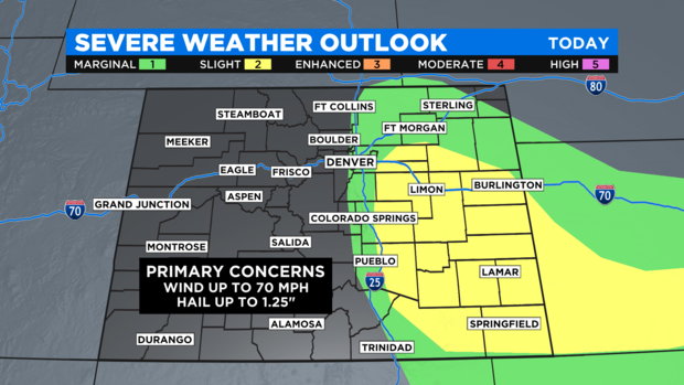
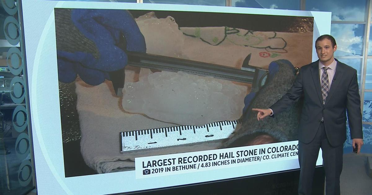
In some cases, hail could be up to the size of half dollars (1.25") and wind could gust up to 70 mph which is almost hurricane strength.
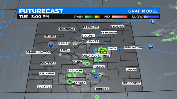
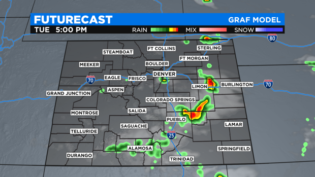
After a few showers and thunderstorms around the state Tuesday morning, most of Colorado will be dry during the early afternoon hours. Then thunderstorms should initially develop around the Colorado Springs area by 3 p.m. followed by a chance for thunderstorms around Denver, Boulder, and Fort Collins closer to 5 p.m.
As these storms move east on the plains, they will likely strengthen and could turn severe.
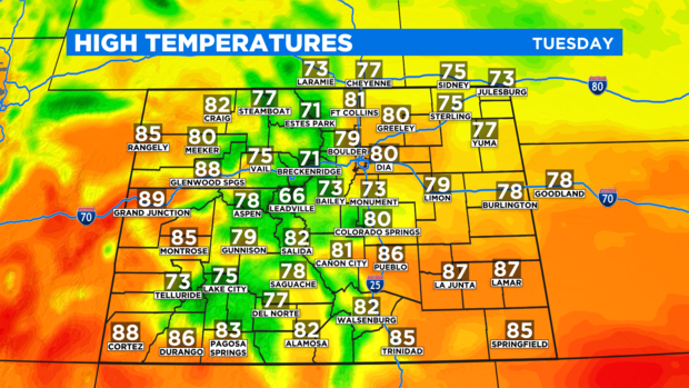
Tuesday will also be the coolest day in weeks for many areas east of the Continental Divide. The Denver area will only reach near 80 degrees for a change! And there may not be a single 90 degree temperature anywhere in the state.
However, the reprieve from big heat will not last long. Denver and the Front Range will return to near 90 degrees again for Wednesday and Thursday and there is no change for below normal temperatures again through next Monday.