From Near Record Heat To Flooding Rains, Big Weather Change Is Coming To Colorado
DENVER (CBS4) - One more hazy, hot, and smoky day is in the forecast for Denver and the Front Range on Tuesday. Then a shift in the weather pattern will bring increasing moisture and decreasing temperatures in the coming days.
The remnants of what was Hurricane Nora in Mexico last weekend was in Arizona on Tuesday morning and was moving slowly northeast. Most of Tuesday will be dry for most of Colorado followed by a very good chance for rain spreading from the Western Slope to the Front Range from Tuesday night through Wednesday night. Most areas east of the I-25 corridor will likely get much less (if any) rain.
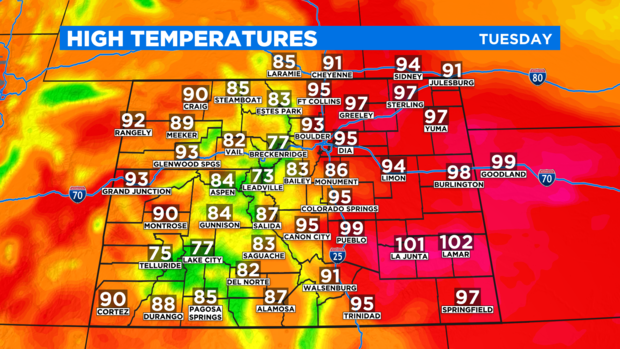
Until the moisture arrives, Tuesday will be very warm across most of Colorado with temperatures reaching the 90s around Denver, Boulder, and Fort Collins. The record high temperature for August 31 in Denver is 98 degrees from 2011 which is probably not at risk of being replaced. But temperatures won't be far from the record Tuesday afternoon.
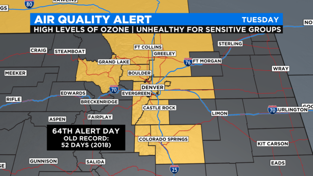
It will also be hazy and smoky on Tuesday thanks to a combination of wildfire smoke and summer ozone. Another Ozone Action Day was declared by the Colorado Department of Public Health and Environment for 64th day this summer which is a record.
The first of the significant rain for the state will reach the Western Slope by early Wednesday. Showers and a few thunderstorms are possible virtually anywhere west of the Continental Divide for the Wednesday morning drive.
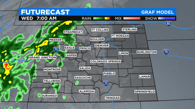
The rain will then gradually spread east across the mountains and should reach the Denver metro area mainly after 5 p.m.
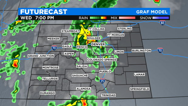
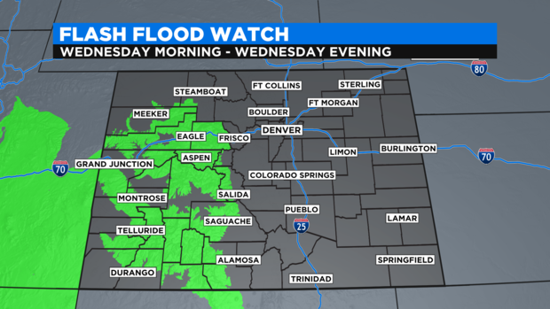
Some of the rain could be quite heavy at times with some areas mainly in the mountains getting more than 1 inch of rain on Wednesday. The burn scars from recent wildfires will be very susceptible to flooding and therefore a large Flash Flood Watch has already been issued for the Pine Gulch, Grizzly Creek, Lake Christine and 416 Fire burn scars in western Colorado.
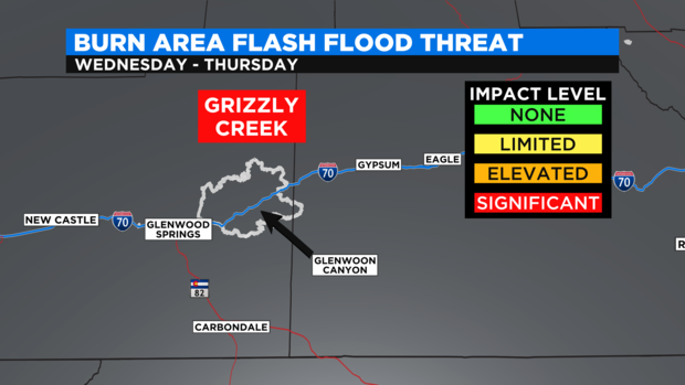
The Grizzle Creek in particular will be closely monitored by CDOT officials and it is possible I-70 may be forced closed through Glenwood Canyon if significant rain falls in that area. The likelihood of a closure as soon as Wednesday is at least 50%.
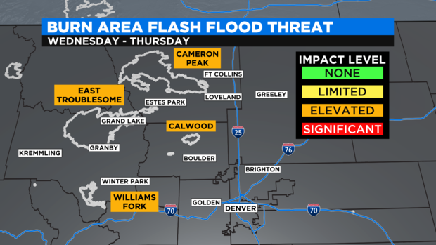
Closer to the Front Range, the burn scars near Rocky Mountain National Park including East Troublesome and Cameron Peak will also be monitored carefully in the coming day for the possibility of flash flooding and mud slides.
For the Denver metro area, following a good chance for rain Wednesday evening into Wednesday night, a chance for mainly afternoon showers and thunderstorms will return for Thursday and Friday. I will also be significantly cooler for the end of the week with high temperatures staying in the lower to mid 80s in Denver.