Denver Weather: The Break Is Over! Heat And Smoke Return On Monday
DENVER (CBS4) - After a short break from intense summer heat and noticeable wildfire smoke on Sunday, both will return to Denver and the Front Range on Monday.
Most of the smoke is still originating from California but a handful of fires in Colorado will also contribute to the smoky skies.
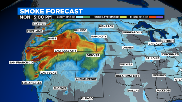
The largest Colorado fire contributing smoke is the 150 acre Black Mountain wildfire in Grand County. Areas near this fire including Kremmling, Parshall, Hot Sulphur Springs, Granby, and Grand Lake will experience some of the thickest smoke in the state on Monday.
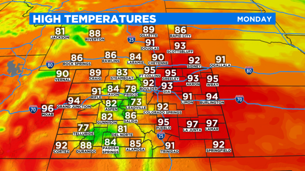
It will also be about 10 degrees hotter in many areas on Monday compared to Sunday when a summer cold front allowed temperatures to stop in the lower 80s in the Denver metro area. Instead, the Denver, Boulder, and Fort Collins areas will reach into the lower and middle 90s on Monday.
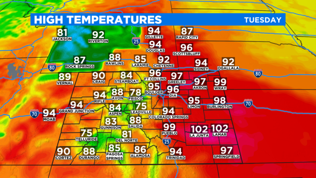
Tuesday will be even hotter. The record high temperature for August 31 in Denver is 98 degrees from 2011. The record is probably safe but the metro area should be within a couple degrees of the record.
Similar heat is expected on Wednesday before the weather pattern across Colorado changes for everyone by Thursday. A cold front coming from the Seattle area will reach the region and combine with moisture leftover from what was Hurricane Nora in western Mexico. The result will be wet weather for the end of the week in much of Colorado and especially in the mountains.
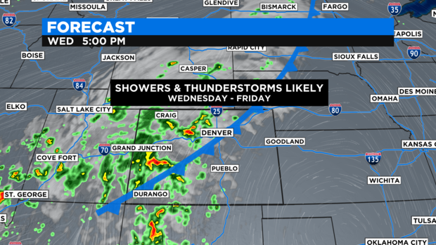
Afternoon temperatures for Denver and the Front Range should stay mostly in the 70s on Thursday and Friday. Then warmer and drier weather will gradually return over the Labor Day weekend.