Cooldown Coming To Colorado As Fall-Like Storm Threatens Snow In Montana
UPDATE: Some Of Colorado's 14ers Could See Rain Change To Snow On Thursday
DENVER (CBS4) - An unusually cool storm system will move into the Pacific Northwest this week with temperatures running several degrees below normal for this time of year. The cooler weather is expected to bring a little help to crews fighting some of the larger wildfires in the northwest part of the United States.
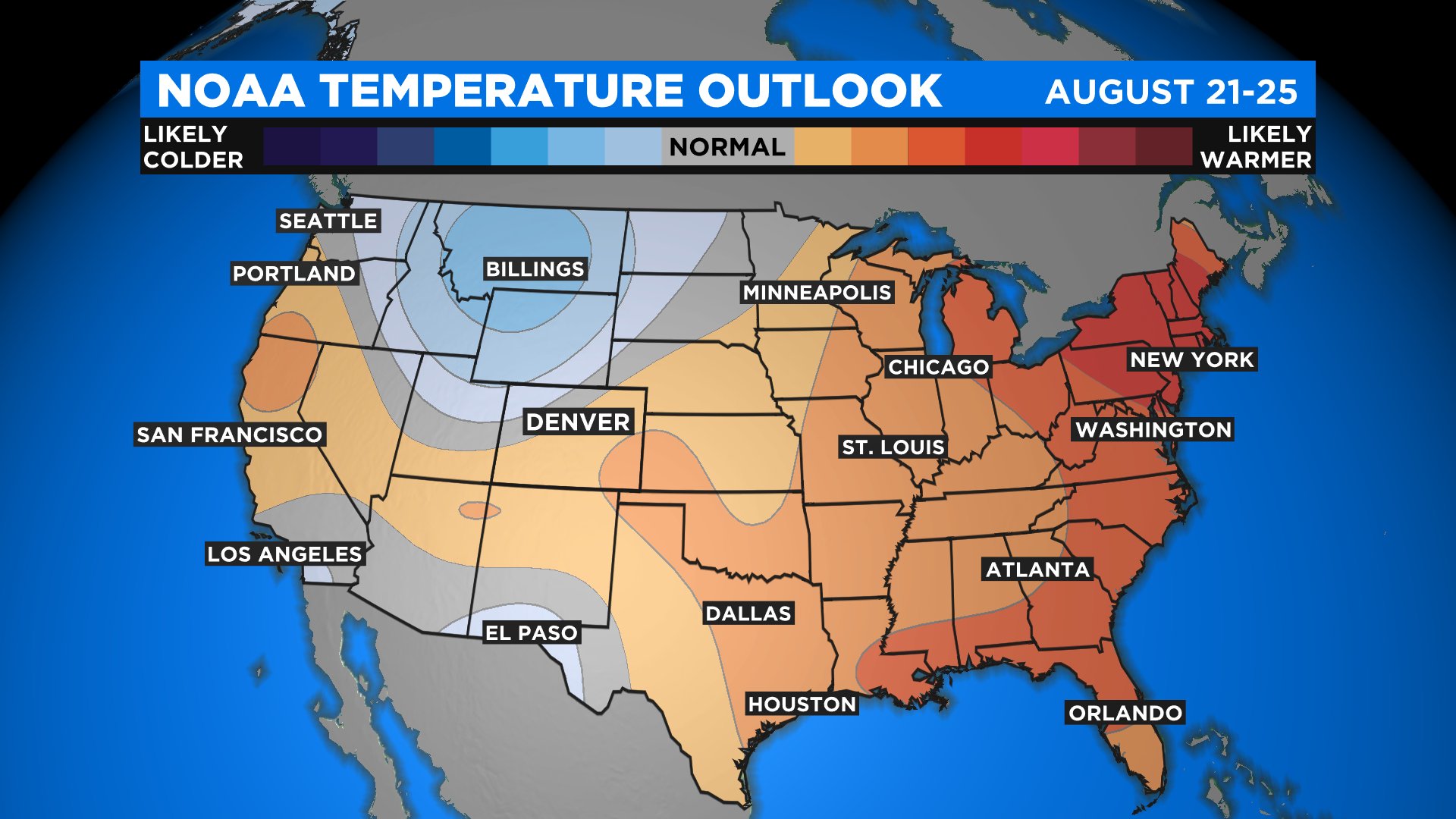
The latest 6-10 Day Temperature Outlook released on Sunday from NOAA's Climate Prediction Center indicates below normal weather could impact a large part of the northern Rockies, including parts of northern Colorado and Utah. Some places in Montana will see highs only in the 40s and 50s with lows in the 30s over the next few days.
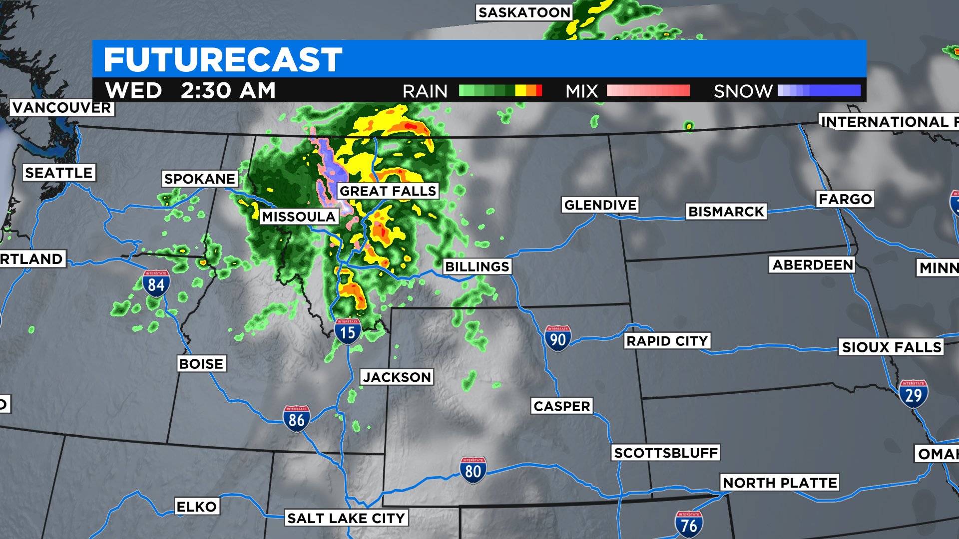
It could even be cold enough for some light snow to develop across the higher mountains of Montana and northwest Wyoming by late Tuesday night or Wednesday morning. The snow levels would remain very high and it might even be mixed with rain, but its definitely a sign of what's the come as the seasons start to change over the next several weeks.
While it won't be that cold in Colorado we do anticipate some much cooler air arriving sometime during the afternoon or evening hours on Wednesday. By Thursday, the high in Denver will be about 10 degrees cooler with a statewide chance for some showers and thunderstorms.