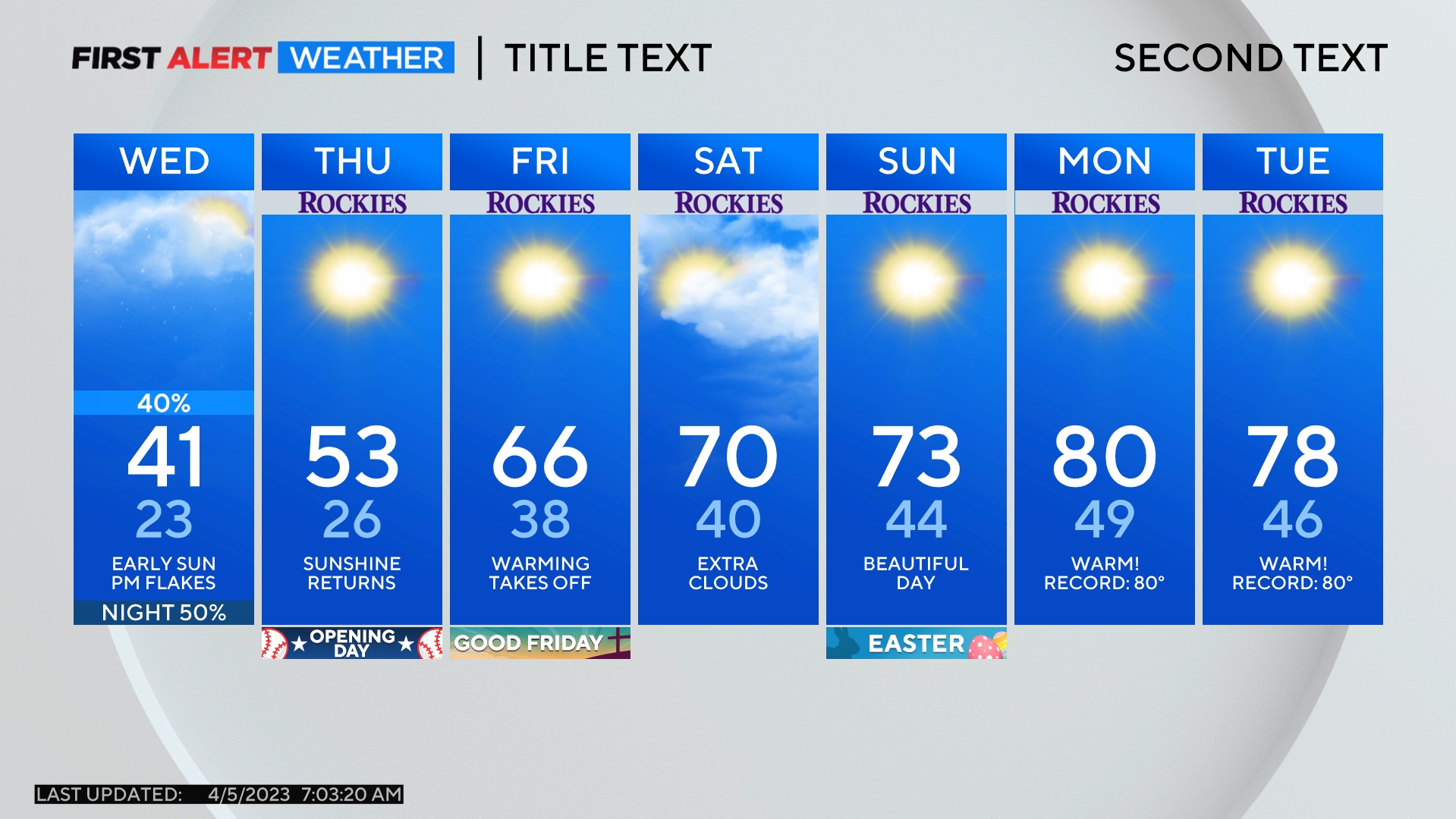
Colorado Weather: As Temperatures Heat Up, The Burn Scar Flood Threat Goes Down
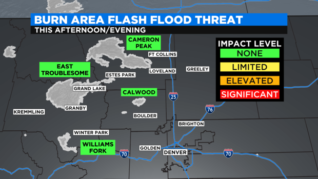
DENVER (CBS4) - For the first time in more than a week, there are no burn area flood threats in the northern mountains on Monday and Tuesday. Afternoon thunderstorms will be mostly confined to southwest Colorado early this week.
It's still possible an isolated thunderstorm could move over the East Troublesome, Cameron Peak, Calwood, or Williams Fork burn scar Monday or Tuesday afternoon, but the rain is not expected to be heavy enough or last long enough to create flooding and mudslides.
Farther west, there is a somewhat better chance for thunderstorms in the Glenwood Canyon area including over the Grizzly Creek burn scar. However, the rain is not forecast to be severe enough to cause another closure of I-70 on Monday.
It's a different story in southwest Colorado where the threat for more heavy rain could cause localized flooding the San Juan Mountain region. Areas such as Telluride, Lake City, Ouray, Montrose, Pagosa Springs, and Durango have a good chance for showers and thunderstorms Monday and Tuesday.
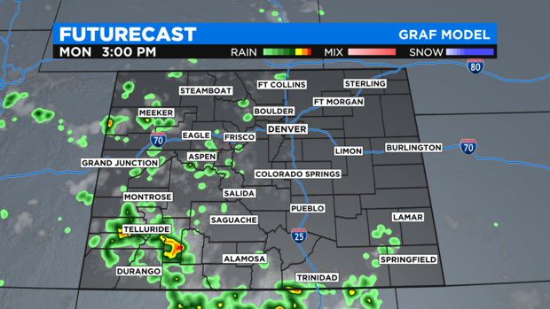
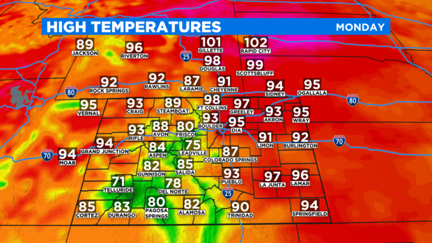
For Denver and the Front Range, the chance for an isolated late day thunderstorm early in the week is only 10%. The bigger weather story will be heat with high temperatures soaring well into the 90s.
Monday should be at least 1-2 degrees hotter than Sunday when Denver reached 94 degrees.
The city has a chance of reaching 100 degrees for the fifth time this season on Wednesday. Any temperature above 98 degrees will be a new record for July 28.