Colorado Weather: More Afternoon Storms, Flash Flooding Possible Over Burn Scars
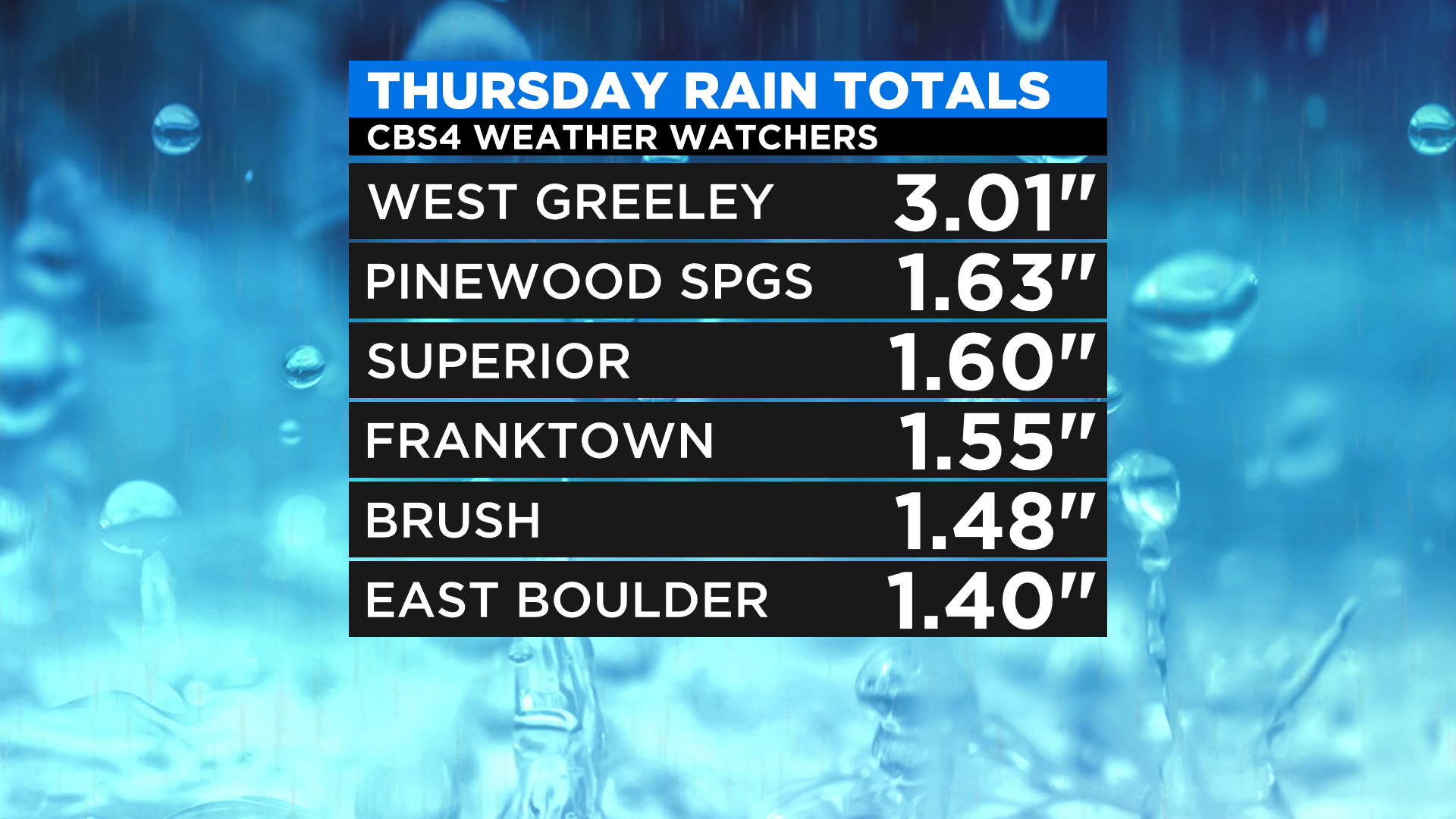
DENVER (CBS4) - Thursday turned out to be a pretty wild day in parts of the state as monsoon showers and thunderstorms dropped locally heavy rain. A few places in the central and western part of Greeley picked up more than three inches of rain in a short period of time.
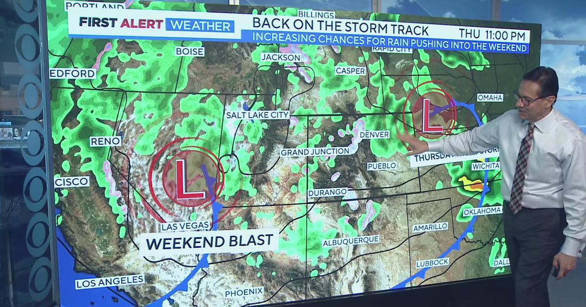
We'll see more afternoon storms again today with the potential to see flash flooding, but the highest threat will shift back into the mountains and foothills, especially in and around the burns scars in Larimer County and Boulder County.
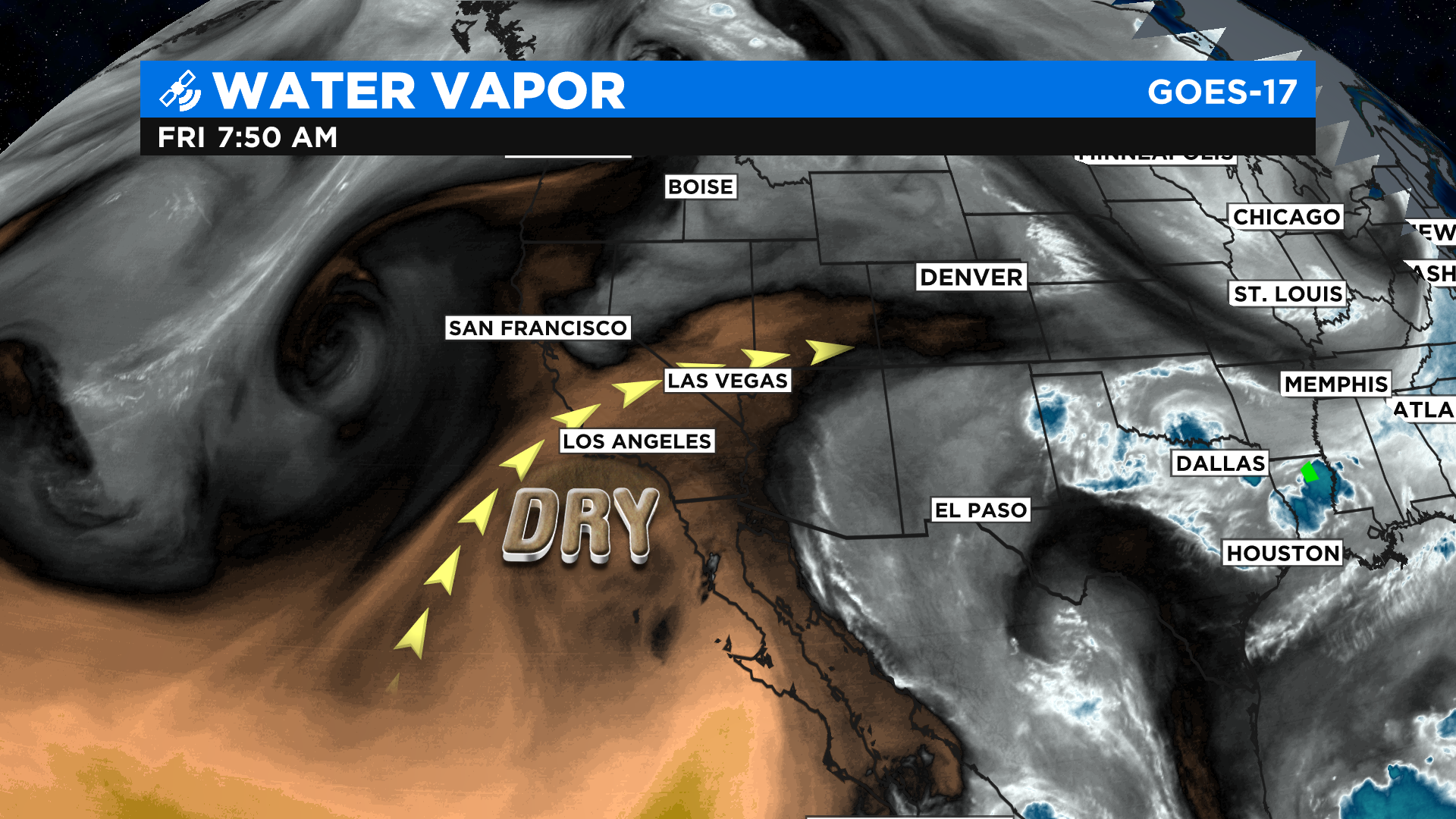
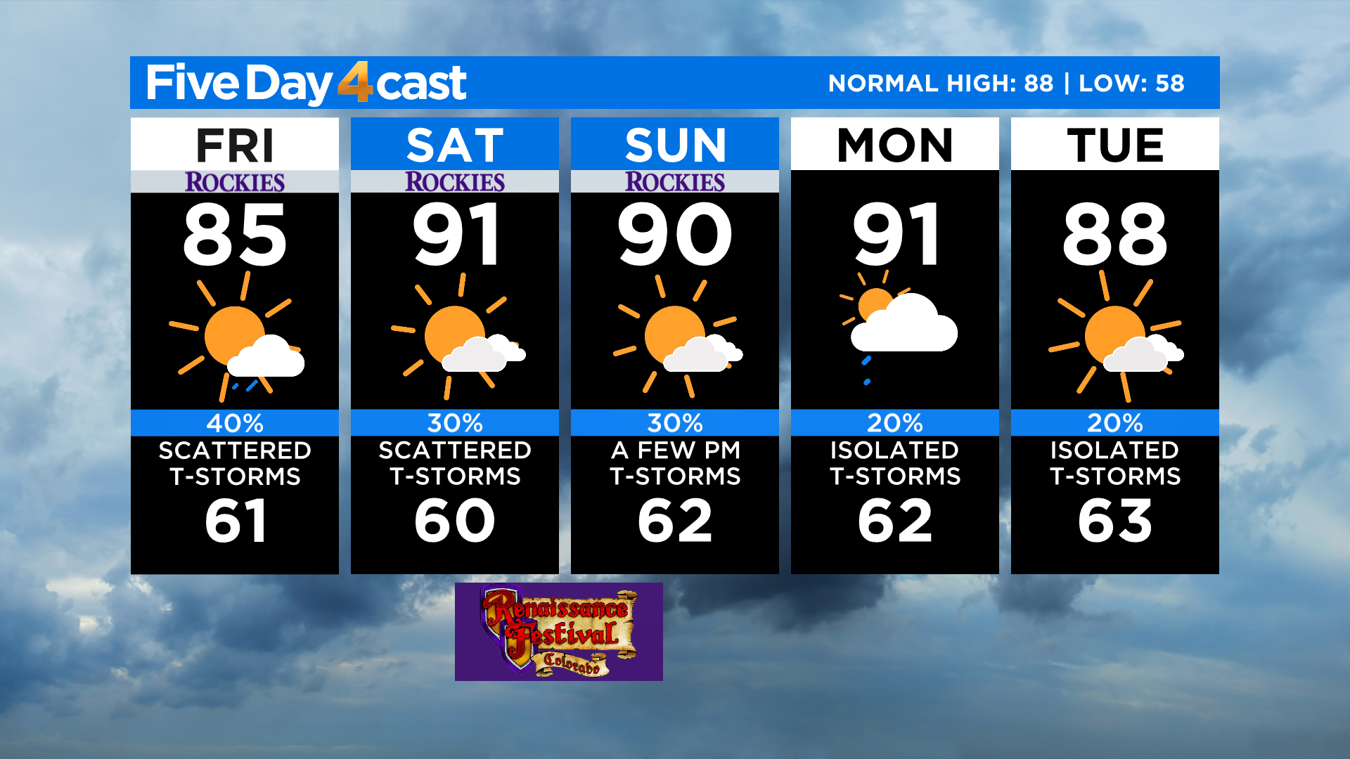
Over the holiday weekend we'll see a flow of drier air move in from the west and southwest. This will allow temperatures to climb back to around 90 degrees in Denver for the first time in a few weeks.
The drier air moving in will also lower our thunderstorm chances just a little bit over the holiday weekend but they won't go away entirely. By the time we get into Sunday the storms should be more of the isolated nature.
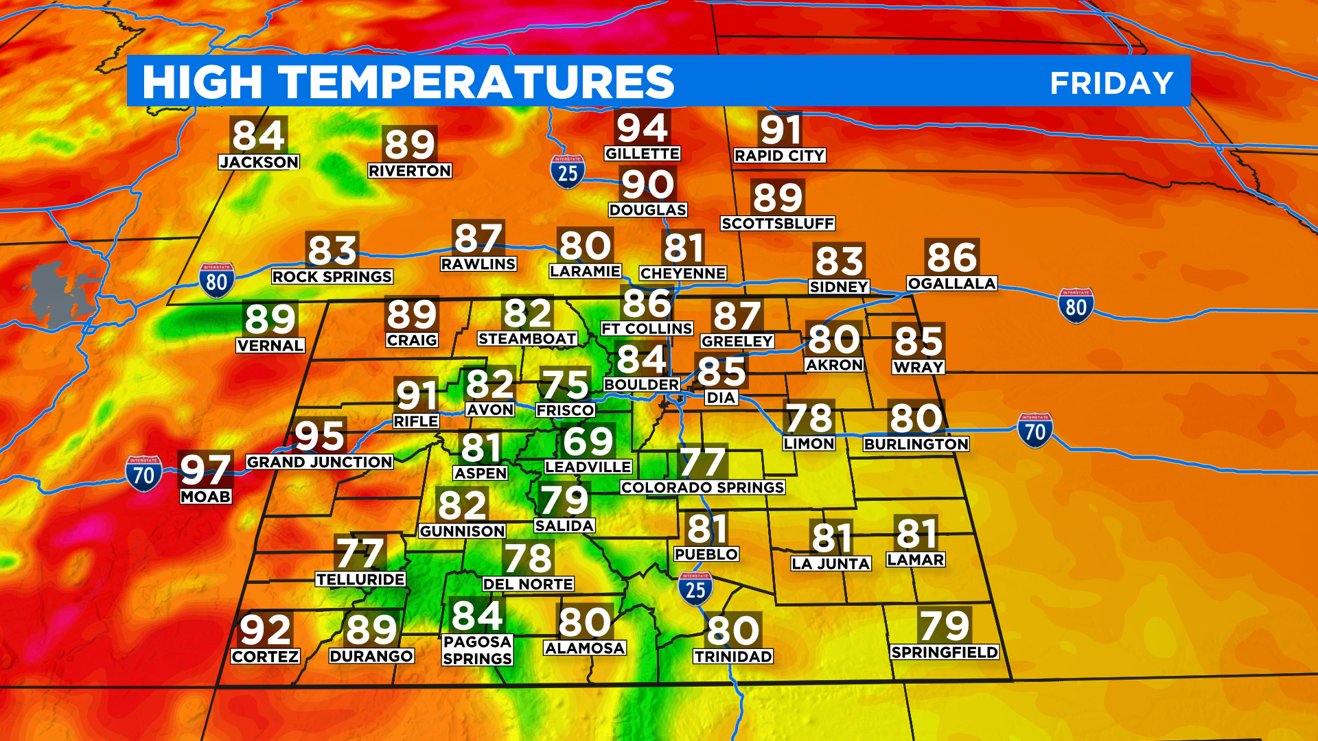
Highs today will be in the 70s and 80s around most of the state except on the western slope where we'll see some 90s. This is the leading edge of the warmer and drier air expected over the weekend.