Colorado Weather: Pattern Shift Underway As A Monsoon-Like Flow Develops
DENVER (CBS4) - A large blocking ridge of high pressure over the Pacific Northwest has kept Colorado's weather cool and unsettled since last week. In fact most of the state has been below normal as far as daily high temperatures since last Thursday.
But it's been a much different story to the northwest of Colorado. For those living under a massive ridge of high pressure the weather headline has been all about extreme heat. Many locations in Washington, Oregon, Idaho and western Canada have record new all-time high temperatures that were well into the 100s.
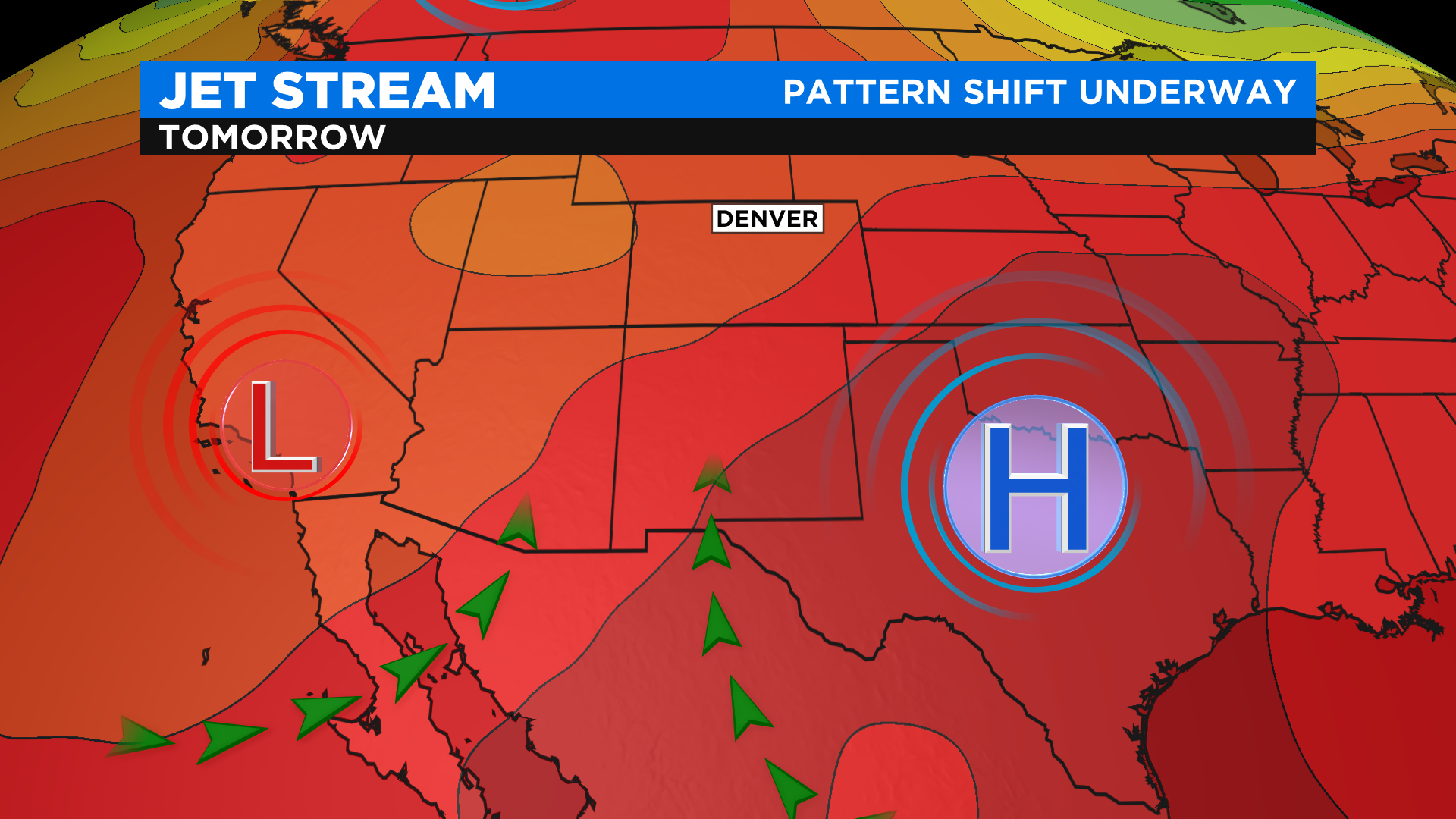
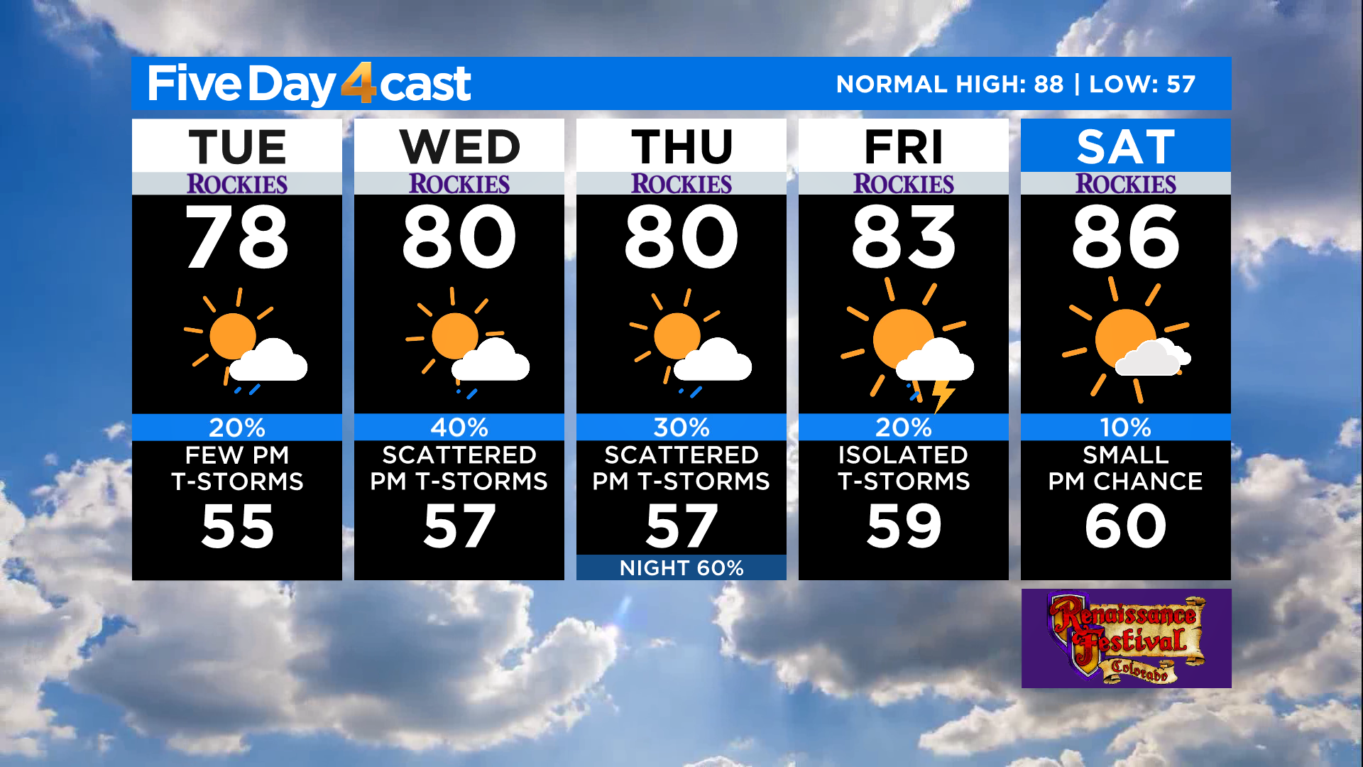
There is good news in the forecast for that part of the country starting today. The ridge is weakening and shifting northeast into Canada. As it moves away our weather in Colorado will also change. The flow of air will shift from the north to the south. That will allow a monsoon-like flow to develop with a large plume of moisture working in from New Mexico.
The result of this shift will be a warming trend in the temperature department but also a good chance for afternoon showers and storms. Because the upper-level steering winds over the state are light right now we'll have to pay close attention to the flash flooding threat. It will go up over the next few days, especially in the high country near burn scars.
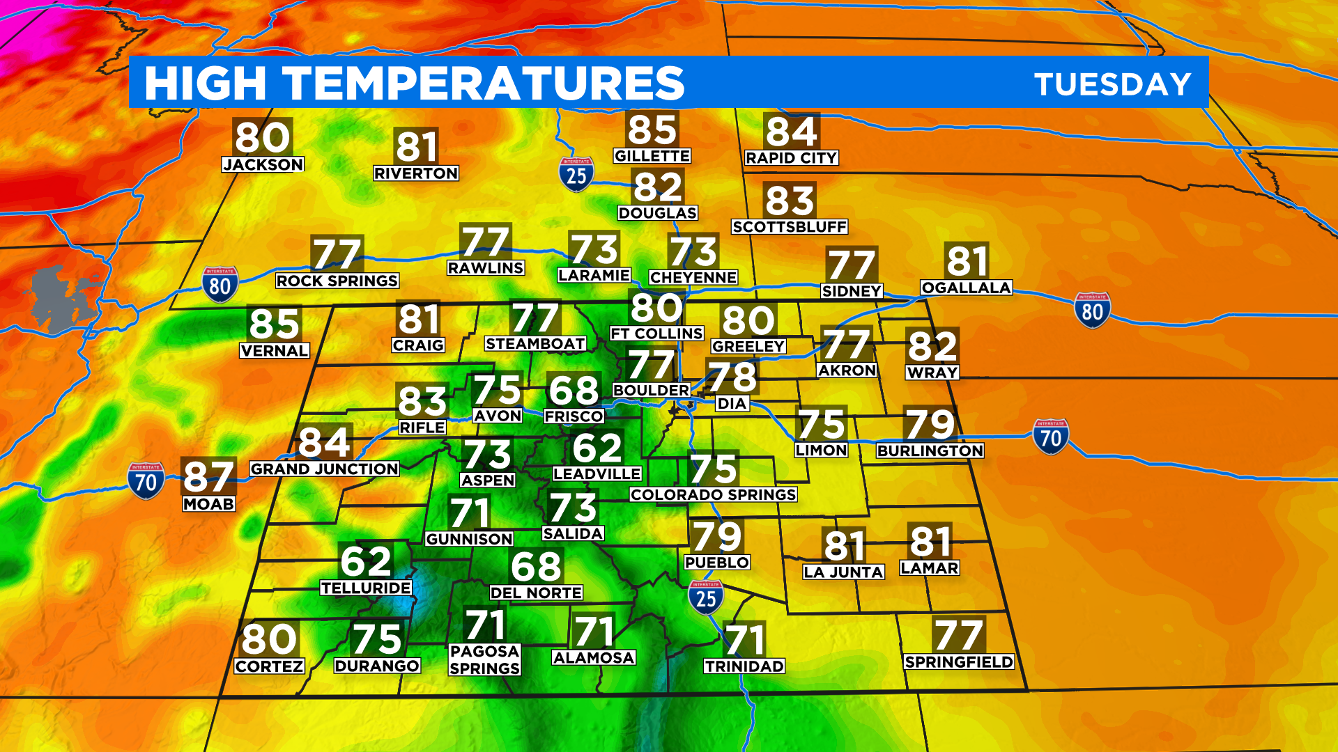
High temperatures on this Tuesday should top out in the 70s for many locations. We'll see some lower 80s mixed in on the western slope and eastern plains with some 50s and 60s in the higher mountains.