Denver Weather: One Day Reprieve, Intense Heat Returns Tuesday
DENVER (CBS4) - Two cold fronts that passed over Denver and the Front Range on Sunday have triggered the coolest day in weeks for the first full day of Hsummer.
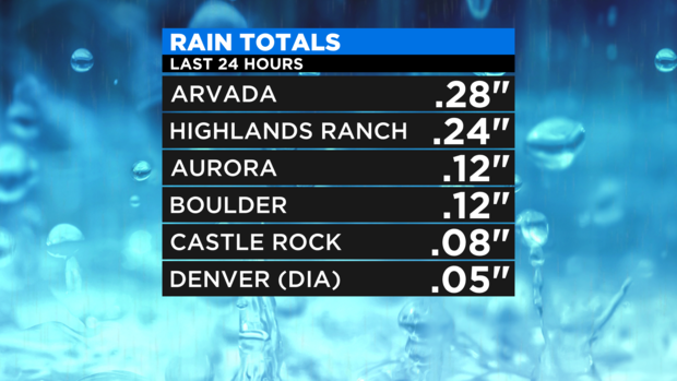
The first cold front early in the day on Sunday caused a lot of wind while the second cold front arrived in the evening and brought welcomed moisture. Most areas around Denver and Boulder received under 0.25" of rain but it was the first measurable precipitation this month. Denver officially received only 0.05" while the Fort Collins and Greeley area generally stayed dry.
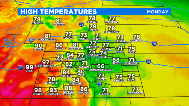
The rain ended in the Denver metro area early Monday morning and the remaining clouds are expected to clear by early afternoon. The remainder of the day will be sunny, dry, and relatively cool compared to recent weeks. With forecast high temperature of only 74 degrees in Denver, it will be the coolest day since June 1.
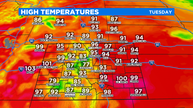
However, the break from intense summer heat won't last long. As the wind in the upper levels of the atmosphere shift back to the southwest starting Monday night, hot weather will return for Tuesday, Wednesday, and Thursday. High temperatures on Tuesday will be at least 20 degrees warmer than Monday.
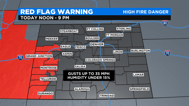
The heat that returns to the Denver metro area on Tuesday will still be found on far Western Slope on Monday. That has prompted another Red Flag Warning for Colorado counties along the Utah boarder including in the Grand Junction area in Mesa County. If another fire were to start in these areas on Monday, they could spread very quickly.
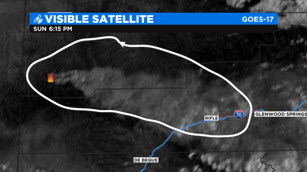
There are already a handful of fires burning in northwest Colorado including at least three that started on Sunday. The largest fires at this time are the Oil Springs fire burning 5,000 acres 42 miles north of Grand Junction, the Collom fire spread across 640 acres 12 miles northwest of Meeker, the Sylvan fire burning 180 acres 13 miles south of Eagle, and the Middle Fire on 95 acres 20 miles southwest of Meeker.
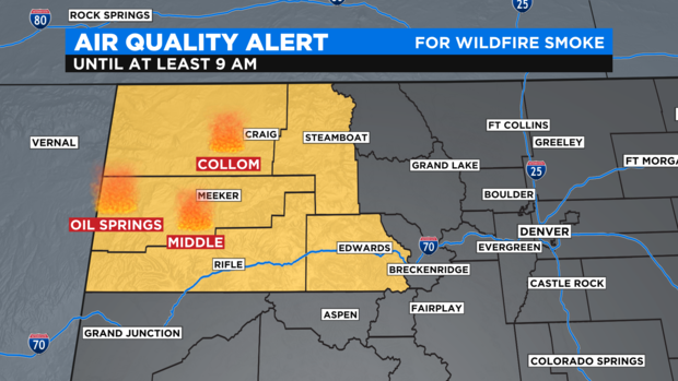
Smoke from all of these fires has triggered an Air Quality Alert for northwest Colorado including in Craig, Meeker, Steamboat Springs, Rifle, Glenwood Springs, Eagle, Edwards, and Vail.
The big heat set to make a comeback for Denver and the Front Range starting Tuesday will also help spread the fire danger farther east but the highest risk will remain west of the Continental Divide.