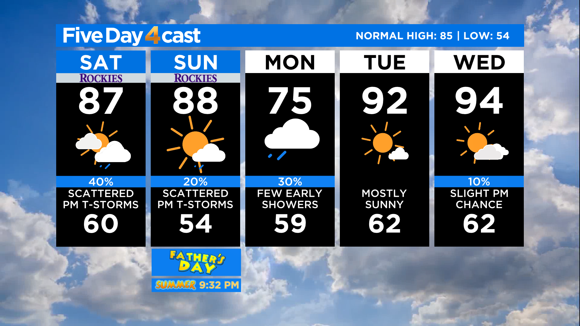
Colorado Weather: Scattered Saturday Storms, Few Could Turn Severe On The Plains
DENVER (CBS4) - A weather disturbance will cross the northern half of Colorado today and it will help instigate scattered showers and thunderstorms. It's fair game to see one anywhere across the state but the best chances are over the northern and central mountains as well as on the northeast plains.
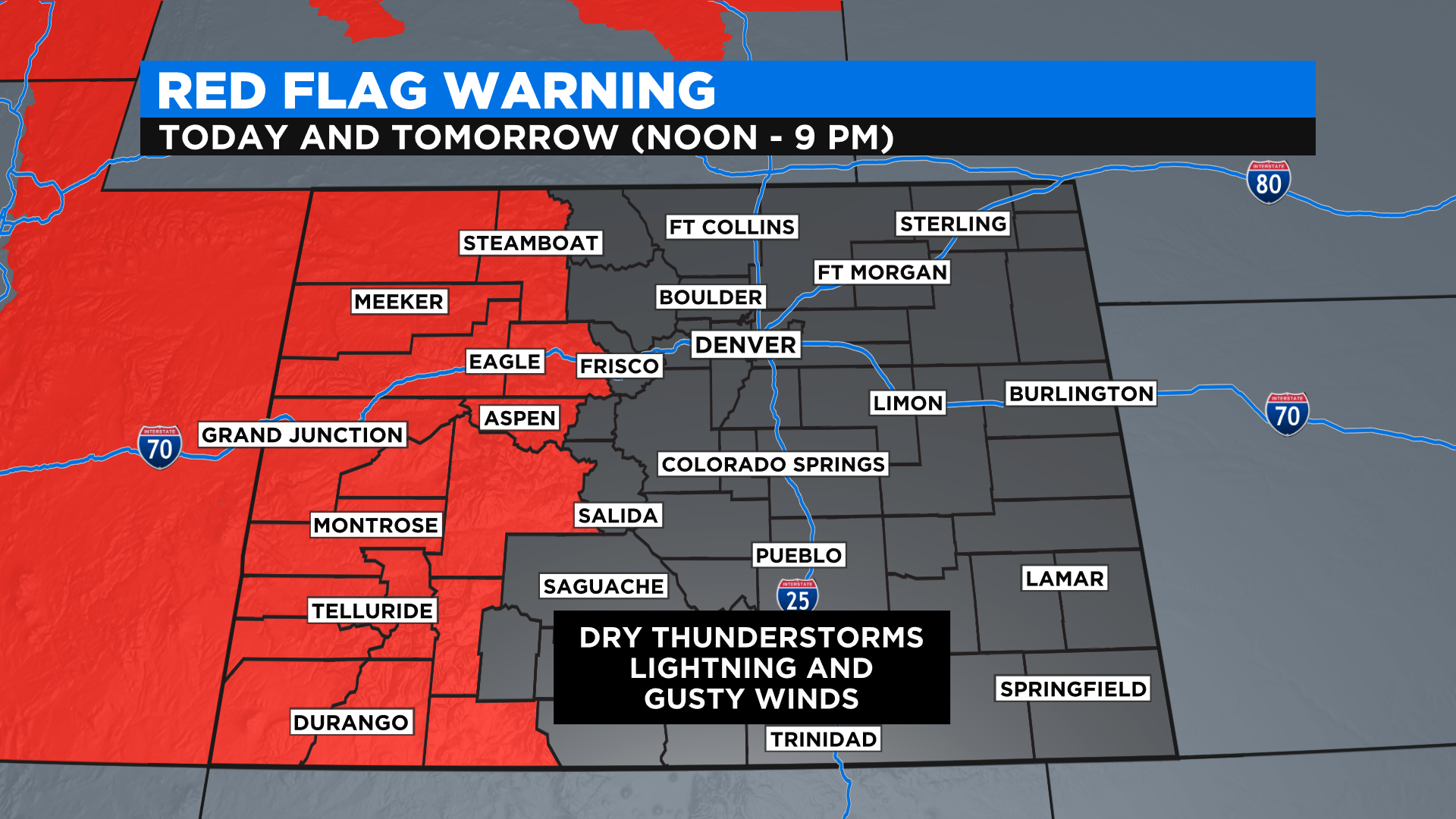
Any storms that form in western Colorado will be what we call "dry" thunderstorms. That means they will produce wind and lightning but little in the way of rainfall because the air near the ground is so dry. Dry thunderstorms can ignite wildfires, especially in drought-stricken areas. We saw 20 new starts in the vicinity of Ute Mountain in the southwest part of the state on Friday alone and one of those fires was already to 80 acres at last check.
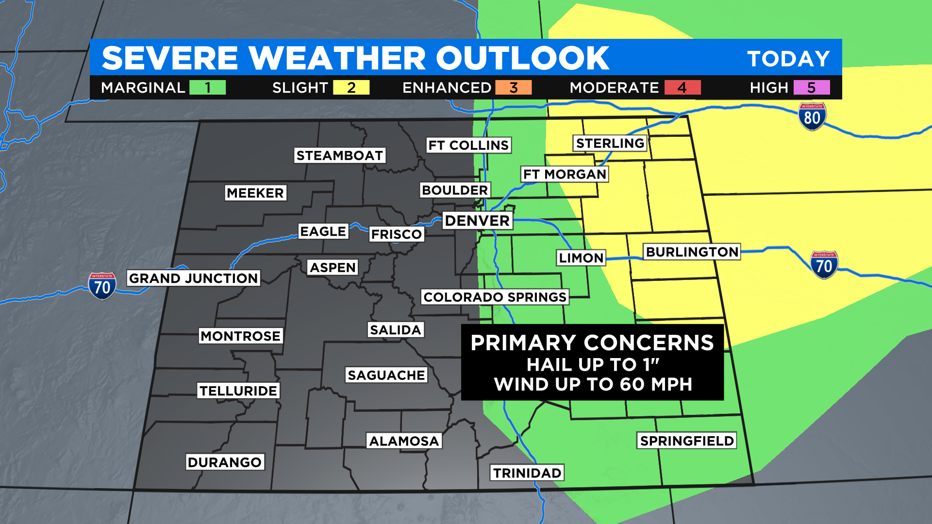
It's a much different story on the northeast plains where there is plenty of low-level moisture for storms to work with, evident by the high dewpoints. As thunderstorms develop Saturday afternoon they could turn severe in this part of the state. Large hail and damaging wind gusts will be the main threats.
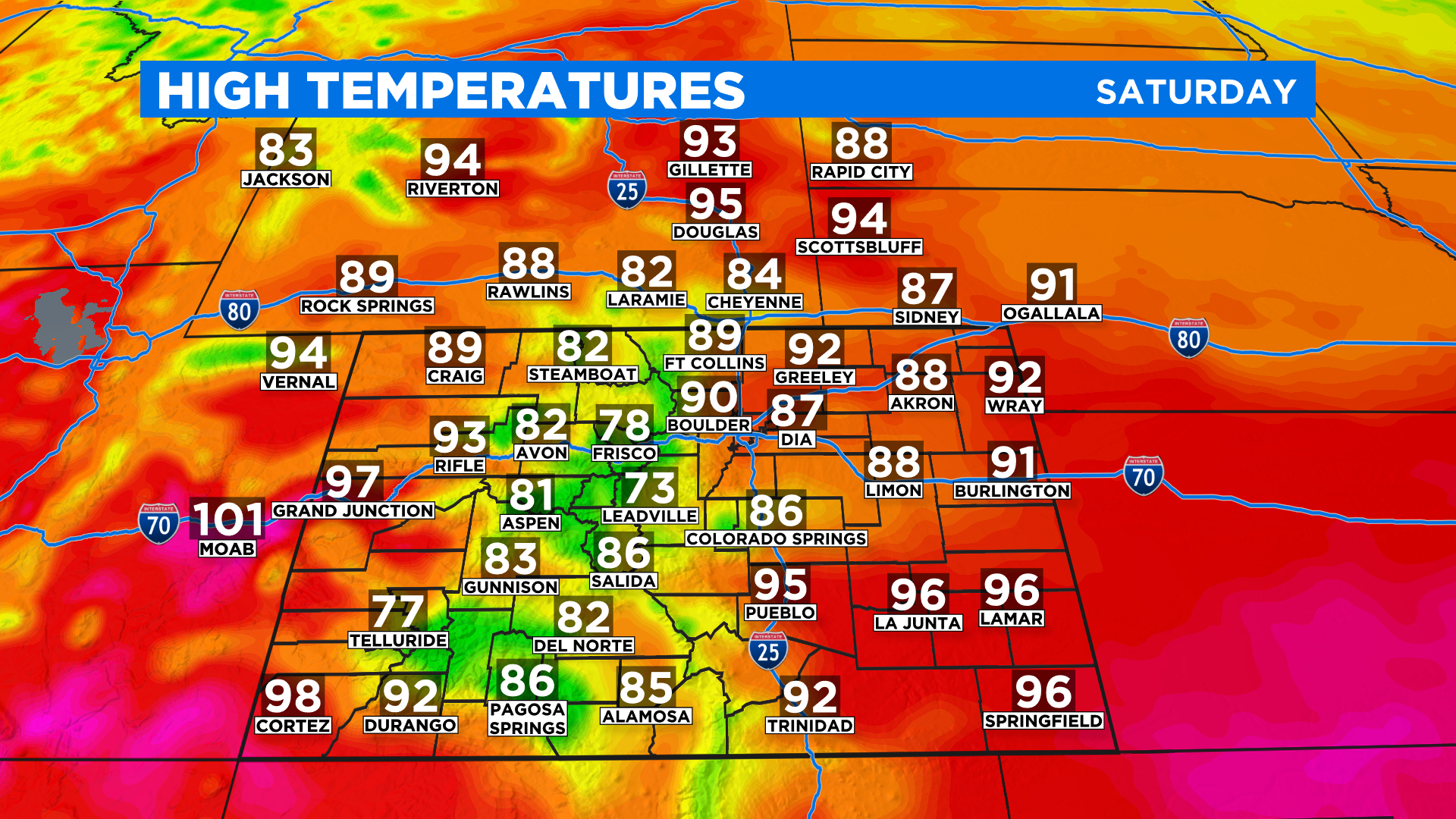
It'll be a bit cooler around the state today compared to recent days thanks to the increased cloud cover and the chance for scattered storms. We'll see 70s and 80s in the mountains with 80s and 90s across the lower elevations. We are not expecting any highs in the 100s but a few places could get close in the Grand Valley and the Arkansas River Valley.