Denver Weather: Cooler With Afternoon Storms, Few May Turn Severe On Plains
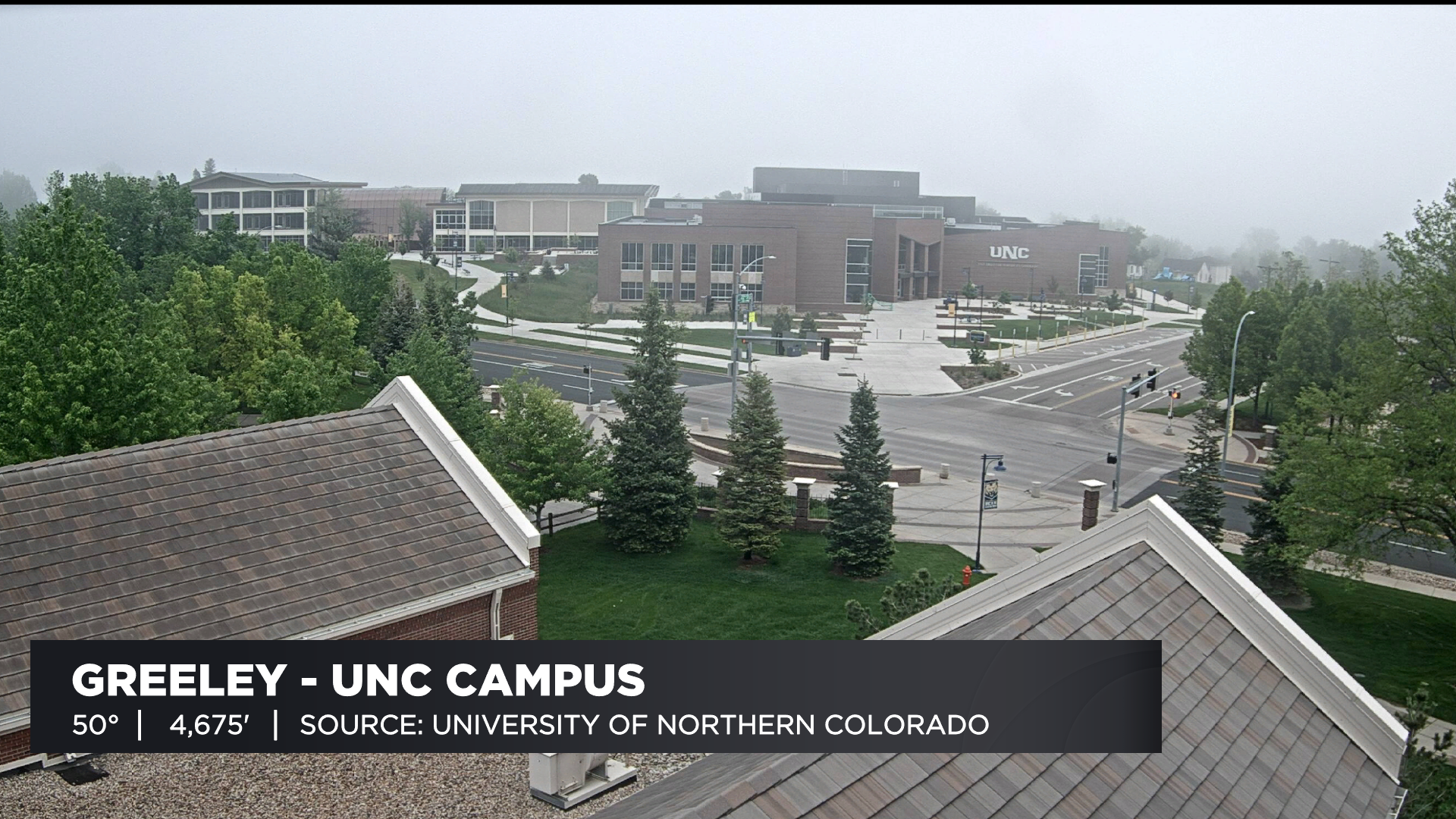
DENVER (CBS4) - A big weather change is underway across Colorado for this holiday weekend. It's starting with a cold front that has worked into the state. It produced areas of dense fog on the plains early Saturday morning. We had a good view on this on the webcam at UNC in Greeley.
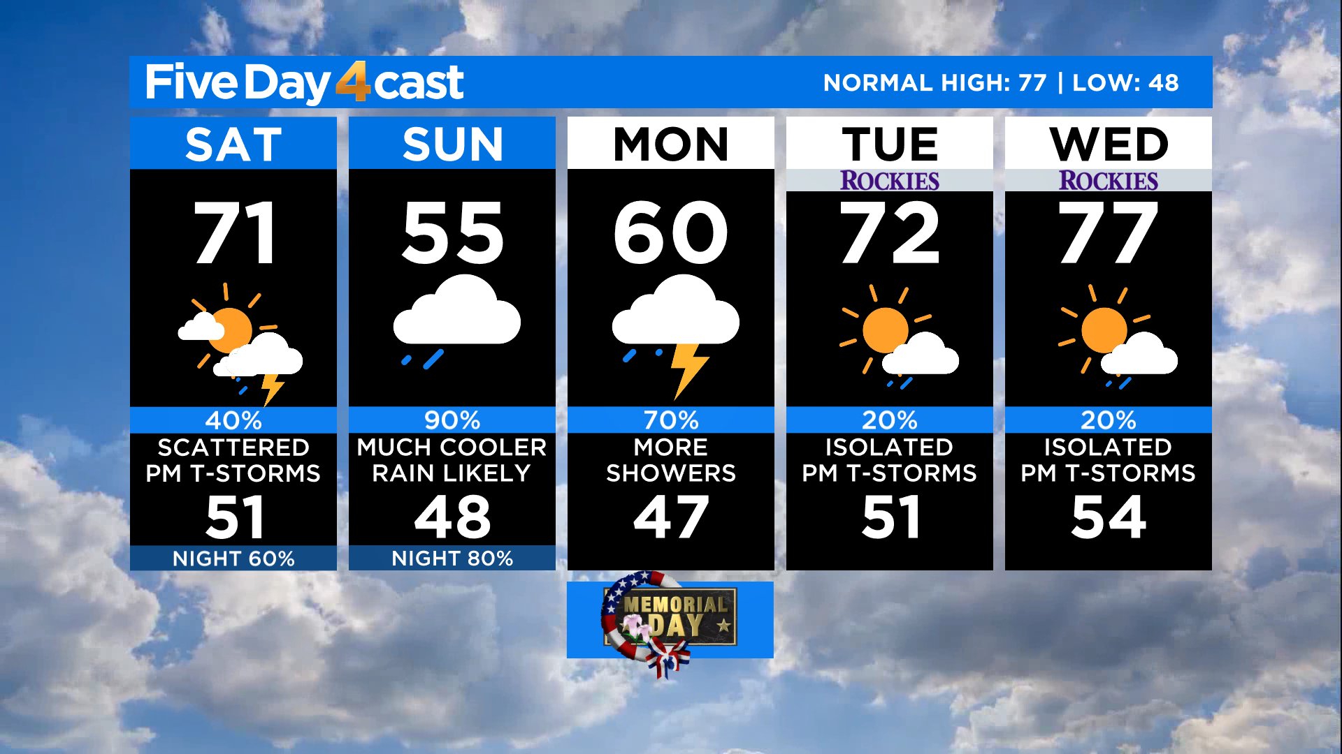
Behind the front high temperatures will be about 10-12 degrees cooler today in Denver and on the northeast plains, compared to highs on Friday. It will still be warm on the western slope with widespread 80s. The mountains will see 60s and 70s.
Scattered showers and thunderstorms will develop with daytime heating Saturday afternoon. They'll initiate in and near the foothills before moving onto the eastern plains.
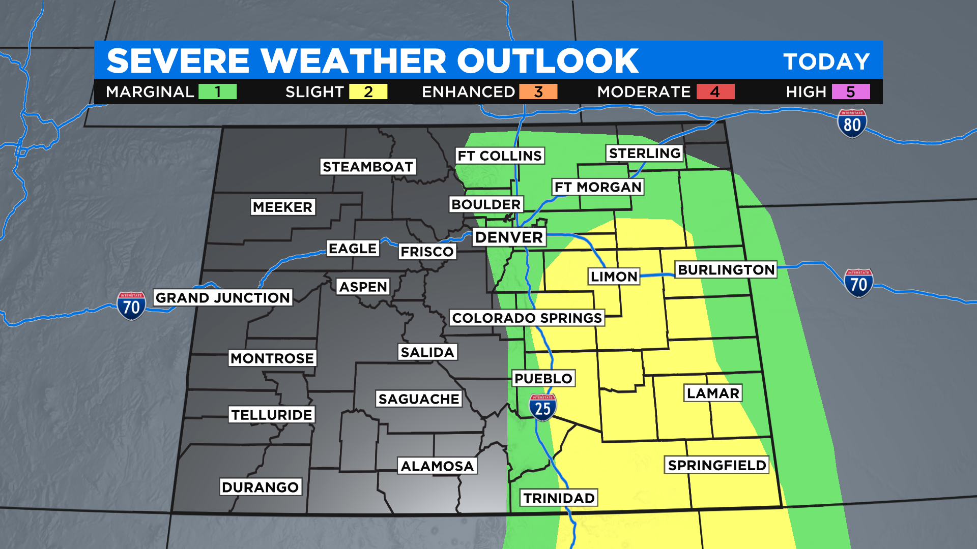
A few of the storms could become strong to severe with locally heavy rain, damaging wind and large hail. We can't rule out an isolated tornado. The highest chance of this happening will be on the plains to the south and east of metro Denver. But don't let your guard down if you live in the urban corridor because we are right on the edge of the threat zone.
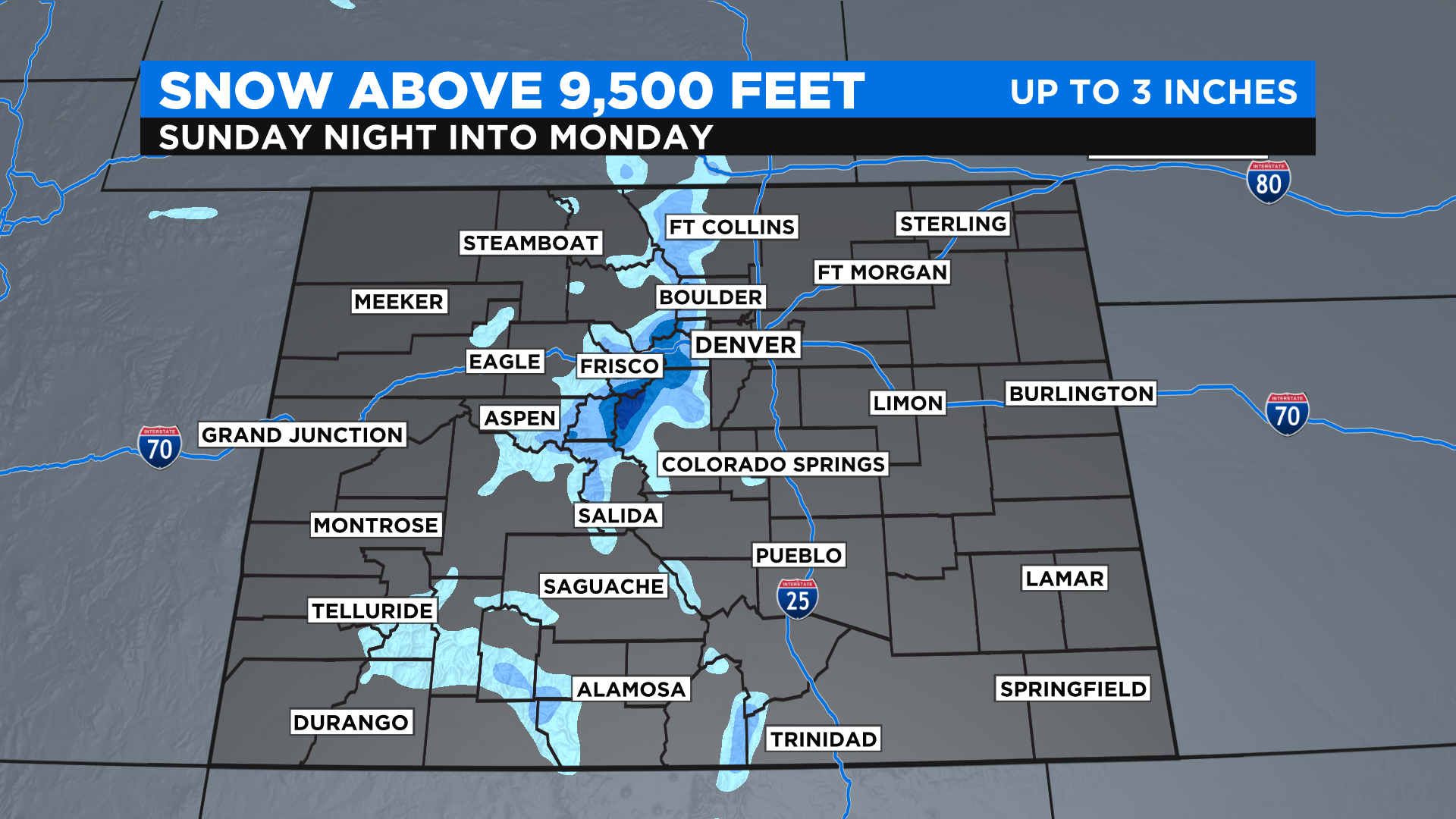
On Sunday the second part of this weather system will enter the picture. It's a big trough of low pressure that will move in from California. Even cooler air will filter into the state with this system, along with a widespread chance for rain. It'll be cold enough for some snow in elevations above 9,500 feet.
A warming and drying trend will move into Colorado starting on Tuesday with temperatures climbing back to where they should be for this time of year. There will be a daily chance for a few afternoon storms but that is pretty typical for early June.