Typical May Weather Returns To Colorado Wednesday, Severe Storms Possible Thursday
DENVER (CBS4) - After several days with cloudy, cool and wet weather across Colorado we'll see a shift in the weather pattern starting Wednesday. That change will get underway as a cut-off area of low pressure moves away from the state, allowing our flow of wind in the atmosphere to turn more from the west and southwest. That wind shift will bring warmer and drier air back into the state.
This pattern change means we'll see some sunshine back in the sky starting Wednesday but it won't be those completely clear blue bird skies all day. Low-level moisture will combine with daytime heating to create showers and thunderstorms during the afternoon, especially over the mountains and foothills.
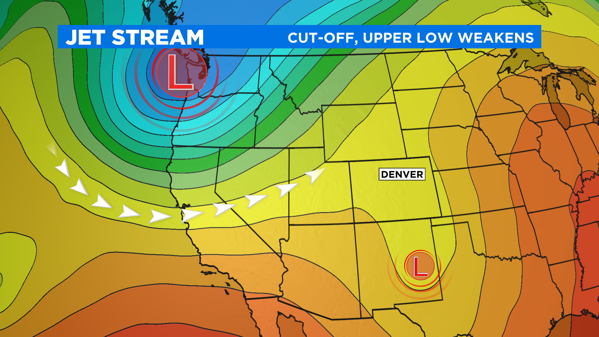
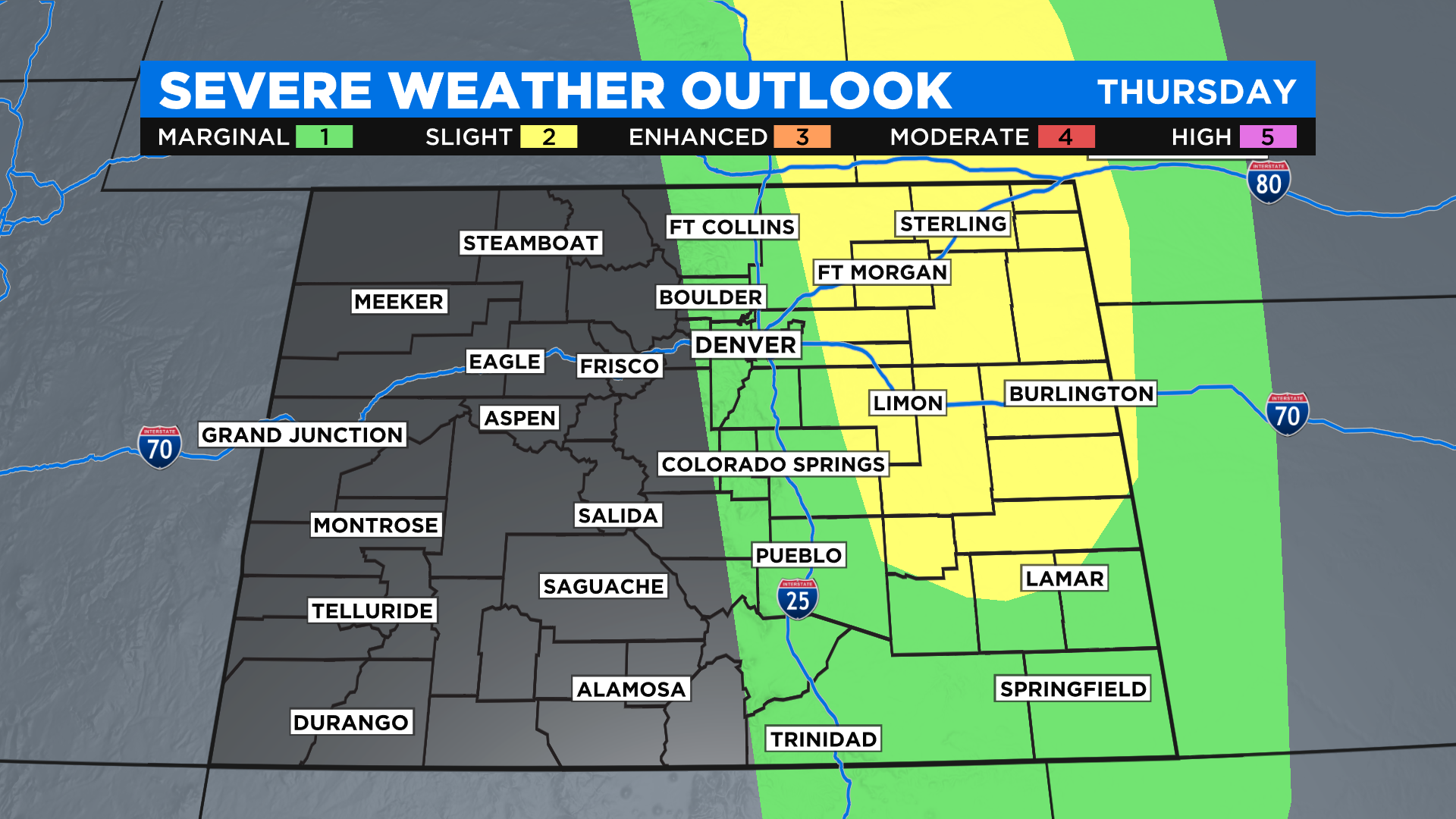
The next storm that will move through the region is currently moving into the Pacific Northwest. By Thursday some of the energy with this could combine with daytime heating and surface moisture to create a chance for strong to severe thunderstorms in the afternoon.
The current thinking if this happens is that storms would be possible anywhere along and east of Interstate 25. The Storm Prediction Center in Oklahoma has already issued an outlook for this.
As the next storm system moves through Colorado this weekend it will keep an ongoing chance for daily thunderstorms in the forecast. But unlike the current storm this next one will be something more like what we are used to where the mornings start off dry and quiet and the storm chances increase during the afternoon. Because it will be much warmer the afternoon storms could reach severe limits each day over the upcoming weekend.