Denver Weather: Chilly And Wet For One More Day In Colorado
DENVER (CBS4) - After rain and snow across much of Colorado Monday night into early Tuesday morning, another surge of moisture is on the way for Tuesday afternoon. It will be all rain at lower elevations while the high country gets another blast of spring snow.
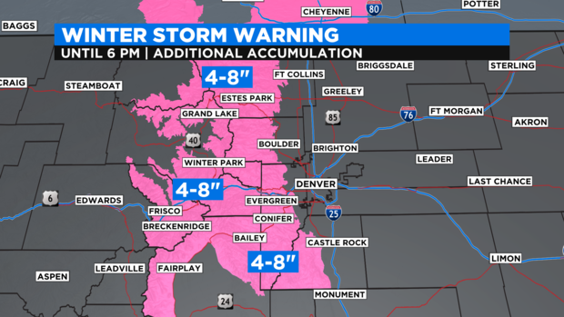
The foothills and mountains west of Denver, Boulder, and Fort Collins remain under a Winter Storm Warning through 6 p.m. Although it is no longer winter, the title is still used whenever winter conditions are expected. Most areas above 7,500 feet as far west as Vail Pass will get 4-8 inches of additional snow. The higher amounts will be generally above 10,000 feet or above most mountain towns.
As of early Tuesday morning, many areas in the high country has already reported at least a half foot of snow. Trail Ridge Road in Rocky Mountain National Park (which generally reopens for the season in late May) had 13 inches as of 5 a.m. Tuesday.
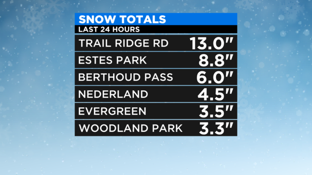
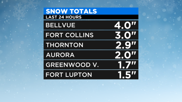
At lower elevations, most locations along the urban corridor that received snow had no more than 3-4 inches mainly on the grass including about 3 inches in Fort Collins and Thornton.
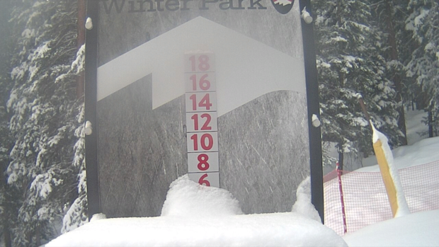
The three ski areas that remain open in Colorado also reported several inches of snow Tuesday morning including 6 inches at Winter Park, 5 inches at Breckenridge, and 4 inches at Arapahoe Basin.
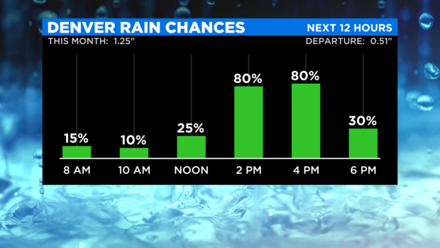
Looking ahead, rain chances for lower elevations and snow chances in the foothills and mountains will stay relatively low through the morning hours on Tuesday. Then the chances will soar during the afternoon before dropping again in the evening.
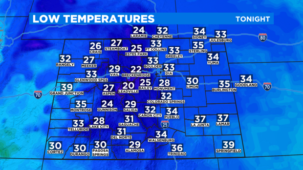
Once the last of the precipitation ends late Tuesday evening, skies will clear from west to east across Colorado causing most areas to get even colder Wednesday morning than Tuesday morning. Another hard freeze will occur in the mountains and higher foothills while some areas along the urban corridor could experience a light freeze.
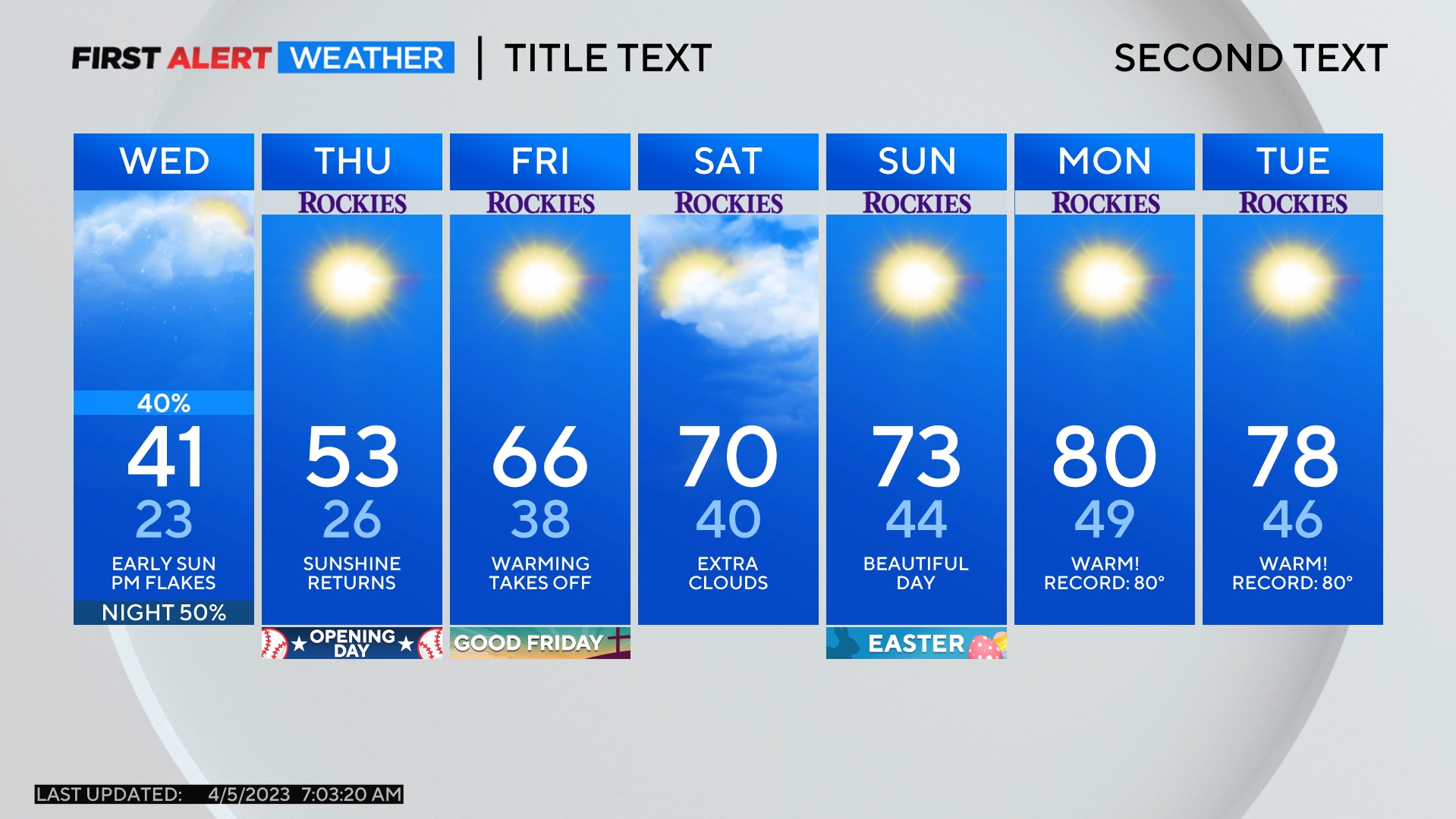
Starting Wednesday, a new weather pattern will develop over Colorado with a large ridge of high pressure moving into the Rocky Mountain region. The chance for moisture will become much smaller with only a 20% chance for late day showers and thunderstorms on Wednesday, Friday, and Saturday. Thursday should be dry statewide.
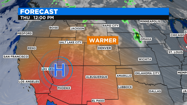
Temperatures will also become much warmer for the end of the week and through the weekend.