Denver Weather: More Soaking Rain In The Metro Area, More Heavy Snow Up High
DENVER (CBS4) - After about an inch of rain at the end of April, the first work week in May has also had a soggy start. Meanwhile, it's still snowing in the high country.
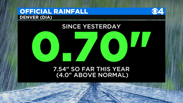
As of 12:30 p.m., Denver had officially received about 0.70" of rain since late Sunday. That brings the total lipid total for the year to more than 7.5" which is a record from January 1 to May 3 at DIA.
Meanwhile, other areas along the Front Range have received well over an inch of rain (these totals are as of Monday morning - many of the final numbers will be higher).
Boulder 1.77"
Broomfield 1.66"
Lafayette 1.56"
Wheat Ridge 1.43"
Arvada 1.36"
Lakewood 1.34"
Lone Tree 1.27"
Denver (CBS4) 1.10"
Thornton 1.06"
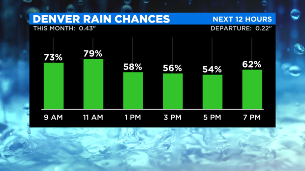
A good chance for additional rain will continue through at least early afternoon Monday before rain chances gradually decrease by late afternoon. A few more showers will be possible Monday evening as well.
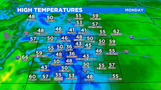
Regardless of the rain, it will stay chilly for May all day with high temperatures only in the 40s around Denver, Boulder, and Fort Collins. That is at least 20 degrees below normal for this time of year.
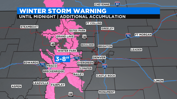
In terms of high country snow, unnecessary travel is discouraged along the I-70 mountain corridor between Georgetown and Vail Pass do to the high likelihood of accidents and significant delays. At least another 3-8 inches of heavy, wet snow will fall along this stretch as well as in the Winter Park and Rocky Mountain National Park regions. These areas are under a Winter Storm Warning until midnight Monday night.
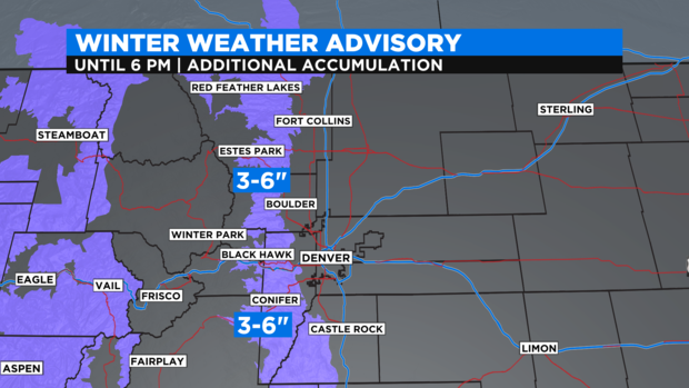
Just east of the warning is a Winter Weather Advisory for the foothills of Jefferson, Boulder, and Larimer Counties which continues until 6 p.m. Monday. Communities such as Conifer, Bailey, Black Hawk/Central City, Ward, Nederland, Estes Park, and Red Feather Lakes will see an additional 3-6 inches of snow through Monday evening.
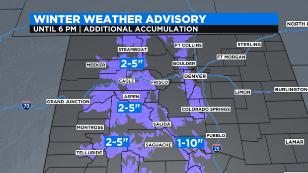
And then west of Vail Pass is a different Winter Weather Advisory for most areas above 9,000 feet on the Western Slope including the mountains around Steamboat Springs, Glenwood Springs, Aspen, Telluride, and Silverton for another 2-5 inches of snow. The Sangre de Cristo Mountains are also under an advisory for up to 10 inches of additional snow in south-central Colorado.
Looking ahead, Tuesday and Wednesday will be far less wet for Denver and the Front Range but scattered showers and thunderstorms will be possible in the afternoon and evening each day. Then much drier and much warmer weather will return for the end of the week with high temperatures reaching in the 80s on Friday.