Colorado Weather: Very Warm Saturday Ahead Of Soggy, Chilly Storm Arriving Sunday
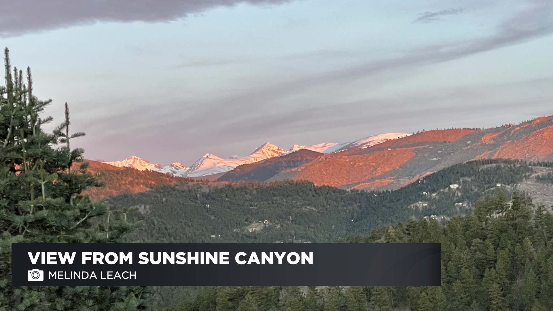
DENVER (CBS4) - Welcome to the month of May and Happy Saturday! A little bit of cloud cover made for a beautiful sunrise this morning. Our weather watcher in Sunshine Canyon snapped a picture of dawn's first light hitting the Continental Divide.
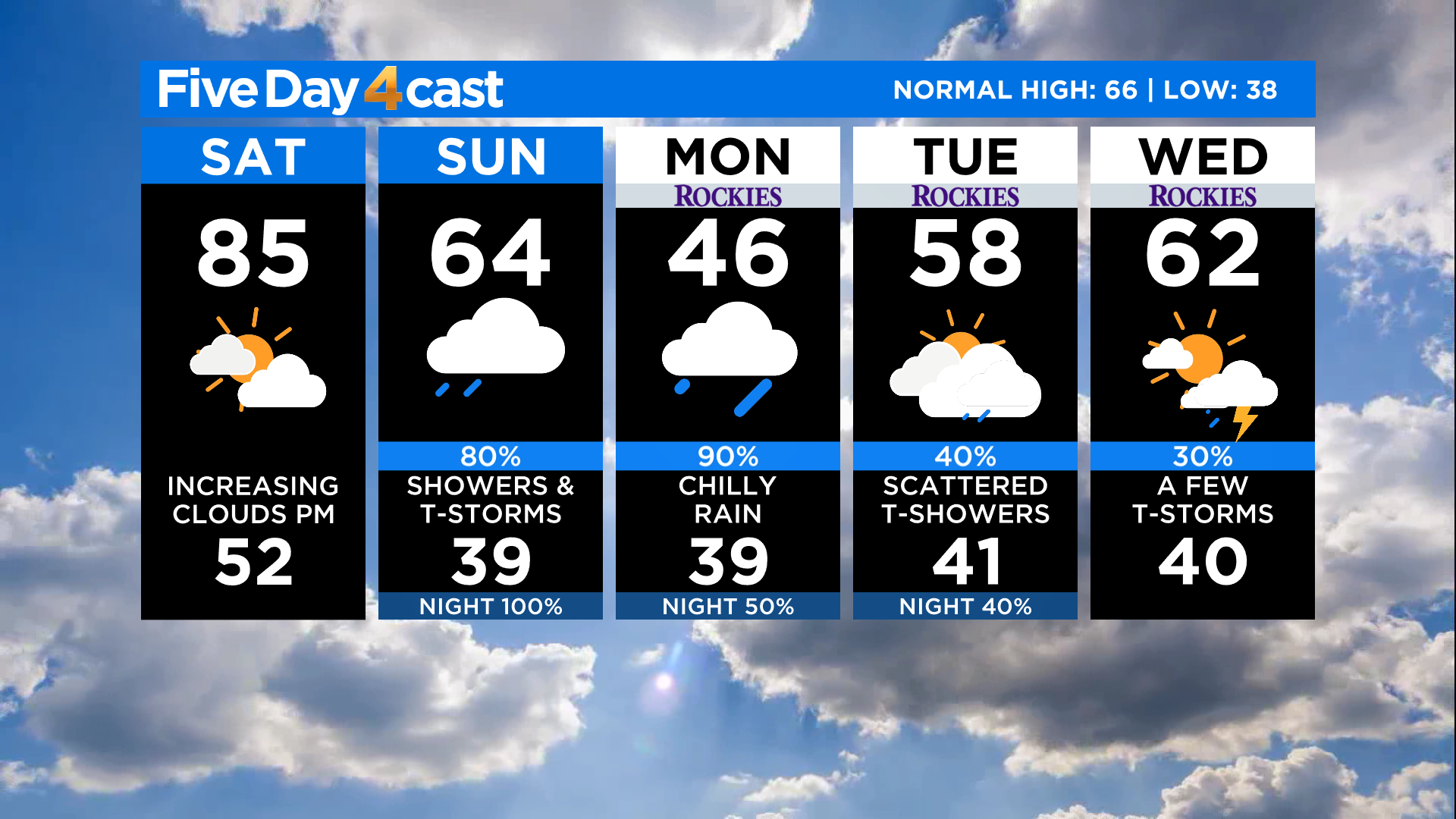
Get outside and enjoy some of this very warm weather if you can because things will change in a big way starting tomorrow as a new storm moves into the state.
We'll see widespread 70s and 80s around Colorado by this afternoon with the potential for lower 90s on the southeast plains. If you are heading into the mountains you'll have 50s and 60s above 10,000 feet.
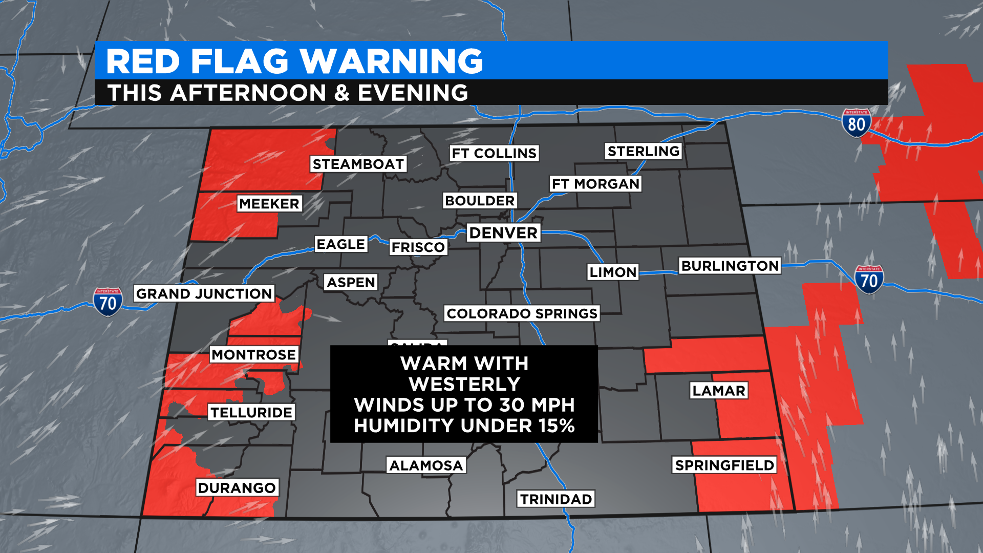
It will turn breezy by this afternoon with westerly wind gusts up to 30 mph possible. That will push the fire danger to extreme levels on the western slope and southeast plains. The forest service is planning to do some controlled burns in the White River National Forest so you may see smoke today along the I-70 corridor through Summit County and Eagle County.
The main weather story for today is the very warm temperatures, but clouds will increase through the day as our next storm gets closer. These will be mid and high-level clouds for the most part which means we stay dry. But a few isolated showers or storms will be possible over the higher terrain.
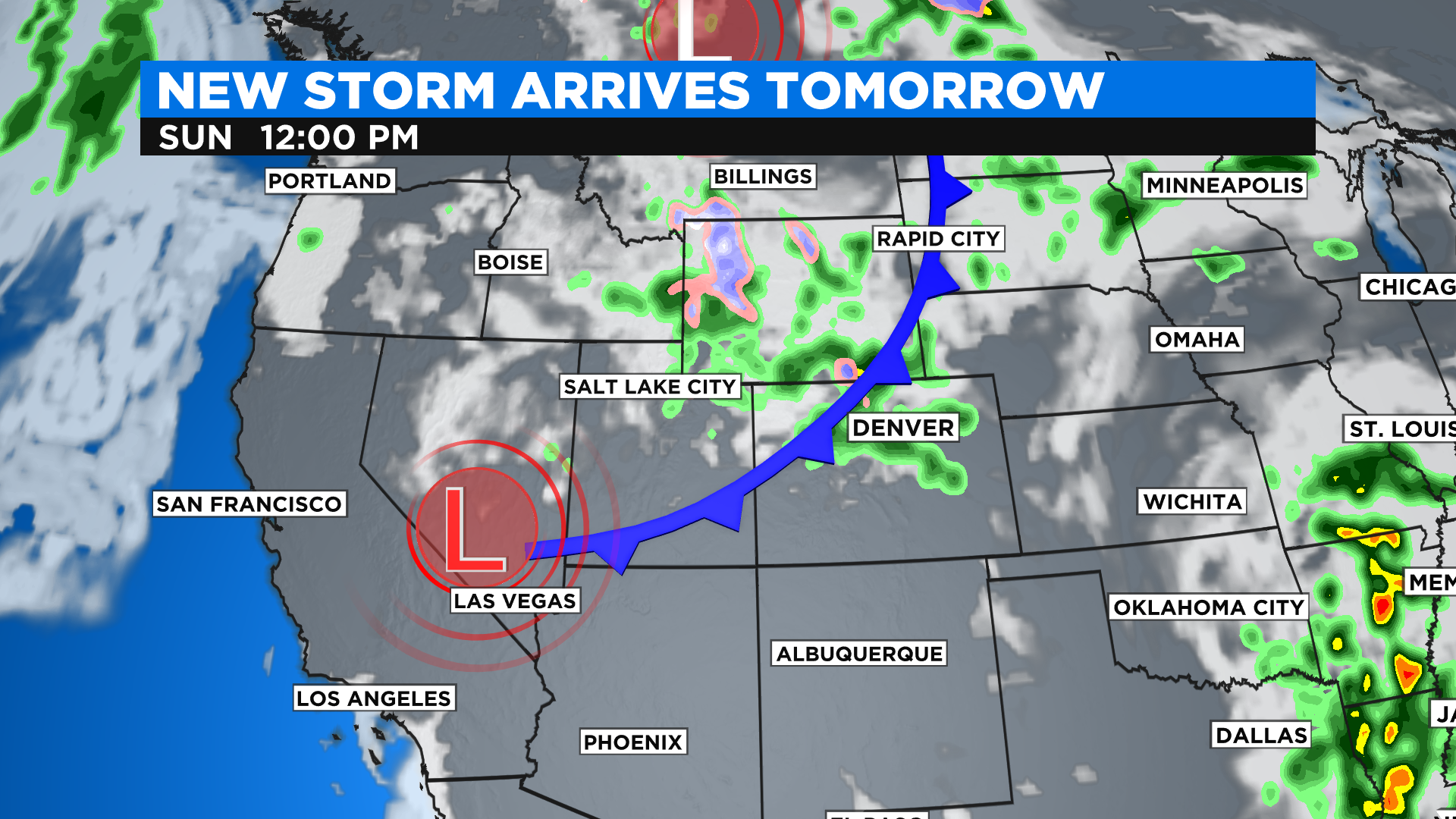
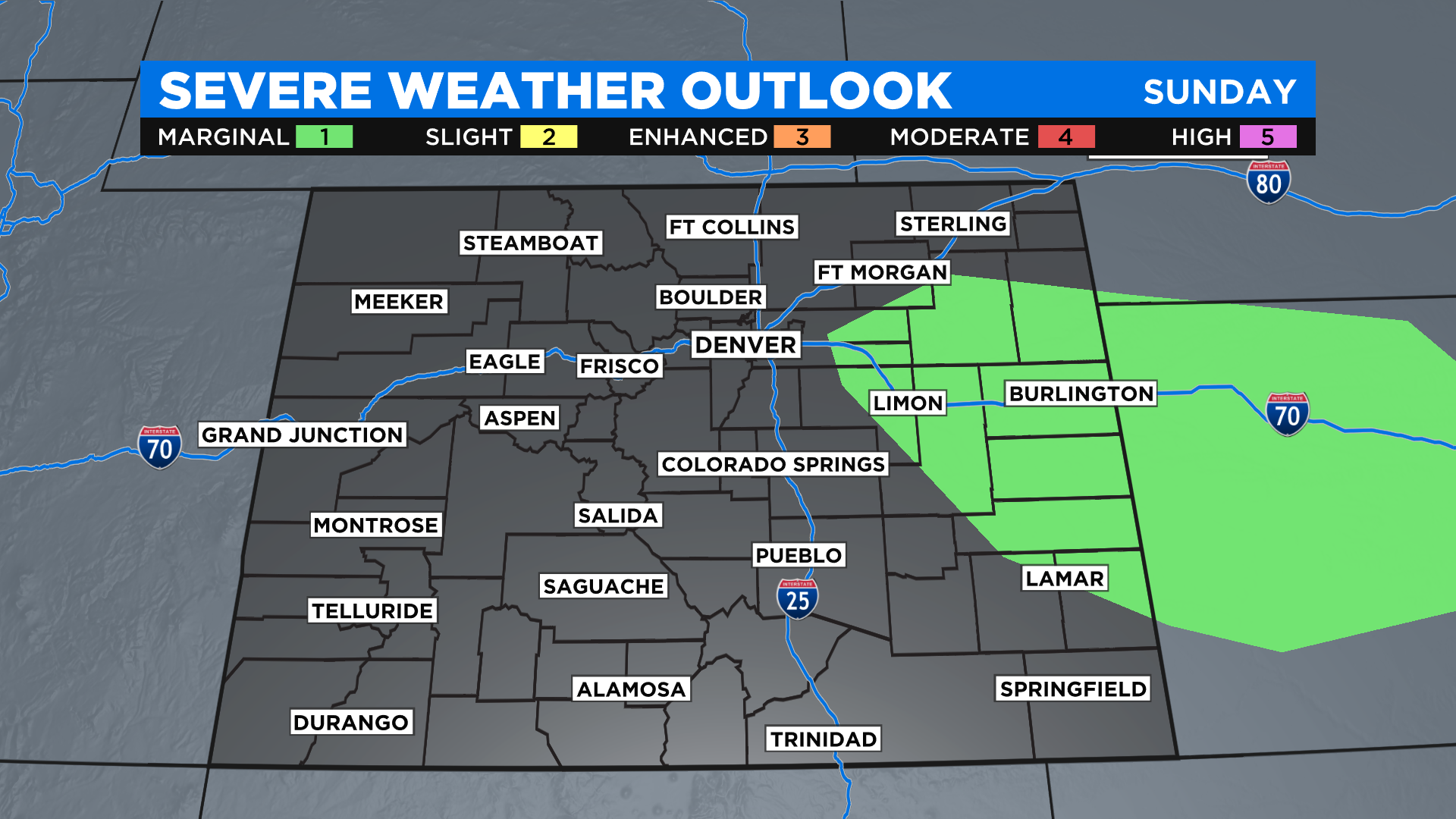
By Sunday morning a cold front will be pushing across the state. It will kick up a round of thunderstorms by the early afternoon. A few of those could be strong to severe on the eastern plains with large hail the primary threat.
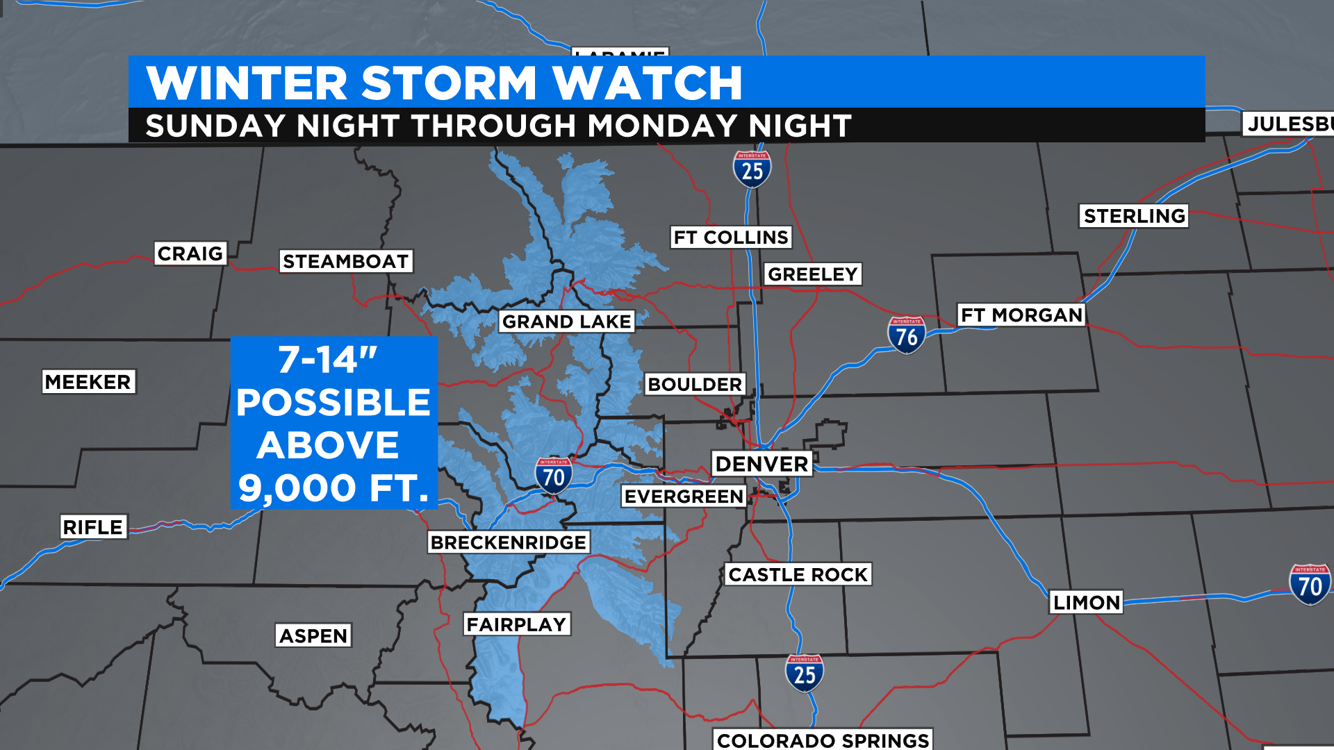
By Sunday night we expect widespread snow in the mountains with a chilly rain in Denver and along the Interstate 25 urban corridor. Above 9,000 feet in the northern and central mountains the snow could be heavy with several inches possible by Monday night.
The snow level could drop as low as 5,500 to 6,000 feet by Monday morning but any accumulation would be on the light side and mostly just on grassy surfaces.
Looking ahead the first week of May will get off to a cool and unsettled start with the potential to see scattered showers or storms all the way through Wednesday. It looks like a big warming trend will return starting Thursday with 70s and 80s back in the forecast just about statewide.