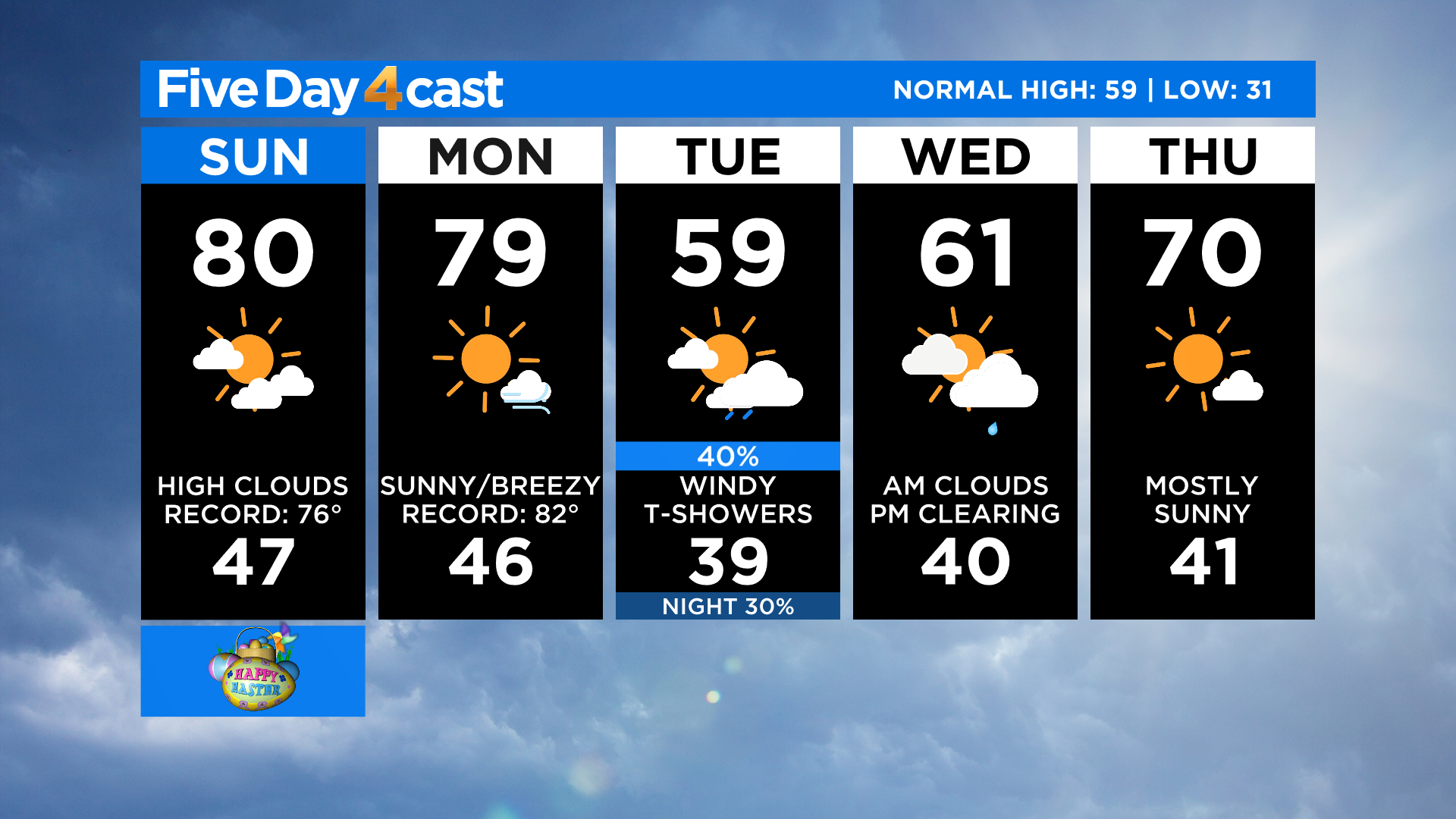
Colorado Weather: Passing Clouds With More Record Highs Possible Easter Sunday
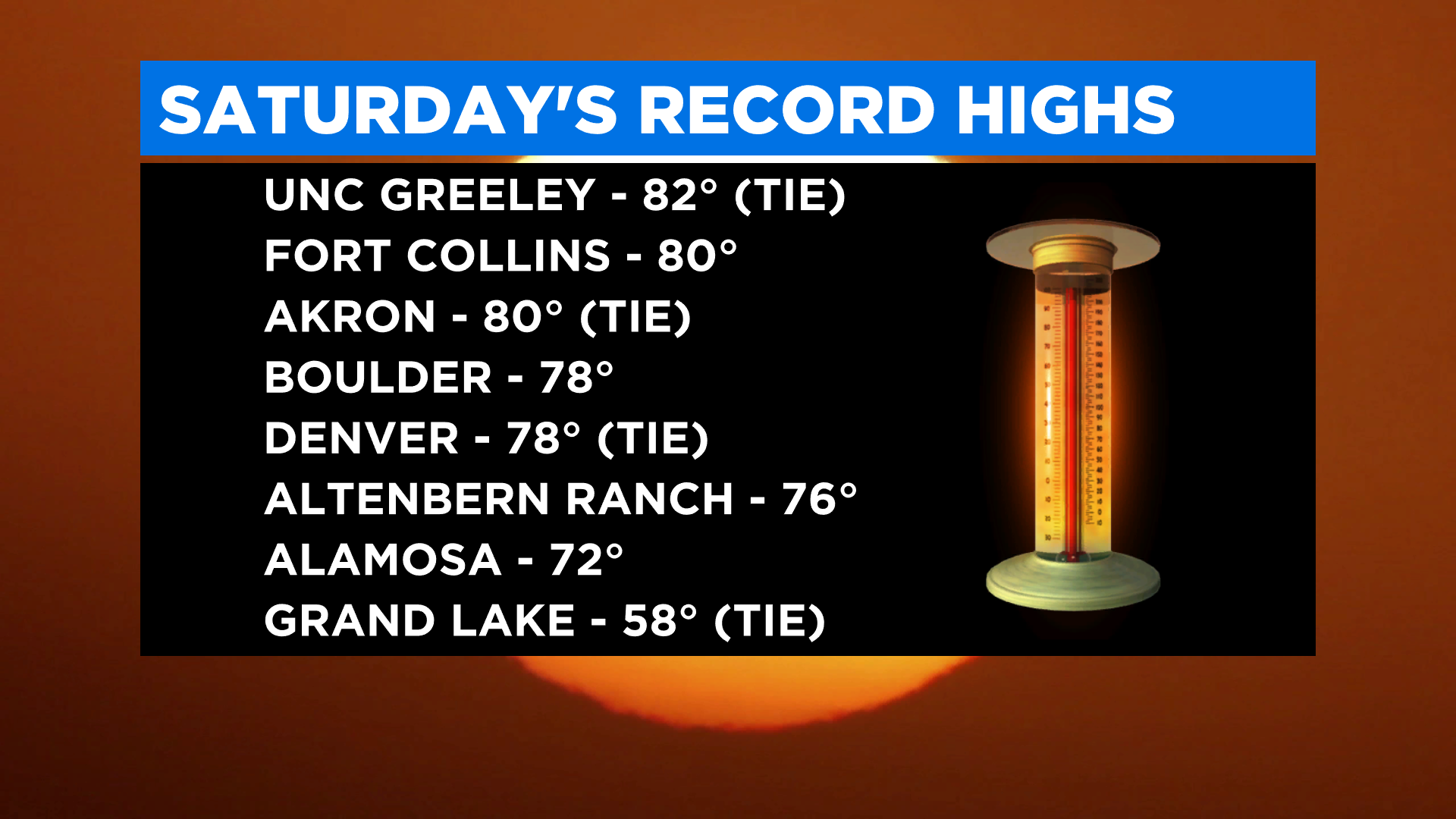
DENVER (CBS4) - Several locations around Colorado tied or set new daily record high temperatures on Saturday, including Denver, Boulder and Fort Collins. We have the potential to see more records fall today as warm air continues to move in from the west and southwest.
There will be one notable difference today compared to Saturday. There is a band of mid and high-level moisture that will cross Colorado by this afternoon. That means we'll see more cloud cover. The clouds will be too high off the ground to make any widespread precipitation but a few places in the mountains could get a sprinkle or a light shower.
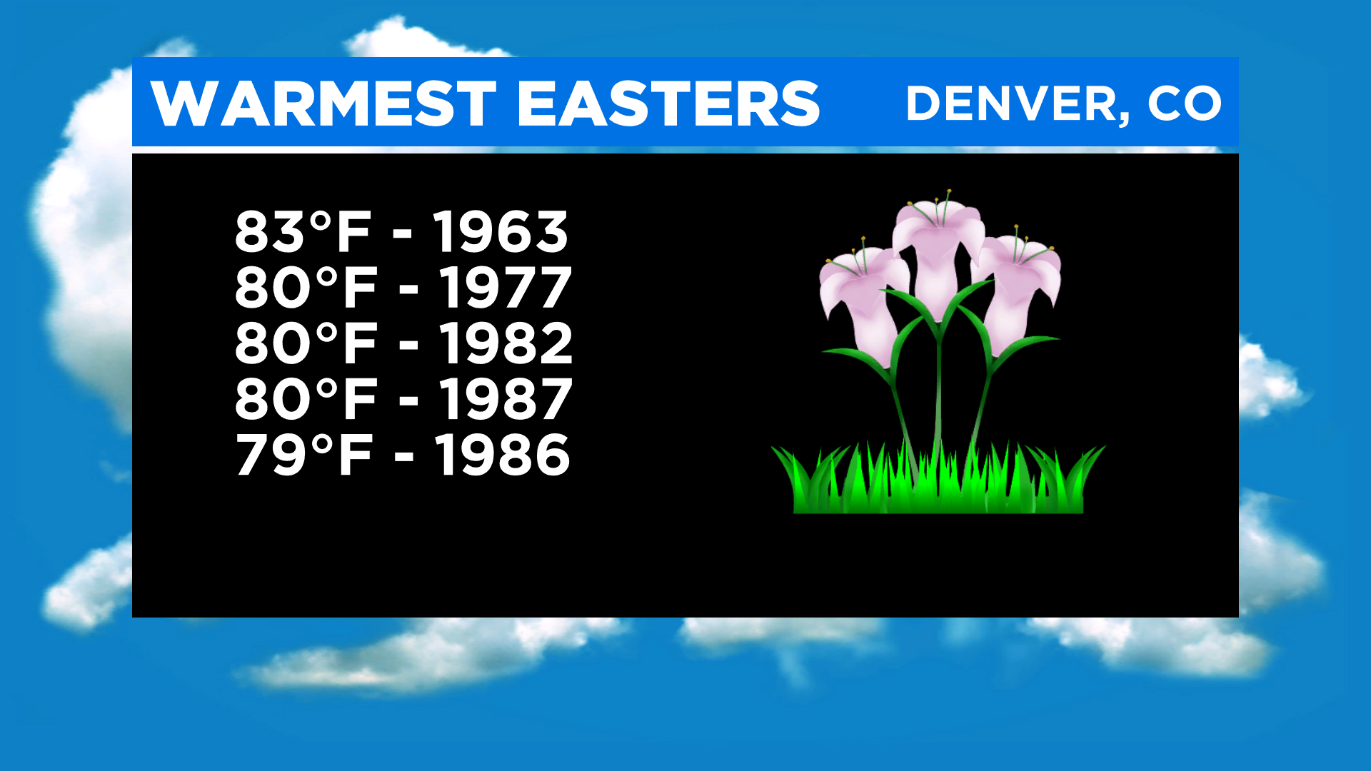
As long as the cloud cover isn't too thick we have the potential for a high of 80 degrees in Denver today. That would land us on the list of warmest Easters on record for the city.
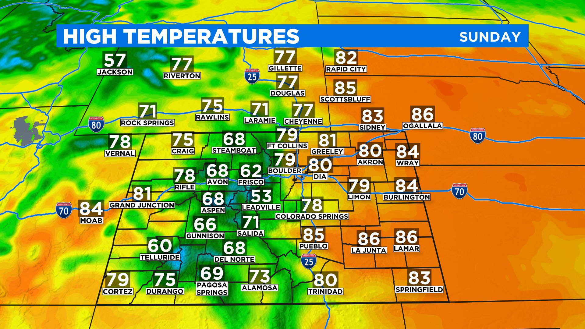
The high country will be in the 50s and 60s once again this afternoon with widespread 70s and low 80s on the eastern plains and western slope. Wind speeds today will average anywhere between 5-15 mph at times and the predominant direction will be from the west or southwest. Occasional gusts to 20 mph will be possible.
Looking ahead the new work week will start off warm with similar temperatures expected statewide again on Monday. But a cold front will sweep through by Tuesday with much colder air and a chance for showers and thunderstorms. It should be cold enough in the mountains for some snow above 9,000 feet.