Denver Weather: Major Storm To Hit Colorado Starting Saturday
DENVER (CBS4) - Our big storm is getting closer! Currently, it's still off to our west and will still take its time arriving in the state.
There will be a little light snow ahead of the storm on Saturday morning and into the lunch hour. Once we get past 12:00 pm, things should start to ramp up and heavy snow will build as the afternoon continues.
We have several Winter Storm Warnings for this storm, including the Denver area and foothills. This is going to be wet, heavy snow that could cause tree branches to snap and power to go out. Once this storm gets closer, it will start tapping into the moisture rich Gulf of Mexico. This combined with our expected upslope flow, which funnels moisture right into the Front Range, means we are in for potentially very high snow totals.
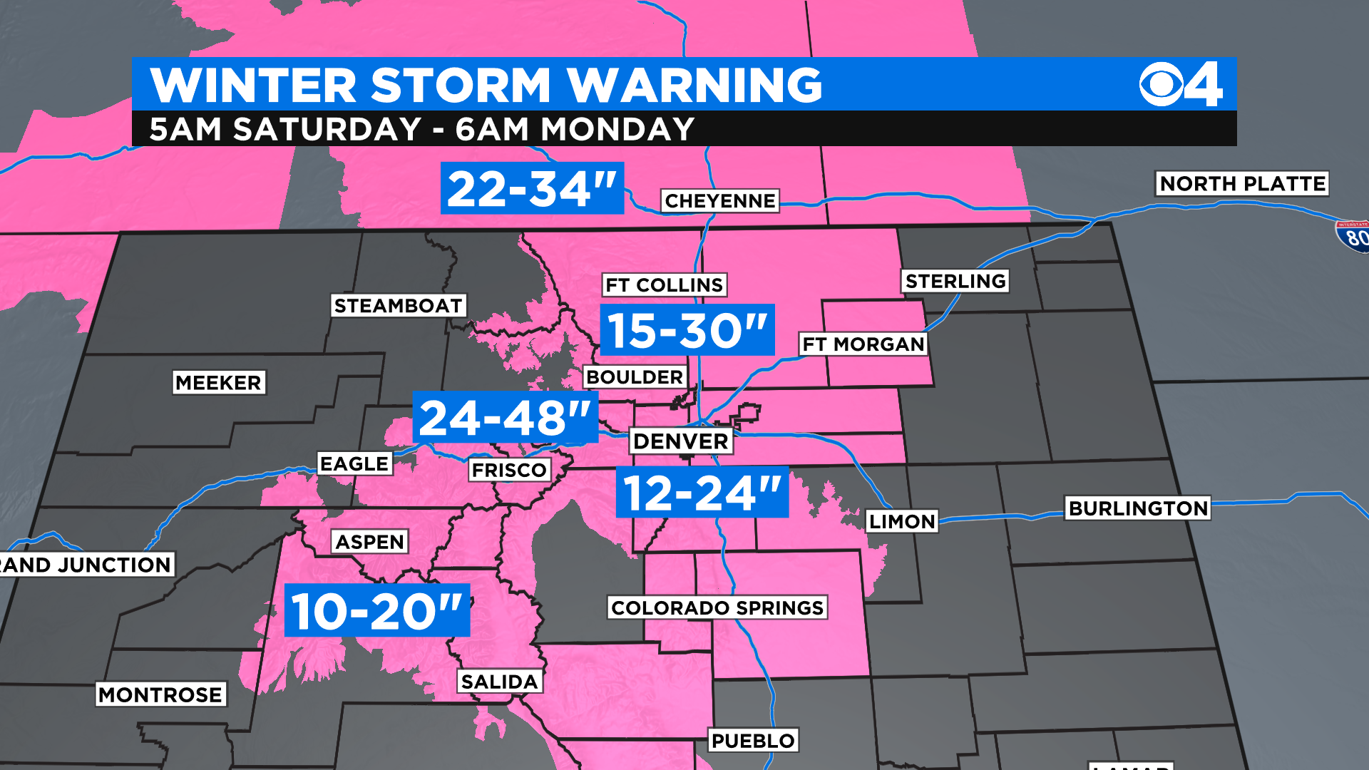
We also have number Winter Weather Advisories through the weekend for many mountain areas and eastern plains. 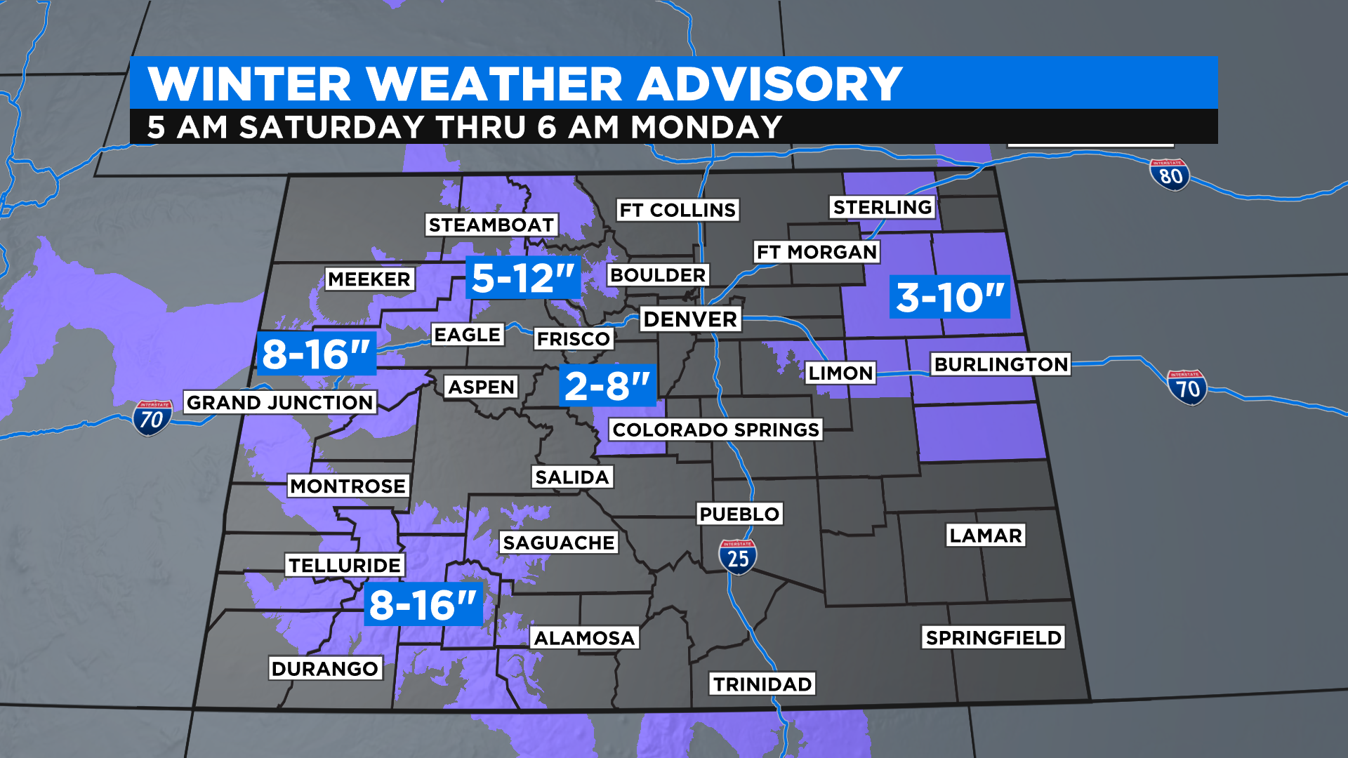
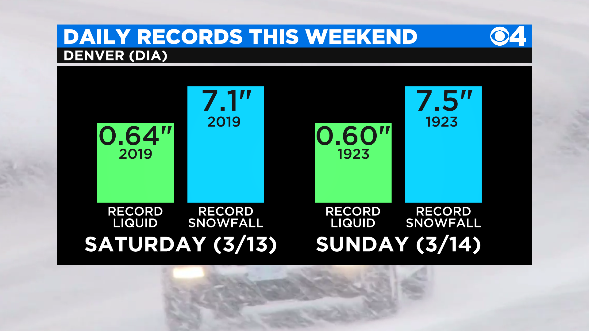
We most likely won't be breaking into the 2003 snow storm level of close to 32 inches of snow. But we will most likely be breaking a few daily records for snowfall with this storm.
This storm will bring quite a bit of liquid with it as well. This snow is very moisture rich, and could potentially bring anywhere from 3 to 5 inches of liquid to the Front Range and foothills. This would be incredible for our drought.
Snow should taper by Sunday evening or late night, with only flurries left by Monday morning. Be safe this weekend and don't drive around unless you absolutely have too, especially on Sunday.


