Weekend Winter Storm: Colorado Department of Transportation Urges Drivers To AVOID TRAVEL
DENVER (CBS4)- The Colorado Department of Transportation is urging motorists to avoid travel during the winter storm this weekend. If drivers have weekend plans, CDOT says be prepared to arrive early and hunker down.
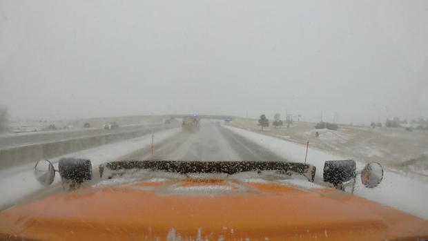
CDOT said because heavy accumulation is possible along Interstate 70, Interstate 25 and other highway corridors in the foothills and Front Range, drivers should only travel if absolutely necessary.
"Those typical day trips that people often make back and forth to Summit and Eagle counties just aren't going to be that safe. This is that weekend to make the preparations to find a hotel reservation, find a condo reservation that you can book, stay with friends. We want people to get there Friday and stay put," said Matt Inzeo, Communications Director for CDOT.
According to CBS4 Meteorologist Ashton Altieri, the powerful winter storm moving from the West Coast should become close enough to Colorado to cause a surge in snow Friday night into Saturday morning. It's during this time (after midnight Friday night) when travel will start to become difficult.
Travel may eventually become impossible in many areas, conditions will become dangerous for livestock and outdoor pets, and power outages will be possible through the weekend.
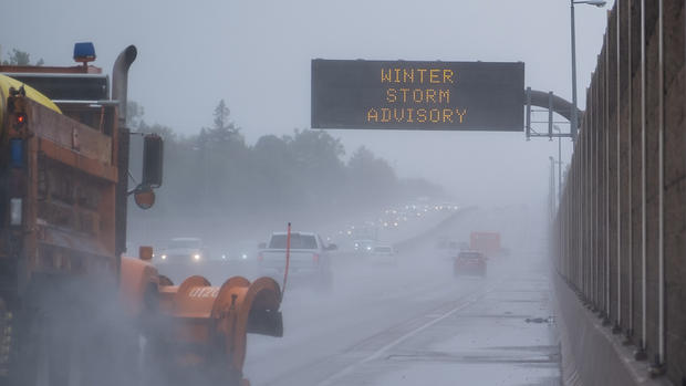
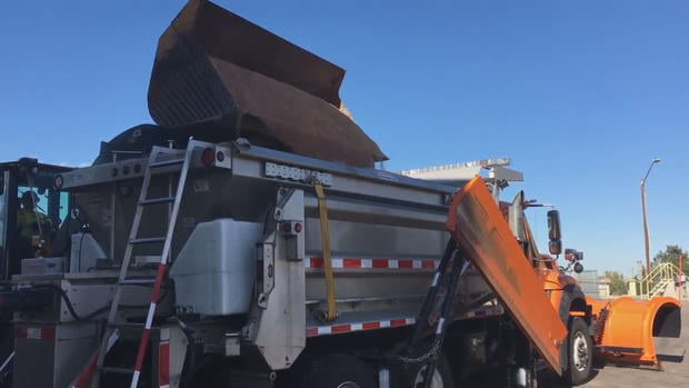
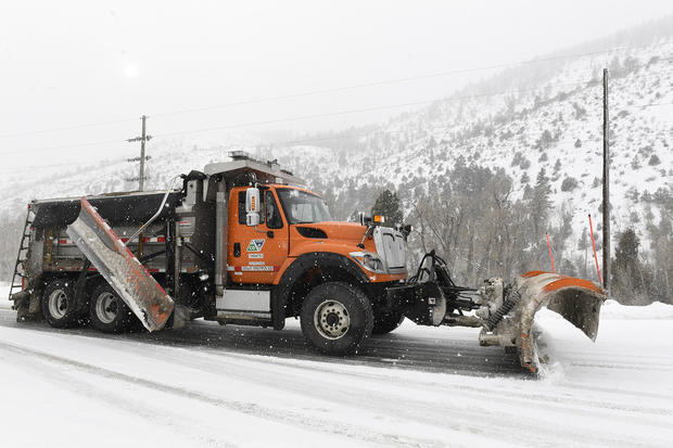
CDOT says while the big storm requires all hands-on deck, it's something plow drivers are used to in the high country.
"We actually have a lot of experience dealing with snowstorms of this magnitude. It's never fun when they last for days on end. Crews can get tired, but again, we've got some muscle memory there. We know how to deal with that. A lot of this is making sure that the traveling public knows what to expect," said Inzeo.
The biggest difference for plow drivers this time? A majority will be focusing their attention on the Front Range instead of the mountains.
The general snow forecast for Friday through Sunday is 1 to 3 feet along the Front Range. The highest amounts will be in the foothills and along the Palmer Divide in Douglas and Elbert Counties. But snowfall totals could easily exceed 12 inches even in Denver.
"This time they're going to be coming over the mountains, obviously not leaving those alone, but just going to shift and shape those resources more toward the Front Range so that we have as much equipment and as many people as possible right in the thick of things."
For those who have to travel, CDOT will have courtesy patrols, a majority of which will be stationed along I-25.
"We're going to be there to assist folks who need it, still our preference is, if you don't need to be on the road just make those plans ahead of time."
Inzeo said closures of roadways to clear snow should be expected as well, so if you find you have an essential trip to make, now would be a good time to throw a shovel, a blanket and other emergency preparedness items in the back of your car.
RELATED: Colorado Is Known For Heavy March Snow, One Storm Ended Record Drought In 2003
Additional Information from CDOT:
- If you are planning to travel the I-70 mountain corridor for a weekend in the mountains, head to your destination BEFORE the storm, before Friday evening.
- Regardless of your destination, get there before the storm hits.
- AVOID traveling on impacted roads during the storm, throughout the Denver metro area, on the I-70 Mountain Corridor and I-25 South Gap construction zone between Castle Rock and Monument. CDOT is likely to close these roadways for safety reasons depending on the severity of the storm.
- It is also possible I-70 east of Airpark Road and other roadways in the Eastern Plains may close depending on the severity of the storm.
- CDOT crews will be out in force and plowing roads, focusing on clearing I-25, I-70 and impacted interstates. They will make multiple passes on these roads during the storm and will not be able to plow the secondary routes until the worst of the storm has passed. This means many roadways could be heavily snow packed, making for hazardous driving conditions.
- During a significant and high impact snow storm, travel should be limited to emergency and essential reasons with the proper vehicle and tires for heavy snow. DO NOT ATTEMPT to drive in such weather conditions unless you have the appropriate tires with good tread. Motorists should leave ample distance behind the vehicle ahead and NOT PASS PLOWS. If you are out in the storm, have an emergency kit with blankets, food, batteries, water, a shovel and survival supplies should you get stuck or stranded.
- It's best to STAY OFF THE ROADS DURING A HEAVY SNOW EVENT.
- For more information on preparing for the snow, chain and traction laws and other winter storm related guidance, go to winter.codot.gov
Some lingering snow could continue into Monday, but accumulation should conclude by sunrise on Monday. Then the focus for much of next week will be chilly, below-normal temperatures which should continue through at least Thursday or Friday.