Denver Weather: Light Snow Expected By This Evening, Will Linger Into Tuesday
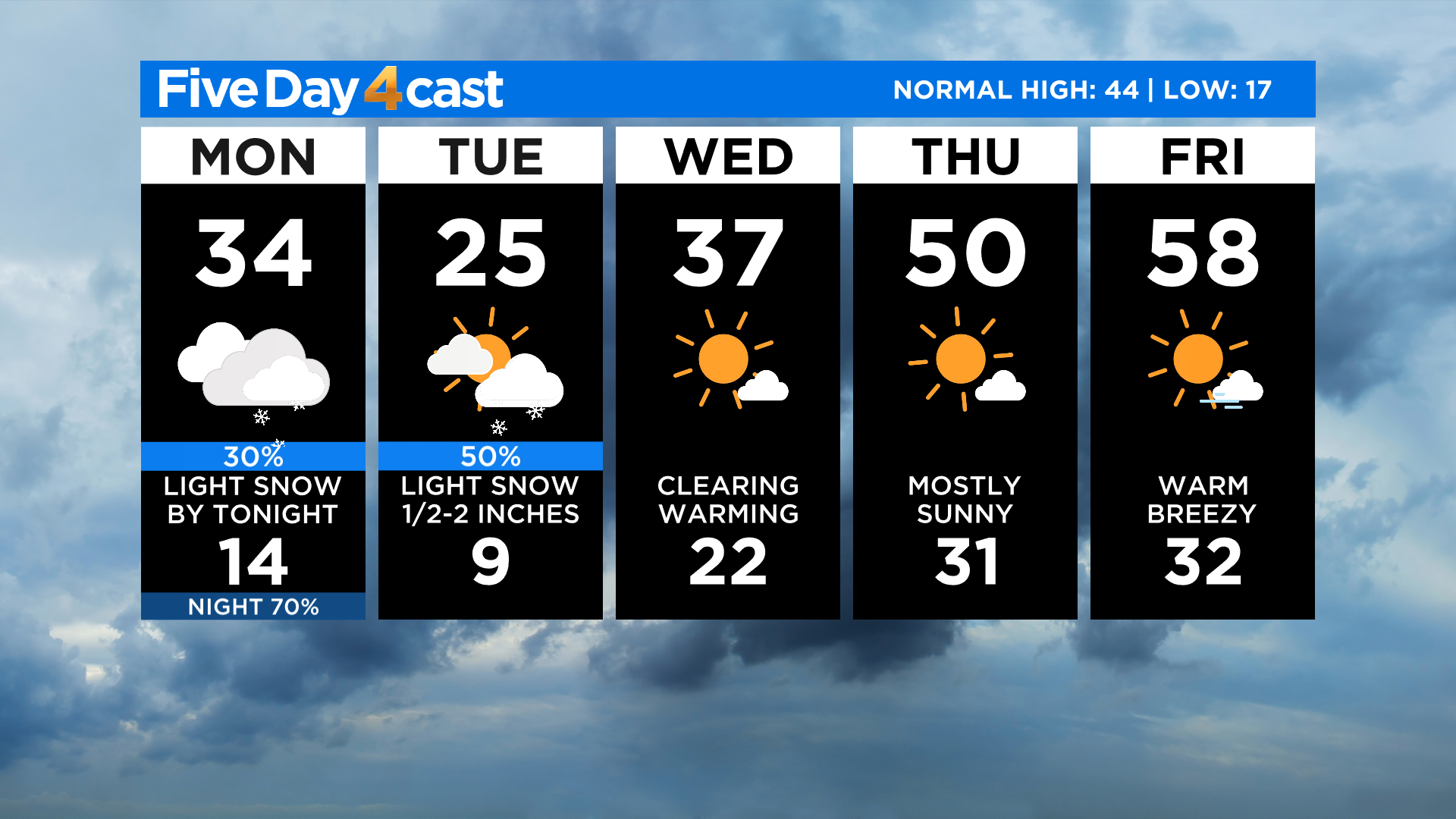
DENVER (CBS4) - If you missed out on snow last night and early this morning you will have another chance tonight as the second of two weather systems moves into the state. It will bring more light snow both to the mountains and the eastern plains.
We think the Front Range will get in on the action this time with light snow developing in the foothills by sunset. Snow showers should move into the Denver metro area shortly thereafter.
The map below shows potential snow totals between tonight into Tuesday. In Denver we only expect anywhere from a 1/2" to maybe 2" in spots.
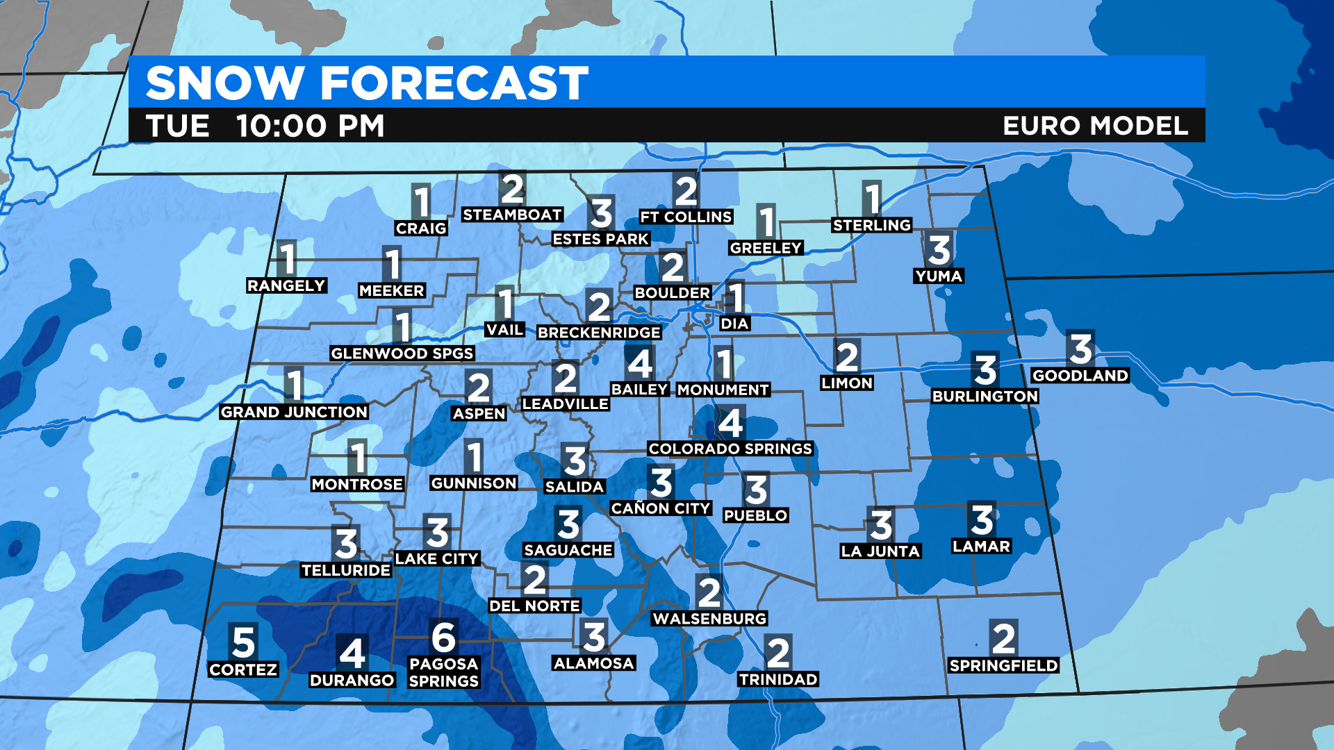
This is a very fast-moving and relatively weak weather maker but some locations in the southwest mountains could get up to 10 inches of additional snowfall. That is a concern because several locations in the San Juan Mountains have reported 1 to 3 feet of snow in the past few days.
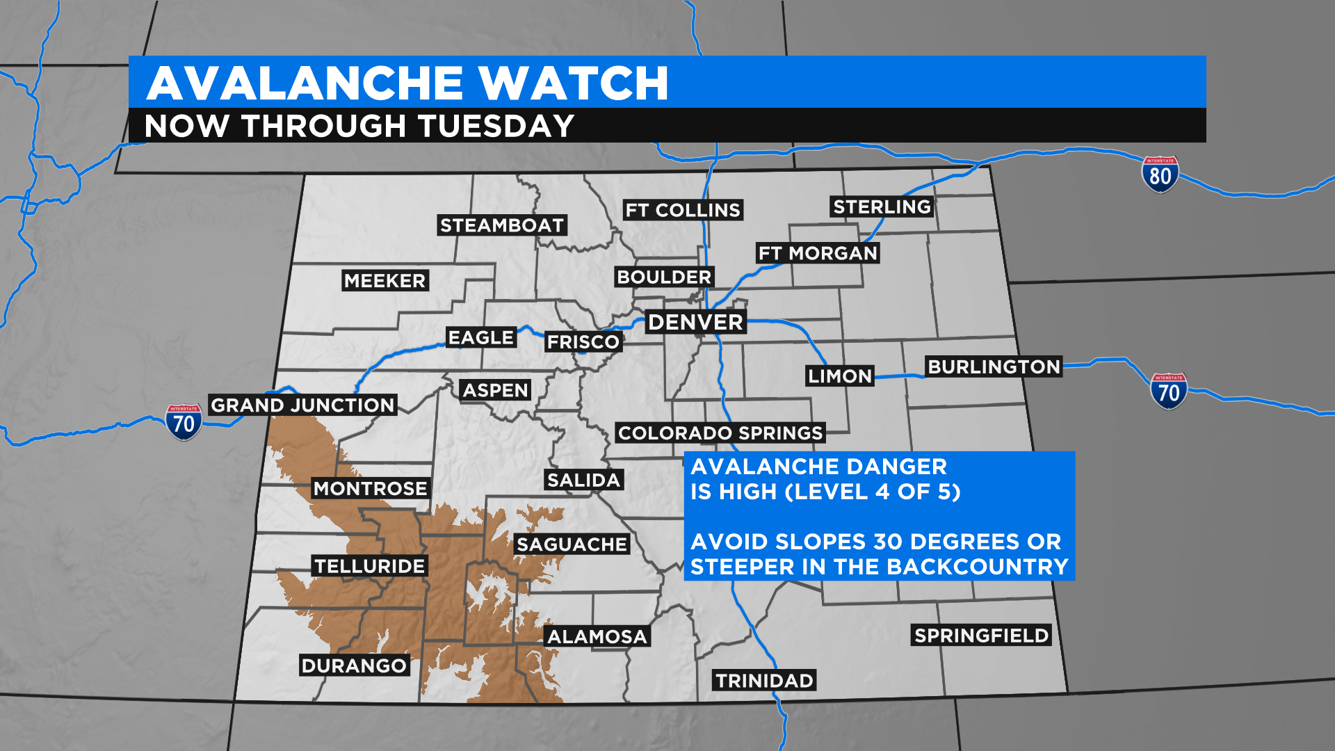
New snowfall will create a high risk for avalanches and therefore a watch has been issued by the Colorado Avalanche Information Center through Tuesday.
The next 48 hours will be chilly with the coldest air of the week expected tomorrow. Most of the state will stay at or below freezing on Tuesday. Warmer and drier weather will arrive for the last half of the week.