Denver Weather: Two Chances For Light Snow Starting Sunday Night
DENVER (CBS4) - The week will start off chilly and unsettled around Colorado as two different storm systems pass through the region. The first one will arrive Sunday night and early Monday. The second one will be here Monday night and early Tuesday.
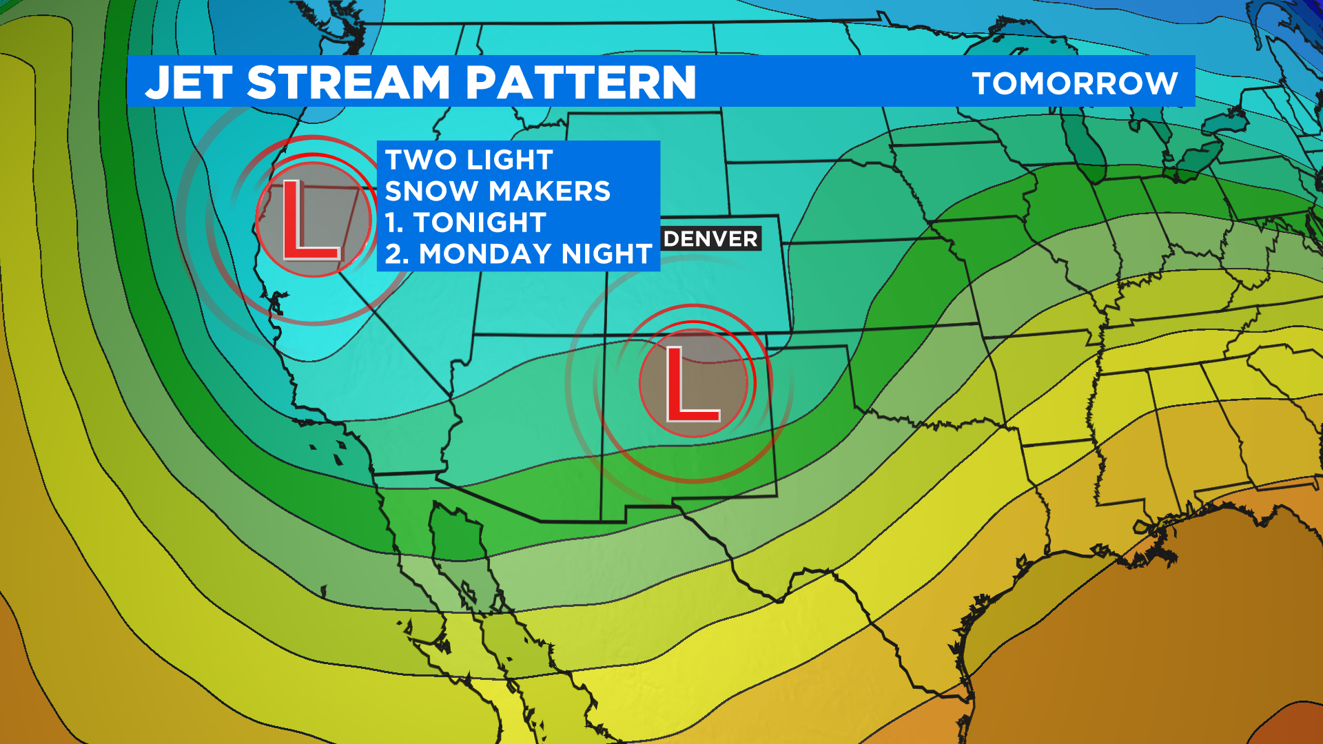
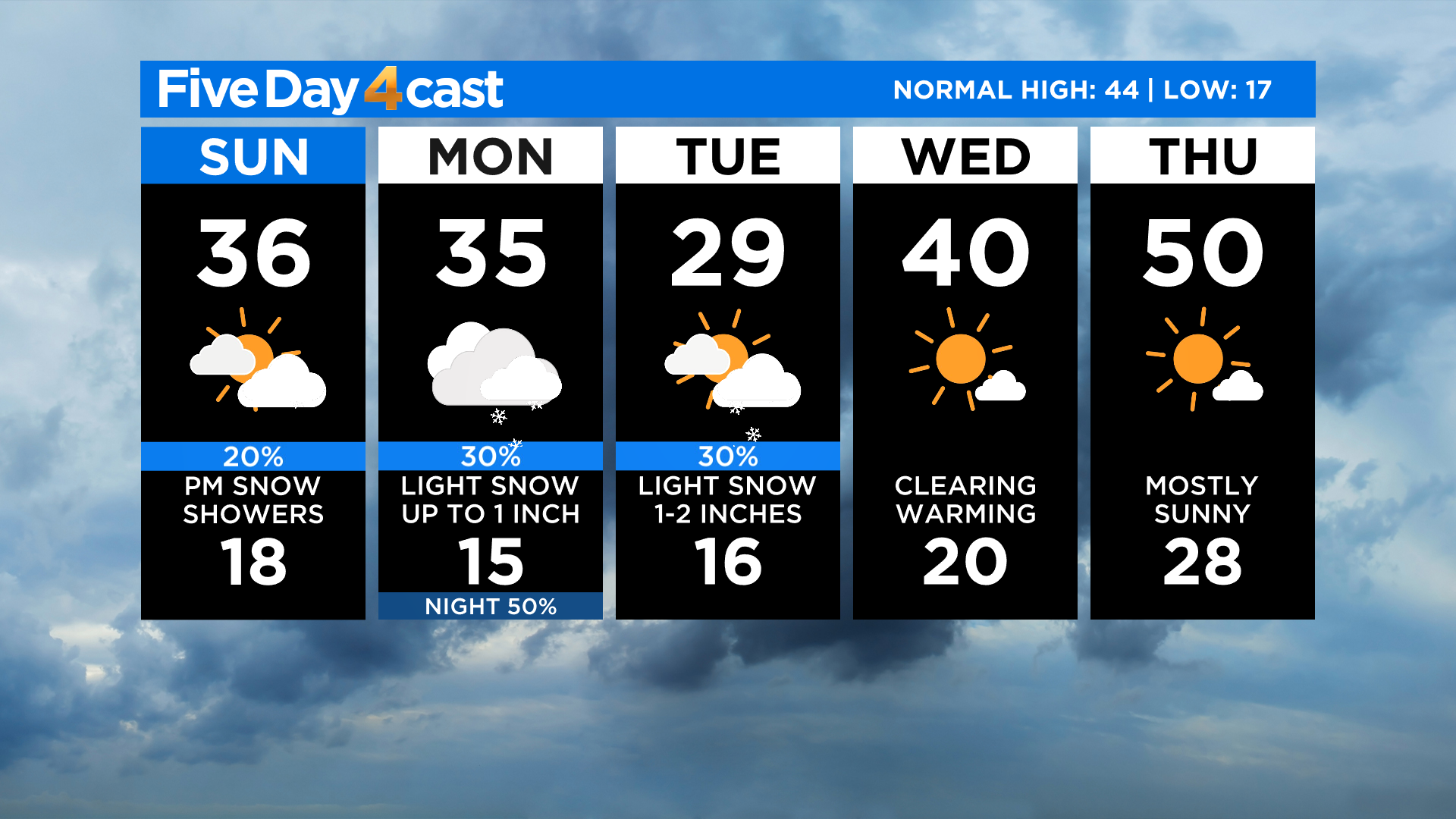
Each storm will bring a round of light snow to the mountains and the eastern plains. Denver will also get in on the action with a chance for some light snow Sunday night and Monday morning. We'll see another chance by Monday afternoon and lasting through noon on Tuesday.
The following two maps show potential snow totals from both systems for the period Sunday night through noon on Tuesday. Each model tells a similar story. In Denver we could get a dusting to an inch from the first storm and maybe an inch or two from the second.
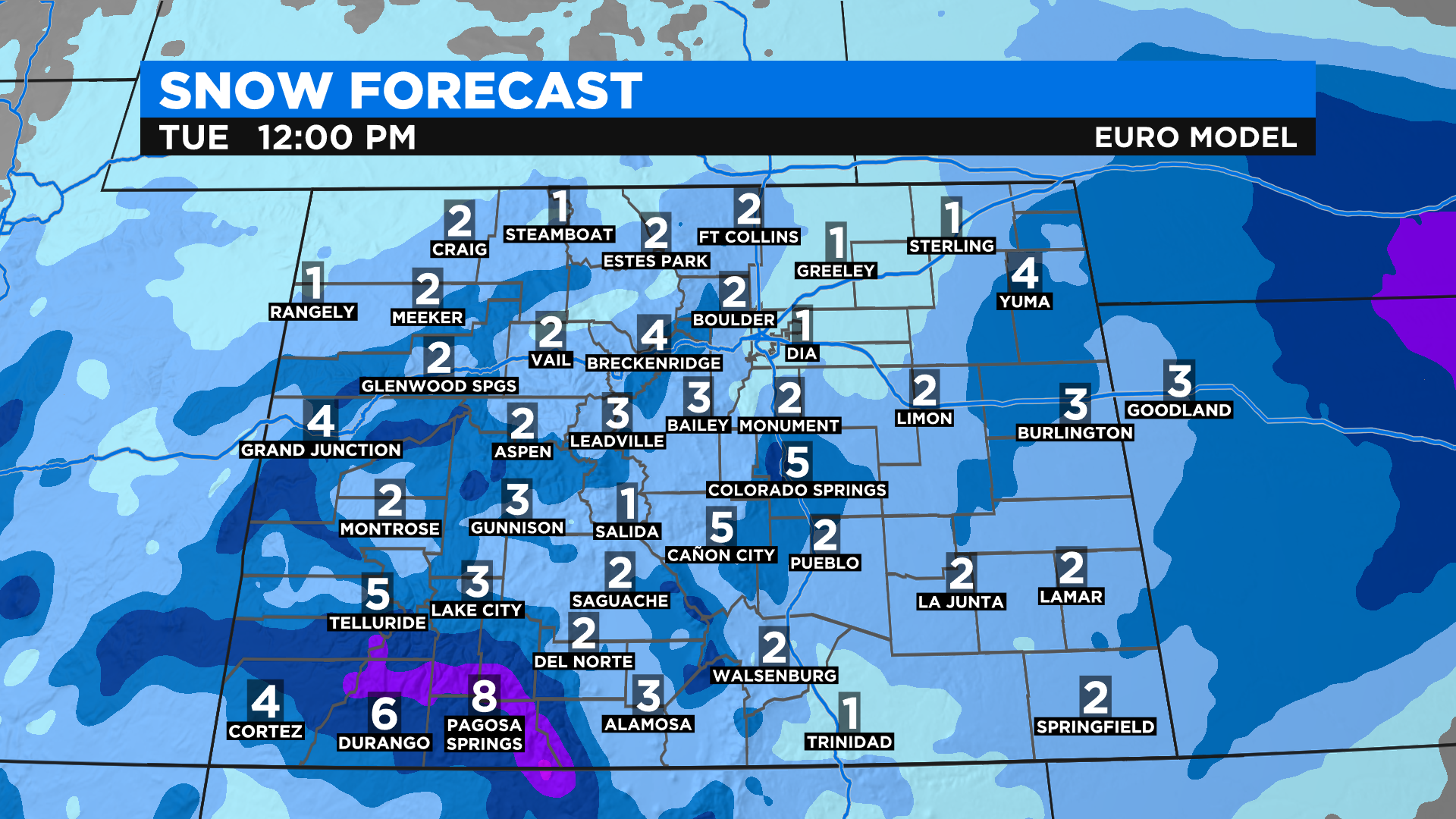
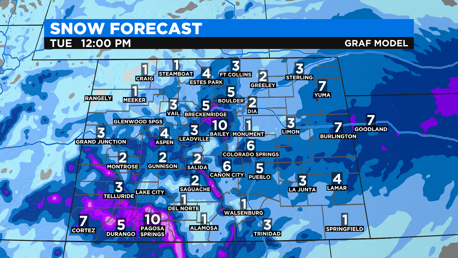
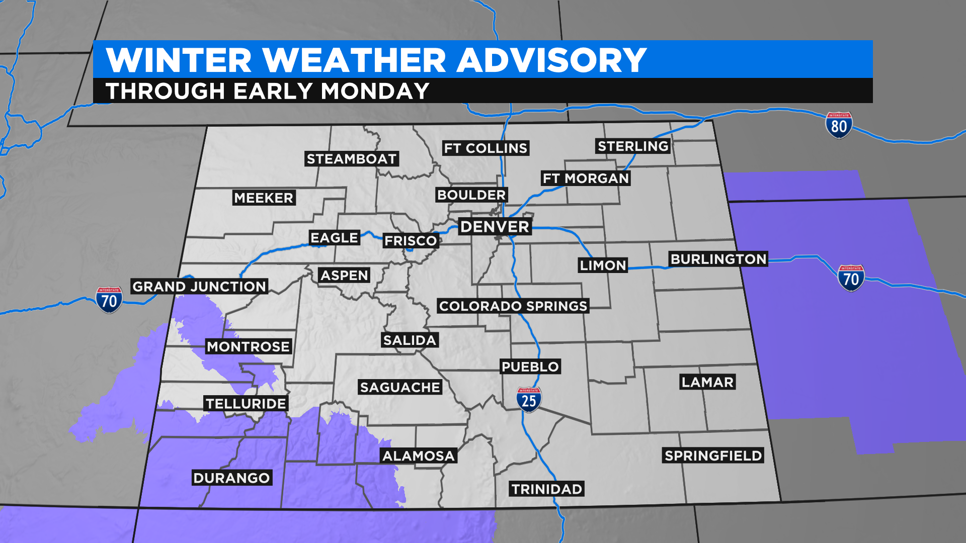
The highest snow totals over the next 48 hours will come from the southwest part of the state where the National Weather Service has issued a Winter Weather Advisory through early Monday. If you have travel plans to this part of Colorado expect winter driving conditions.
We could also see a narrow band of some higher snow totals on the far eastern plains between Colorado Springs and Burlington. At this time there are no winter weather alerts in effect there, but most of Kansas and Nebraska are under advisories or warnings if you have travel plans that way over the next 24 hours.
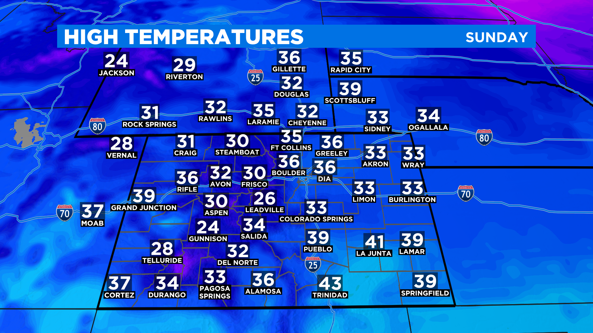
High temperatures today will be cooler in Denver and for most of eastern Colorado as compared to Saturday. We expect 20s and 30s just about statewide.
The week ahead will be chilly around the state with highs running below normal in places like Denver. Warmer and drier weather is expected for the second half of the work week.